Baffin Island Current
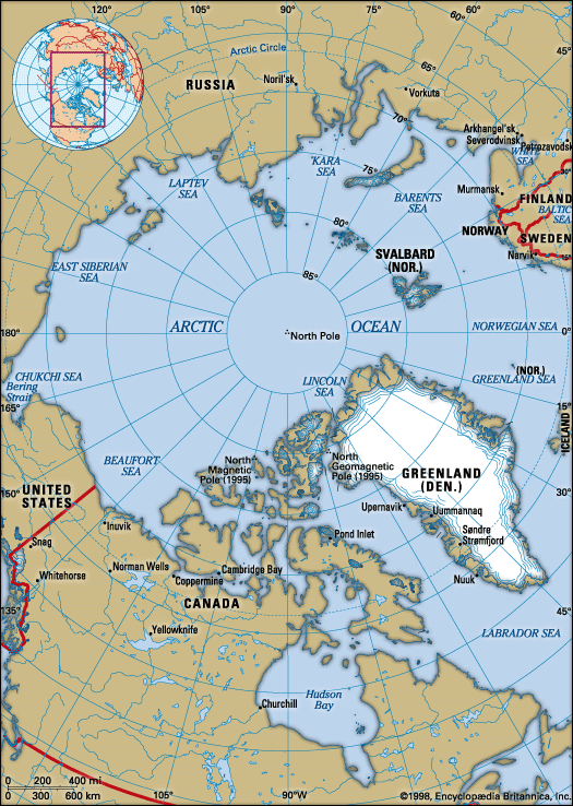
The Baffin Island Current is a surface oceanic current that flows southward along the western side of Baffin Bay, Canada. It moves at a rate of approximately…
What is Baffin Island Current?
The Baffin Island Current is a surface oceanic current that flows southward along the western side of Baffin Bay, Canada. It moves at a rate of approximately 11 miles (17 km) per day.1
This current is formed by the combination of two primary water sources:
- Inflow from the West Greenland Current.1
- Outflow of cold water from the Arctic Ocean through the channels of the Canadian Arctic Archipelago.1
The Baffin Island Current is a significant component of the Labrador Current, which continues the southward flow through the Davis Strait into the Labrador Sea.23
How does the Labrador Current affect shipping and icebergs?
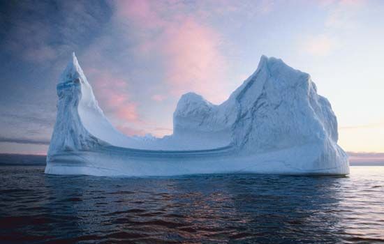
The Labrador Current significantly impacts maritime safety by transporting several thousand icebergs southward from the Arctic each year. These icebergs pose a severe hazard to shipping, as they can damage or sink vessels, a danger famously highlighted by the loss of the Titanic in 1912Titanic* in 1912.27
Impact on Shipping and Navigation
- Hazardous Conditions: Icebergs drifting through the current are difficult to detect, especially in heavy seas where their smooth surfaces produce a low radar cross-section. Decaying icebergs also release smaller, dangerous fragments known as “growlers” and “bergy bits” that can remain undetected while posing a threat to ships.5
- Navigation Restrictions: Because of the high concentration of icebergs, main shipping routes in the Labrador Sea are generally restricted to the eastern portion, with navigation seasons often limited to midsummer through late fall.36
- Safety Management: To mitigate these risks, the International Ice Patrol tracks icebergs entering shipping lanes and provides regular updates to vessels. Modern technology, including synthetic aperture radar and satellite imagery, is used to monitor iceberg positions, and in some cases, threatening icebergs are towed away from critical areas.5
What is the difference between the West Greenland Current and the Baffin Island Current?
The West Greenland Current and the Baffin Island Current are distinct oceanic systems that differ primarily in their geographic location and water composition:
- West Greenland Current: This current originates at the southern tip of Greenland (Cape Farewell) and flows northward along the west coast of Greenland into the Davis Strait. It is influenced by warmer North Atlantic Current waters, which help keep the west coast of Greenland relatively free of ice.1
- Baffin Island Current: This current flows southward along the western side of Baffin Bay. It is a cold-water current formed by the combination of inflow from the West Greenland Current and the outflow of cold water from the Arctic Ocean through the Canadian Arctic Archipelago.10
Ultimately, both currents serve as major contributors to the Labrador Current, which carries cold, low-salinity water and icebergs southward through the Labrador Sea.2
Why is the Labrador Sea important for navigation and fishing?
The Labrador Sea is a critical region for both maritime navigation and commercial fishing, though it presents significant environmental challenges.
Navigation
The sea serves as a historic corridor for maritime travel, famously explored by those seeking the Northwest Passage. However, navigation is heavily influenced by the Labrador Current, which transports numerous icebergs southward from the Arctic. Due to these hazards, primary shipping routes are concentrated in the eastern portion of the sea, and the navigation season is typically restricted to the period between midsummer and late fall.3
Fishing
Fishing is a vital industry in the region, particularly for Greenland ports where cod remains a major economic staple. While the nearby Grand Banks are internationally renowned for their once-abundant groundfish stocks, the region has faced severe challenges due to overfishing and environmental shifts, leading to significant stock depletion. Despite these setbacks, other fisheries such as lobster and northern shrimp continue to flourish, supporting the local economy.311
Sources
- Baffin Island Current — Encyclopædia Britannica
- Labrador Current — Encyclopædia Britannica
- Labrador Sea — Encyclopædia Britannica
- Baffin Bay — Encyclopædia Britannica
- iceberg - Iceberg distribution and drift trajectories — Encyclopædia Britannica
- Strait of Belle Isle — Encyclopædia Britannica
- iceberg - Iceberg detection, tracking, and management — Encyclopædia Britannica
- ocean current - Distribution of ocean currents — Encyclopædia Britannica
- Marine ecosystem - Ocean currents — Encyclopædia Britannica
- Greenland Current — Encyclopædia Britannica
- Labrador — Encyclopædia Britannica
- Grand Banks — Encyclopædia Britannica
Published on · 3 min read