Beartooth Range
The Beartooth Range is a segment of the northern Rocky Mountains located in the United States, stretching approximately 50 miles (80 km) from the Stillwater…
What is Beartooth Range?
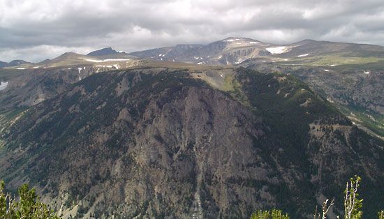
The Beartooth Range is a segment of the northern Rocky Mountains located in the United States, stretching approximately 50 miles (80 km) from the Stillwater River in southern Montana to the Clarks Fork of the Yellowstone River in northwestern Wyoming.1
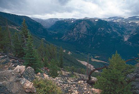
Characterized by alpine peaks, high plateaus, glaciers, and granite formations, the range includes Granite Peak, which at 12,799 feet (3,901 m) is the highest point in Montana. The area encompasses parts of the Gallatin, Custer, and Shoshone national forests, as well as the Absaroka-Beartooth Wilderness. Historically, the range is notable as the path taken by Chief Joseph and the Nez Percé during their 1877 attempt to reach Canada. While sometimes associated with the Absaroka Range, the Beartooth Plateau is considered a northeastern spur of that larger system.12
What is the significance of Granite Peak in Montana?
Granite Peak is primarily significant for being the highest point in the state of Montana, reaching an elevation of 12,799 feet (3,901 meters).314
Located within the Beartooth Range and situated northeast of Yellowstone National Park, the peak is a prominent feature of the Absaroka-Beartooth Wilderness. Its significance extends beyond its stature as a geographic landmark:
- Recreational Hub: The surrounding wilderness area is well-regarded for its high mountain passes, numerous lakes, and opportunities for hunting, fishing, and winter sports.31
- Geological Landmark: As part of the northern Rocky Mountains, the peak is characterized by the scenic granite formations that define the region’s rugged landscape.31
How did the Nez Perce use the Beartooth Range in 1877?
In 1877, the Nez Percé utilized the Beartooth Range as a critical passage during their desperate 1,600-mile flight toward Canada. Led by Chief Joseph, the group attempted to navigate these rugged mountains in the northern Rocky Mountains to escape forced relocation to a reservation in Idaho and avoid retaliation from the U.S. Army following a conflict with white settlers.15
The trek through this challenging terrain was part of a broader three-month retreat across multiple states. While the Nez Percé successfully outmaneuvered pursuing troops for much of their journey, they were eventually intercepted and forced to surrender in the Bear Paw Mountains of Montana, just 40 miles short of the Canadian border.15
What are the main differences between the Beartooth and Absaroka ranges?
The Absaroka Range and the Beartooth Range are both segments of the northern Rocky Mountains, but they possess distinct geological and physical characteristics:
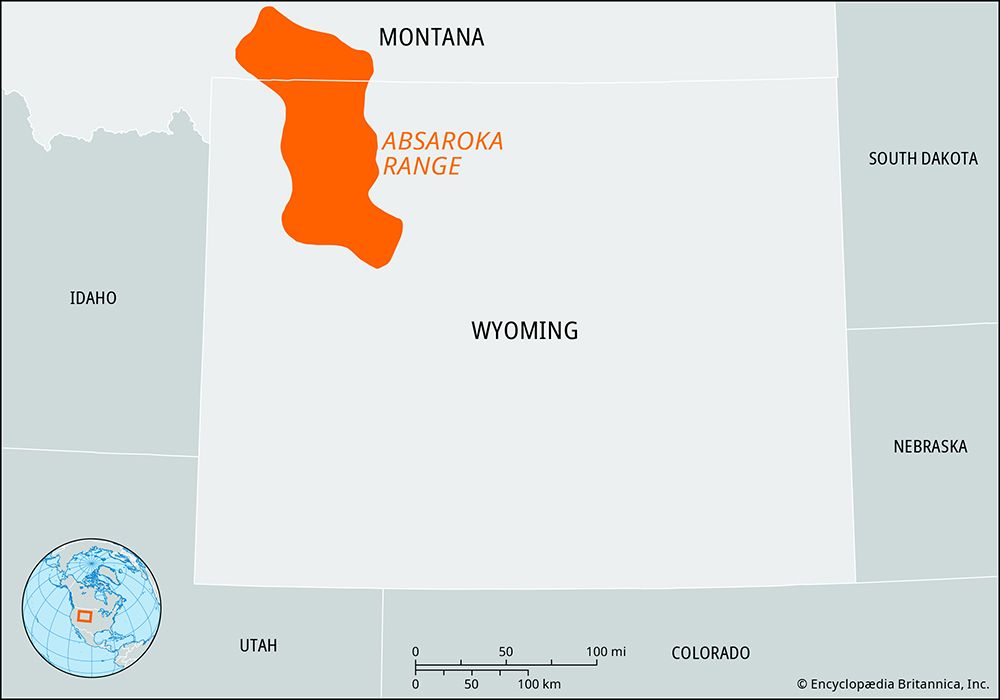
- Geological Origin: The Absaroka Range is primarily the result of volcanic action, which created a large uplifted plateau that was later shaped by stream and glacial erosion. In contrast, the Beartooth Range is defined by its scenic granite formations, alpine peaks, and high plateaus.21
- Scale and Scope: The Absaroka Range is significantly larger, extending 170 miles long and 50 miles wide. The Beartooth Range is a smaller, more compact segment extending 50 miles.21
- Relationship: The Beartooth Plateau is considered a northeastern spur of the Absaroka Range.2
- Elevation: The highest point in the Absaroka Range is Francs Peak at 13,140 feet. The Beartooth Range contains Granite Peak, which stands at 12,799 feet and serves as the highest point in Montana.21
Sources
- Beartooth Range — Encyclopædia Britannica
- Absaroka Range — Encyclopædia Britannica
- Granite Peak — Encyclopædia Britannica
- Granite Peak — Merriam-Webster
- Chief Joseph — Encyclopædia Britannica
Published on · 2 min read