Amargosa Range
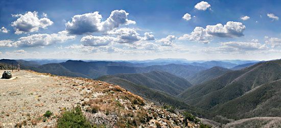
The Amargosa Range is a group of mountains located in eastern California and southern Nevada, U.S. It serves as a geographical barrier that separates Death…
What is Amargosa Range?
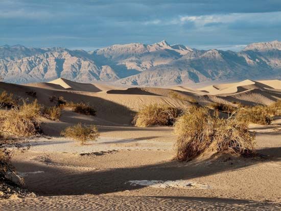
The Amargosa Range is a group of mountains located in eastern California and southern Nevada, U.S. It serves as a geographical barrier that separates Death Valley from the Amargosa Desert.1
As part of the Basin Ranges, the mountains extend approximately 110 miles (180 km) from Grapevine Peak—which reaches an elevation of 8,705 feet (2,653 m)—to the Amargosa River in the south-southeast. The range is comprised of three distinct mountain groups: the Grapevine, the Funeral, and the Black Mountains. Within the Black Mountains, Dante’s View stands at 5,475 feet (1,669 m), offering a prominent vantage point overlooking Death Valley and the Panamint Range located to the west.1
What are the characteristics of the Death Valley landscape?
Death Valley is a structural depression located in southeastern California that serves as the lowest, hottest, and driest region in North America. Its landscape is defined by several distinct characteristics:3
- Geologic Structure: Formed as a graben, or rift valley, the area resulted from block faulting that began approximately 30 million years ago. As crustal blocks sank, they created a deep trough that has since been filled with up to 9,000 feet of sediment.4
- Extreme Topography: The valley floor features a massive salt pan, with Badwater Basin reaching 282 feet below sea level. This is contrasted by the surrounding mountains, including the Panamint Range to the west and the Amargosa Range to the east, which includes the 11,049-foot Telescope Peak.3
- Unique Landforms: The park contains diverse features, including expansive sand dunes, volcanic craters like Ubehebe Crater, and the mysterious sliding rocks of Racetrack Playa.5
- Climate: The valley is characterized by extreme heat, with air temperatures reaching as high as 134 °F (57 °C), and severe aridity due to the rain-shadow effect of the western mountains.4
How do mountain ranges form in the Basin and Range province?
Mountain ranges in the Basin and Range Province are formed through a process of large-scale crustal extension, which began more than 40 million years ago and accelerated significantly about 15 million years ago.67
As the region underwent this extension, the Earth’s crust was stretched and pulled apart, causing it to break into a series of roughly parallel, north-south-trending blocks. This tectonic activity created a landscape of fault-block mountains and downdropped basins. Specifically:68
- Faulting: The mountains are the remains of crustal rocks that were uplifted along north-south fault lines.6
- Horst and Graben Formation: The process involves the creation of horsts (the raised mountain blocks) and grabens (the downdropped basins or rift valleys).98
- Modification: Over time, these blocks have been tilted, eroded, and partially buried by alluvial debris accumulating in the basins at their feet.68
This phase of crustal extension remains active today, with many basins continuing to deepen while the adjacent mountain ranges increase in height.7
What kind of plants and animals live in the Amargosa Desert?
The Amargosa Desert, located within the Amargosa Basin, supports specialized life forms adapted to its arid and often saline environment.
A notable botanical feature of the region is the Amargosa niterwort (Nitrophila mohavensis), a rare plant species that serves as a biological indicator of the basin’s unique ecological conditions. Like many plants in desert ecosystems, the flora of the Amargosa region has evolved specific strategies to survive moisture shortages, such as becoming physiologically inactive during dry periods or utilizing underground organs like rhizomes to store energy until rain triggers growth.1011
Animal life in such desert environments is typically characterized by nocturnal and subterranean habits, which allow species to avoid the intense heat and dehydration of the day. While specific comprehensive lists of all fauna in the Amargosa Desert are extensive, the broader region shares many characteristics with the Mojave Desert, where wildlife is primarily reptilian and includes species like the desert tortoise.1112
For more detailed information on the specific native species found in this area, you can explore resources provided by the Amargosa Conservancy.
Sources
- Amargosa Range — Encyclopædia Britannica
- Amargosa Range — Merriam-Webster
- Death Valley — Encyclopædia Britannica
- Death Valley - Death Valley National Park — Encyclopædia Britannica
- Death Valley - Physical environment — Encyclopædia Britannica
- Basin and Range Province — Encyclopædia Britannica
- horst and graben — Encyclopædia Britannica
- Western Cordillera — Encyclopædia Britannica
- Tertiary Period - Volcanism and orogenesis — Encyclopædia Britannica
- North America - Deserts — Encyclopædia Britannica
- Rare but Not Forgotten - Learn more — Encyclopædia Britannica
- Desert - Population and community development and structure — Encyclopædia Britannica
- Desert - Origin — Encyclopædia Britannica
Published on · 3 min read