Absaroka Range
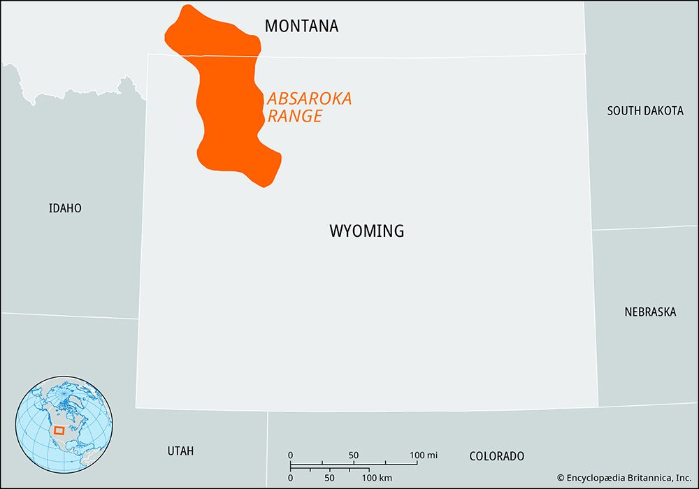
The Absaroka Range is a segment of the northern Rocky Mountains located in northwestern Wyoming and southern Montana, United States. Stretching approximately…
What is Absaroka Range?
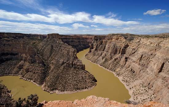
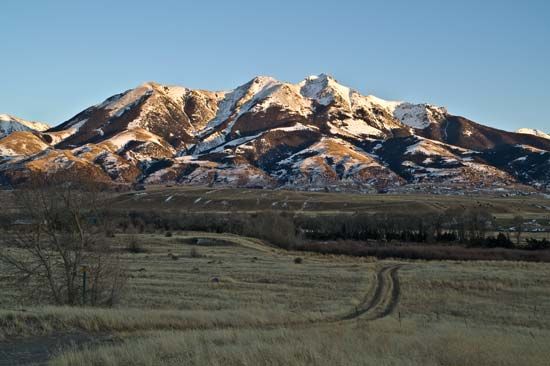
The Absaroka Range is a segment of the northern Rocky Mountains located in northwestern Wyoming and southern Montana, United States. Stretching approximately 170 miles (270 km) in length and 50 miles (80 km) in width, the range was formed by the uplift of a volcanic plateau, which has since been shaped by glacial and stream erosion into rugged, spectacular terrain.1
The range features eight summits exceeding 12,000 feet (3,700 meters), with Francs Peak serving as the highest point at 13,140 feet. It acts as a vital source for the headstreams of the Bighorn River and encompasses parts of the Gallatin, Shoshone, and Custer national forests, as well as the northeastern section of Yellowstone National Park. Additionally, the Beartooth Plateau—a northeastern spur of the range—contains Granite Peak, the highest point in Montana](https://www.britannica.com/place/Granite-Peak), the highest point in Montana.1
How did volcanic activity shape the Rocky Mountains?
Volcanic activity played a significant role in shaping specific portions of the Rocky Mountains, most notably in the Yellowstone-Absaroka region of northwestern Wyoming.3
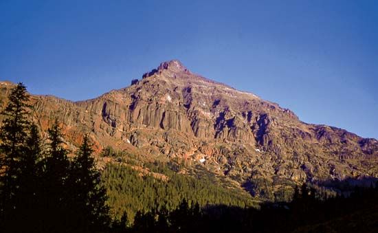
In the Absaroka Range, volcanic action created a large plateau that was subsequently uplifted and carved by glacial and stream erosion into its current rugged form. Similarly, the Yellowstone area is defined by a massive underlying magma chamber that has repeatedly filled and emptied, triggering cycles of volcanic eruptions involving basaltic and rhyolitic lava and ash. These events have caused the surface to bulge, tilt, and rise over time.43
Beyond these specific regions, volcanic processes contribute to mountain building through the intrusion of molten rock into the crust, which can raise the surface, or through the accumulation of volcanic rock on the landscape. In other parts of the Rockies, such as the Colorado Plateau, magma has been injected between sedimentary layers to form laccoliths—domed structures that create distinct mountain massifs.13
What wildlife lives in Yellowstone National Park?
Yellowstone National Park hosts the most diverse assemblage of mammals in the contiguous United States, with more than 60 species identified.5
Large Mammals
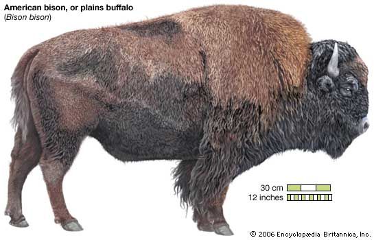
The park is home to several thousand bison, which inhabit breeding grounds in the Hayden and Lamar valleys. Other prominent large mammals include:5
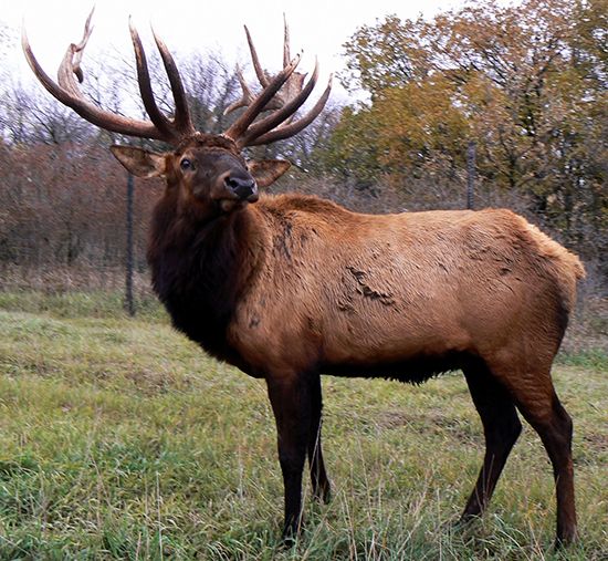
- Ungulates: Elk, mule deer, bighorn sheep, pronghorns, mountain goats, and moose.5
- Predators: Black bears, grizzly bears, foxes, coyotes, and wolves, the latter of which were successfully reintroduced in 1995. Bobcats, lynx, and pumas are also present.56
Birds, Fish, and Other Wildlife
- Birds: Over 300 species have been recorded, including songbirds, woodpeckers, trumpeter swans, and Canada geese. Raptors such as bald eagles, ospreys, and peregrine falcons have also made significant population recoveries.5
- Fish: Native species include cutthroat trout, Arctic grayling, and Rocky Mountain whitefish.5
- Reptiles and Amphibians: Due to the cold climate, fewer than a dozen species exist, including the prairie rattlesnake, boreal chorus frogs, and blotched tiger salamanders ched tiger salamanders.5
- Microorganisms: The park’s hydrothermal features support various thermophiles, including algae, bacteria, and archaea.5
How do glaciers change mountain landscapes over time?
Glaciers fundamentally reshape mountain landscapes through powerful processes of erosion and deposition, transforming rugged terrain over geological time.
Erosional Landforms
Glaciers drastically alter the V-shaped valleys typically carved by rivers. Because glaciers have greater mass and viscosity, they erode the base and sidewalls of valleys more uniformly, creating characteristic U-shaped valleys with steep, often vertical sides.910
As glaciers move, they sculpt specific features:
- Cirques: Amphitheatre-shaped hollows formed at the heads of glacial valleys. These often contain small lakes known as tarns after the ice melts.9
- Arêtes and Horns: When multiple cirques erode a mountain from different sides, they leave behind sharp, knife-edge ridges called arêtes and pointed peaks known as horns, such as the Matterhorn.9
- Hanging Valleys: Smaller tributary glaciers erode their beds less deeply than the main glacier. When the ice retreats, these tributaries are left high above the main valley floor, often resulting in waterfalls.10
Depositional Landforms
Glaciers also reshape the landscape by transporting and depositing till and other debris. Moraines—ridges of sediment—mark the former margins of ice sheets. Additionally, meltwater streams create features like eskers, which are long, sinuous ridges of sediment deposited in subglacial tunnels.11
Sources
- Absaroka Range — Encyclopædia Britannica
- Absaroka Range — Merriam-Webster
- Rocky Mountains - Physiography — Encyclopædia Britannica
- tectonic landform — Encyclopædia Britannica
- Yellowstone National Park - Plant and animal life — Encyclopædia Britannica
- gray wolf - Conservation status — Encyclopædia Britannica
- Yellowstone National Park - Geology — Encyclopædia Britannica
- wolf - Gray wolf — Encyclopædia Britannica
- glacial landform - Cirques , tarns, U-shaped valleys, arêtes, and horns — Encyclopædia Britannica
- Quaternary - Landforms — Encyclopædia Britannica
- glacial valley — Encyclopædia Britannica
- glacial landform - Meltwater deposits — Encyclopædia Britannica
- glacier - Glacier hydrology — Encyclopædia Britannica
Published on · 3 min read