Cape Corrientes
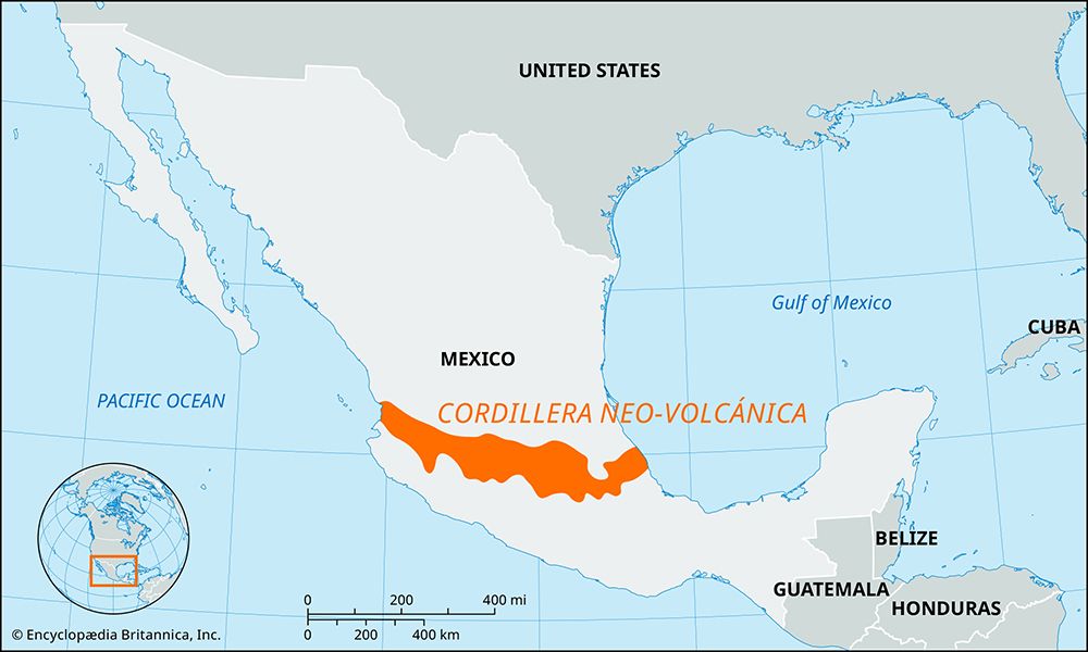
Cape Corrientes is a prominent headland located on the Pacific Ocean in the southwestern part of Jalisco state, Mexico.
What is Cape Corrientes?
Cape Corrientes is a prominent headland located on the Pacific Ocean in the southwestern part of Jalisco state, Mexico.1
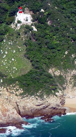
Rising to an elevation of 505 feet (154 meters) above sea level, the cape is formed by the western extremity of the Sierra del Cuale, which is part of the southern Sierra Madre Occidental mountain range. A lighthouse is situated on the cape to mark the entrance to the Bahía de Banderas, which lies just to the north.1
What is the Sierra Madre Occidental mountain range?
The Sierra Madre Occidental is a major mountain range in northwestern Mexico that runs parallel to the Pacific coast. Extending approximately 700 miles (1,100 km) in length and 100 to 300 miles (160 to 480 km) in width, the range serves as the western margin of the Mexican Plateau.234
Physical Characteristics
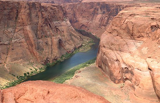
The mountains are characterized by formidable escarpments on their western flanks, which drop into deep, angular canyons known as barrancas. Some of these canyons, most notably the Barranca del Cobre (Copper Canyon), are comparable in scale to the Grand Canyon in the United States. Most summits in the range exceed 6,000 feet (1,800 meters), with some peaks rising above 10,000 feet (3,000 meters).3
Geology and Ecology
While once thought to be a simple layer of volcanic rock, the range has a complex structural history involving folding, faulting, and igneous intrusions. The region supports diverse ecosystems, ranging from high-altitude conifer forests to oak-pine forests and drought-tolerant scrub at lower elevations. Wildlife includes coyotes, deer, and black bears, though larger predators like jaguars and pumas have become increasingly scarce.45
How do lighthouses help ships navigate near capes?
Lighthouses serve as essential aids to maritime navigation by warning mariners of hazards, helping them establish their position, and guiding them toward their destinations. Near capes and coastal areas, these structures function through several key methods:6
- Visual Identification: Mariners identify a specific lighthouse by its unique structure, color, or the rhythmic flash pattern of its light, known as its “character”. These patterns, such as flashing, group-flashing, or occulting lights, are regulated internationally to ensure they are easily distinguishable.67
- Daymarks: During daylight, the structure itself acts as a visual marker. Lighthouses are often painted white or feature high-contrast bands to stand out against the surrounding landscape.7
- Directional Guidance: Some lighthouses use fixed lights with red and green sectors to provide precise directional information for harbor approaches. Others utilize “range lights”—two lights of different elevations that, when aligned vertically, indicate a safe course.7
- Reliability: Despite modern electronic systems, lighthouses remain a vital backup, offering simplicity and reliability for vessels without specialized equipment.6
What are the main geographical features of the Mexican coastline?
Mexico’s coastline is diverse, shaped by distinct physiographic regions that vary significantly between the Pacific and Gulf of Mexico sides.
Pacific Coast
- Baja California Peninsula: This 800-mile-long peninsula separates the Pacific Ocean from the Gulf of California. Its eastern side features steep escarpments, while the western side slopes gently toward the ocean, characterized by sandy shores, lagoons, and islands.10211
- Pacific Coastal Lowlands: Extending south from the Colorado River delta, these lowlands consist of coastal terraces, mesas, and riverine deltas. They are bounded to the east by the Sierra Madre Occidental.10
- Southern Highlands: In the south, the Sierra Madre del Sur often meets the sea directly, creating a rugged, mountainous coastal margin known for tourist destinations like Acapulco.10
Gulf of Mexico and Caribbean Coast
- Gulf Coastal Plain: This region is much wider than its Pacific counterpart. It is characterized by lagoons, low-lying swampy areas, and sandy beaches, extending from the U.S. border to the Yucatán Peninsula.104
- Yucatán Peninsula: This region features a flat, limestone (karst) terrain with little surface drainage. It separates the Gulf of Mexico from the Caribbean Sea and is known for its subterranean caverns and sinkholes called cenotes10.
Sources
- Cape Corrientes — Encyclopædia Britannica
- Sierra Madre - Physiography of the Sierra Madre — Encyclopædia Britannica
- Sierra Madre Occidental — Merriam-Webster
- Sierra Madre - Geology — Encyclopædia Britannica
- Sierra Madre - Plant and animal life — Encyclopædia Britannica
- lighthouse — Encyclopædia Britannica
- lighthouse - Identification — Encyclopædia Britannica
- lighthouse - Floating lights — Encyclopædia Britannica
- navigation - Other aids to navigation — Encyclopædia Britannica
- Mexico - Physiographic regions — Encyclopædia Britannica
- Baja California — Encyclopædia Britannica
- Mexico - Drainage of Mexico — Encyclopædia Britannica
- lagoon - Storms and catastrophic events — Encyclopædia Britannica
- Laguna Madre — Encyclopædia Britannica
- Sebastián Vizcaíno Bay — Encyclopædia Britannica
- Gulf of California — Encyclopædia Britannica
- Gulf of Mexico / Gulf of America - Physiography and geology — Encyclopædia Britannica
Published on · 3 min read