Columbia Plateau
The Columbia Plateau is a vast geographic region in the northwestern United States, spanning approximately 100,000 square miles (260,000 square km) across…
What is Columbia Plateau?
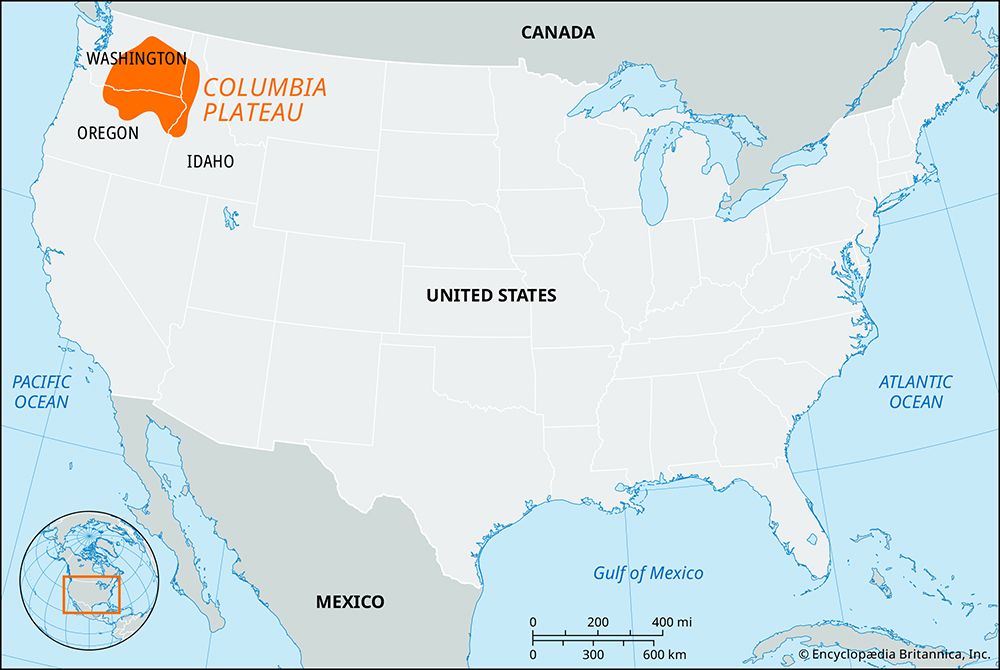
The Columbia Plateau is a vast geographic region in the northwestern United States, spanning approximately 100,000 square miles (260,000 square km) across Washington, Oregon, and Idaho.1
Geologically, the plateau was formed between 17 and 14 million years ago by massive floods of basaltic lava. It is characterized by these uniform lava flows, though subsequent warping and faulting have created elevations ranging from 200 to 5,000 feet (60 to 1,500 meters) above sea level.21
The region is situated between the Rocky Mountains to the east and the Cascade Range to the west. This location results in a semiarid climate, as the surrounding mountains shield the area from extreme weather and moisture. Consequently, the landscape is dominated by shrubs and grasses, and the region is drained by the Columbia River and the Snake River.13
How did basaltic lava flows create the Columbia Plateau?
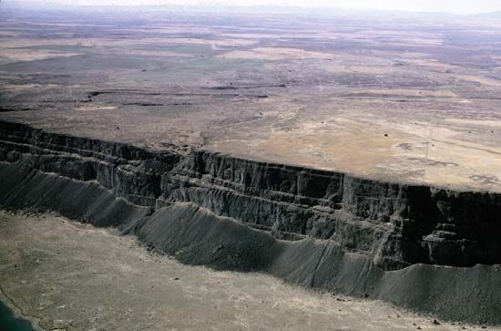
The Columbia Plateau was formed between approximately 17 and 14 million years ago by massive, extensive eruptions of mantle-derived basaltic lava, a process often referred to as a flood basalt event.14
These eruptions were likely associated with a hot spot—possibly the same one that currently underlies the Yellowstone volcanic center. Unlike typical volcanic activity that builds prominent mountains or central vents, these flood basalts were characterized by lavas that traveled long distances from their sources, effectively burying the preexisting terrain under layers of volcanic rock that can reach tens to hundreds of meters in thickness.245
Because the lava was highly fluid, it spread out to create a top surface that is typically very flat, though it has since been modified by subsequent warping, faulting, and the incision of canyons and valleys. This process transformed the region into a vast, relatively uniform plateau that now spans parts of Washington, Oregon, and Idaho.65
What role do the Columbia and Snake rivers play in the region?
The Columbia and Snake rivers are the primary drainage systems for the Columbia Plateau, playing a vital role in the region’s economic and physical development.17
Economic and Infrastructure Contributions
- Hydroelectric Power: The rivers are central to the Pacific Northwest’s power grid. A series of dams, including the Grand Coulee and Bonneville dams, convert the river’s flow into significant hydroelectric energy, which is shared across the region and traded with neighboring states.8
- Irrigation: The rivers have transformed arid landscapes into productive agricultural land. The Columbia Basin Irrigation Project, for instance, uses water pumped from the reservoir behind Grand Coulee Dam to irrigate areas that were previously covered by desert vegetation.8
- Navigation: The river system serves as a major transportation artery. Through a series of locks, barge traffic is enabled as far inland as Lewiston, Idaho, facilitating the movement of goods9.
Environmental and Historical Context
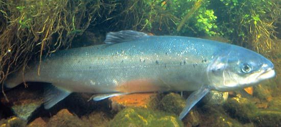
- Ecological Impact: The rivers have historically supported abundant salmon populations, though these have declined significantly due to dam construction, loss of spawning grounds, and other environmental changes.9
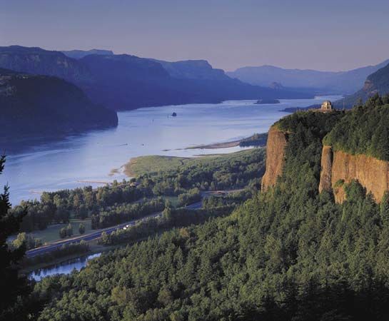
- Geographic Shaping: The rivers have carved deep features into the landscape, such as the Columbia River Gorge and Hells Canyon, the latter being the deepest river gorge in North America.710
How does the Cascade Range affect the local climate?
The Cascade Range acts as a significant orographic barrier that profoundly influences the climate of the Pacific Northwest by forcing moist air from the Pacific Ocean to rise and cool.1112
Windward Side: Precipitation and Moisture
As prevailing westerly winds encounter the western slopes of the Cascades, the air is forced upward, leading to cooling and condensation. This process, known as orographic precipitation, results in high levels of rainfall and snow on the windward side, with some areas receiving more than 100 inches (2,500 mm) of precipitation annually. This abundant moisture supports dense forests, such as stands of Douglas fir.1112133
Leeward Side: The Rain Shadow Effect
As the air descends the eastern slopes of the mountains, it warms and its relative humidity drops. This creates a rain shadow, a region of significantly reduced precipitation on the lee side of the range. Consequently, the climate east of the Cascades is much drier and more continental, with some areas receiving less than 8 inches (200 mm) of annual precipitation. This arid environment is a defining characteristic of the Columbia Plateau, where vegetation is largely limited to shrubs and grasses.12111131415
Sources
- Columbia Plateau — Encyclopædia Britannica
- North America - 30 to 2.5 million years ago — Encyclopædia Britannica
- Columbia River - Climate — Encyclopædia Britannica
- plateau - Formative processes — Encyclopædia Britannica
- plateau - Geographic distribution — Encyclopædia Britannica
- North America - Cenozoic volcanic fields — Encyclopædia Britannica
- Columbia River - Economy of the Columbia River — Encyclopædia Britannica
- Columbia River - History — Encyclopædia Britannica
- Columbia River - Physiography and hydrology — Encyclopædia Britannica
- Snake River — Encyclopædia Britannica
- Pacific mountain system - Climate — Encyclopædia Britannica
- Mountain ecosystem - Environment — Encyclopædia Britannica
- Washington - Climate — Encyclopædia Britannica
- Cascade Range — Encyclopædia Britannica
- Rain shadow — Encyclopædia Britannica
- rain shadow — Merriam-Webster
Published on · 4 min read