Des Plaines River
The Des Plaines River rises in Kenosha County, southeastern Wisconsin, and flows south into Illinois. Its course takes it through the northwestern suburbs of…
What is the geographical location and course of the Des Plaines River?
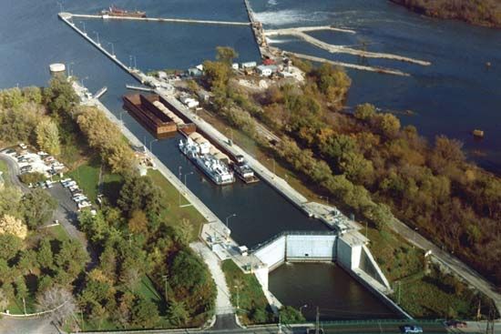
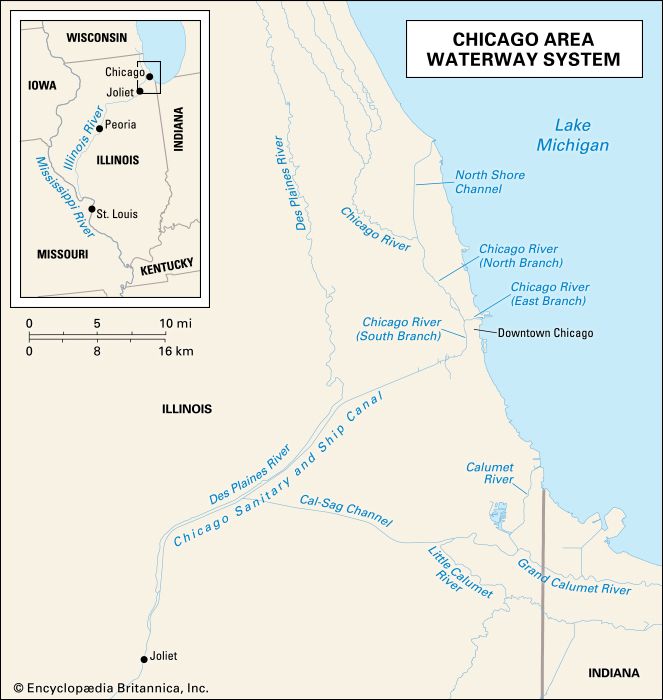
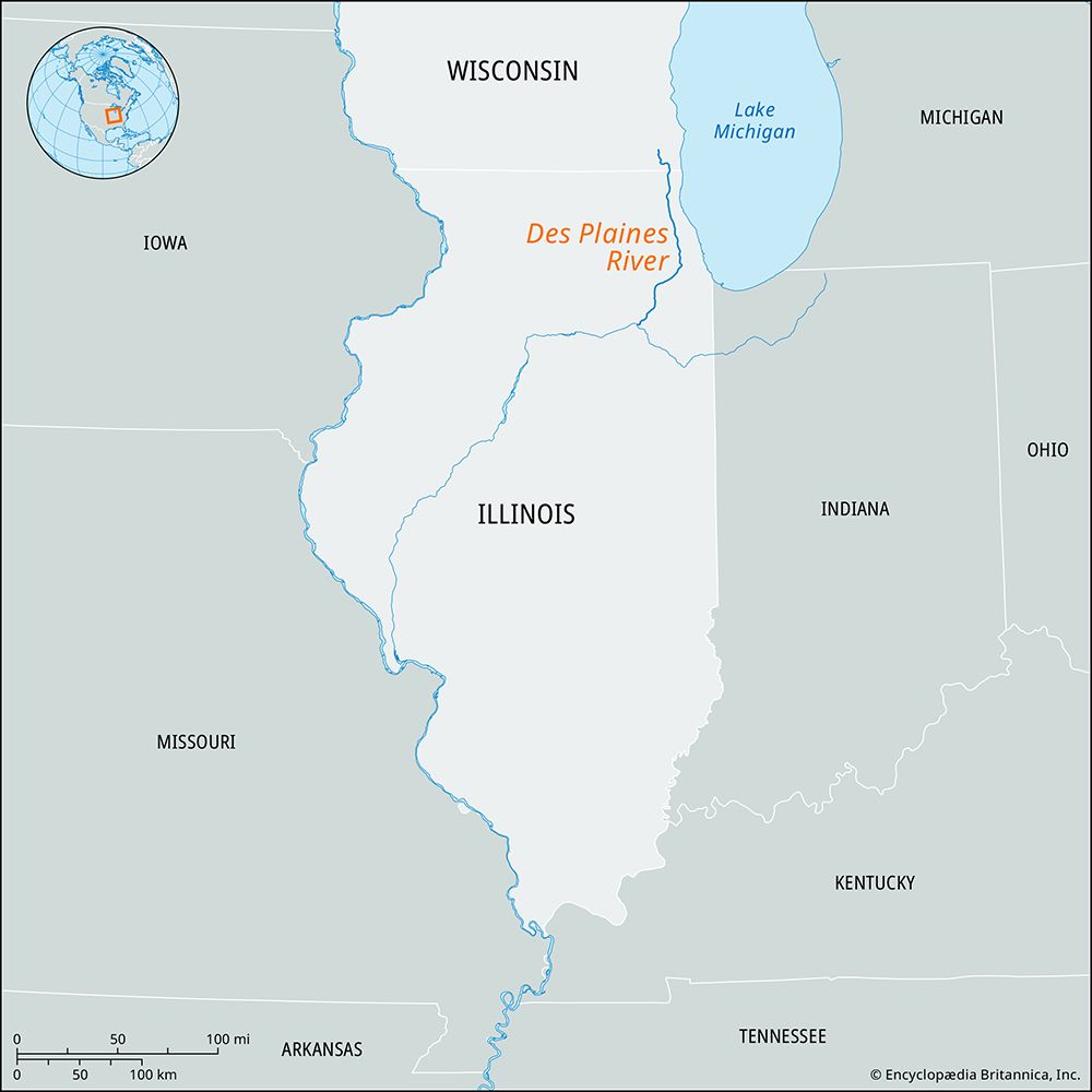
The Des Plaines River rises in Kenosha County, southeastern Wisconsin, and flows south into Illinois. Its course takes it through the northwestern suburbs of Chicago to Lyons, before continuing southwest past Lockport and Joliet.1
The river spans approximately 110 to 150 miles in length. Near Joliet, it joins the Kankakee River to form the Illinois River. Historically significant for trade, the river is now part of the Illinois Waterway, which facilitates barge traffic between the Great Lakes and the Mississippi River system.123
How does the Des Plaines River connect to the larger Mississippi River system?
The Des Plaines River connects to the Mississippi River system primarily through its role in the Illinois Waterway.
The connection functions through the following sequence:
- Confluence: The Des Plaines River joins the Kankakee River to form the Illinois River.13
- Main Channel: The Illinois River flows southwest across the state of Illinois for 273 miles before emptying into the Mississippi River at Grafton.3
- Navigation: The Chicago Sanitary and Ship Canal, completed in 1900, reversed the flow of the Chicago River. This allows water from Lake Michigan to flow into the Des Plaines River, creating a continuous navigable route for modern barge traffic between the Great Lakes and the Mississippi River system.13
Historically, this connection was facilitated by the Illinois and Michigan Canal, which opened in 1848 but was eventually superseded by the modern Illinois Waterway in 1933.13
What Native American tribes historically lived along the Des Plaines River?
The Des Plaines River region was historically inhabited by various Algonquian-speaking Native American tribes. As European colonial expansion pushed indigenous populations westward, the demographic landscape of northern Illinois shifted significantly.
The Potawatomi, who originally resided in the lower peninsula of Michigan, eventually moved into the region that became Illinois and Indiana, becoming prominent in the area surrounding Lake Michigan. Other tribes associated with northern Illinois and the broader region included the Sauk, Fox, Ottawa, Ojibwa, and Kickapoo.145
While the Illinois confederation—which included groups such as the Peoria, Kaskaskia, and Cahokia—was originally spread across southern Wisconsin and northern Illinois, they were later displaced from much of their territory by northern tribes, including the Sauk, Fox, Kickapoo, and Potawatomi, before being forced to move further west in the 19th century.51
What is the origin of the name ‘Des Plaines’ and what does it mean?
The name “Des Plaines” is of French origin and translates to “Of the Plains”.2
The river, which flows through northeastern Illinois and southeastern Wisconsin, was named by French explorers who encountered the landscape. The city of Des Plaines, located in Cook County, was originally named for an early settler, Socrates Rand, but was renamed in 1869 to match the name of the river.27
Sources
- Des Plaines River — Encyclopædia Britannica
- Des Plaines — Merriam-Webster
- Illinois River — Encyclopædia Britannica
- Illinois — Encyclopædia Britannica
- Illinois - History of Illinois — Encyclopædia Britannica
- Potawatomi — Encyclopædia Britannica
- Des Plaines — Encyclopædia Britannica
- Kankakee River — Encyclopædia Britannica
Published on · 2 min read