Mississippi River
Flood control on the Mississippi River has evolved from localized, small-scale efforts to a massive, integrated engineering system, though recent history has…
How has flood control on the Mississippi River evolved over time?
Flood control on the Mississippi River has evolved from localized, small-scale efforts to a massive, integrated engineering system, though recent history has shifted the focus toward more sustainable floodplain management.
Early efforts began in 1717 with French settlers in New Orleans building small levees to protect the city. Over the next two centuries, these efforts expanded into a complex network of embankments. However, the catastrophic Mississippi River flood of 1927 served as a turning point, prompting the federal government to commit to a comprehensive, integrated flood-control program managed by the U.S. Army Corps of Engineers.12
This system utilizes:
- Levees and Floodwalls: Concrete and earthen barriers to “wall in” the river.1
- Spillways and Floodways: Engineered channels like the Bonnet Carre Spillway to divert excess water.31
- Channel Improvements: Dredging and straightening to increase flow capacity.1
Despite these efforts, major floods in 1993, 2005, and 2011 demonstrated that total control is neither possible nor economically feasible. Consequently, modern strategies increasingly emphasize “living with the river” by relocating structures off floodplains and allowing natural flooding.21
What are some of the main tributaries of the Mississippi River?
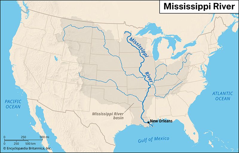
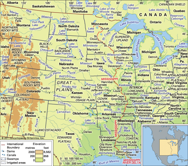
The Mississippi River drainage system is vast, collecting water from a wide array of tributaries across North America. These tributaries are generally categorized by the region from which they originate:
Western Tributaries These rivers rise in the western uplands, including the foothills of the Rocky Mountains, and carry significant silt loads from the Great Plains. Key examples include:
- Missouri River
- Arkansas River
- Red River
- Platte River
- Kansas River
Eastern Tributaries These rivers drain the well-watered Appalachian Mountains and typically flow into the Ohio River before joining the Mississippi. Notable tributaries include:
- Tennessee River
- Cumberland River
- Kentucky River
- Green River
Upper Mississippi Tributaries These rivers are located in regions shaped by glacial action and often trace the paths of former glacial sluiceways:
- Illinois River
- Wisconsin River
- St. Croix River
- Rock River
What is the length of the Mississippi River and how does it compare to other major rivers in the world?
The Mississippi River proper, measured from its source at Lake Itasca in Minnesota to the Gulf of Mexico, is 2,340 miles (3,766 km) long.8
When considering the river’s broader system—specifically the combined Mississippi–Missouri–Red Rock system—the total length is 3,710 miles (5,971 km). By this metric, it is ranked as the fourth-longest river system in the world, following the Nile, the Amazon–Ucayali–Apurímac system, and the Yangtze.78
It is important to note that measuring river lengths is complex due to varying standards for identifying sources and defining main channels, which often leads to ongoing scientific debate. While the Mississippi-Missouri system is a major global waterway, the 2,340-mile length of the Mississippi proper is exceeded by 19 other rivers worldwide. Despite its length ranking, the Mississippi remains one of the most significant rivers globally in terms of commercial activity and discharge volume, which is the largest in North America and the eighth greatest in the world.798
How has the Mississippi River influenced the economic development of the United States?
The Mississippi River has been a fundamental driver of United States economic development, serving as both a vital transportation artery and a catalyst for westward expansion.
Early Economic Expansion
Before the arrival of Europeans, the river was a critical highway and resource for Native American peoples. Following the Louisiana Purchase in 1803, the river became the primary route for American settlers moving westward. Early commerce relied on rafts, flatboats, and keelboats to transport goods downstream, facilitating the growth of agricultural communities and trade networks.11
The Steamboat Era
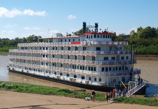
The introduction of the steamboat in 1811 revolutionized river commerce. By the mid-19th century, the Mississippi had become the economic “overlord” of half the country, with thousands of cargo ships moving goods like local produce and manufactured items. This era fostered the growth of numerous riverside towns that vied to provide essential services such as warehousing and fueling.12
Modern Commercial Activity
Despite the rise of railroads, the river remains a vital commercial asset. Managed by the Mississippi River Commission, the waterway supports massive barge traffic carrying bulk goods, including petroleum, iron, steel, and chemicals. Modern infrastructure, such as locks, dams, and deep-water channels, connects the Mississippi to the Great Lakes and the Intracoastal Waterway, ensuring its continued role in national and international trade.13
Sources
- Mississippi River flood of 2011 — Encyclopædia Britannica
- Mississippi River - Hydrology — Encyclopædia Britannica
- levee — Encyclopædia Britannica
- Mississippi River - Flood control — Encyclopædia Britannica
- Mississippi River - Physiography — Encyclopædia Britannica
- U.S. Army Corps of Engineers — Encyclopædia Britannica
- Mississippi River — Encyclopædia Britannica
- world’s longest rivers — Encyclopædia Britannica
- Missouri River — Encyclopædia Britannica
- Amazon River - The length of the Amazon — Encyclopædia Britannica
- Mississippi River - Modern commercial activity — Encyclopædia Britannica
- Mississippi River - Early settlement and exploration — Encyclopædia Britannica
- Mississippi River - Development of the river’s commerce — Encyclopædia Britannica
Published on · 3 min read