Diablo Range
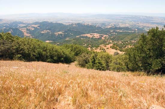
The Diablo Range is a segment of the Pacific Coast Ranges located in west-central California, U.S.
What is Diablo Range?
The Diablo Range is a segment of the Pacific Coast Ranges located in west-central California, U.S.1
Spanning approximately 180 miles (290 km), the range extends southeast from Mount Diablo—situated near Oakland—to northwestern Kern county. It serves as part of the western boundary for the Central Valley and runs parallel to the Pacific Ocean.11
While the mountains average between 3,000 and 4,000 feet (900 to 1,200 metres) in elevation, the highest point is San Benito Mountain, which reaches 5,241 feet (1,597 metres). The name originates from the Spanish Monte del Diablo (“Devil’s Woods”), a term first recorded in 1824 to describe a local indigenous ranchería. Today, the region’s economy is primarily supported by cattle grazing, petroleum, and agriculture.1
How do the Pacific Coast Ranges form?
The formation of the Pacific Coast Ranges is primarily driven by the complex movement of tectonic plates along the western margin of North America. This process has involved folding, faulting, and the intrusion of molten rock over millions of years.2
Key mechanisms include:
- Plate Interaction: The movement of the Pacific Plate relative to the North American Plate along transform faults, such as the San Andreas Fault, has been a major factor in shaping the ranges in California.23
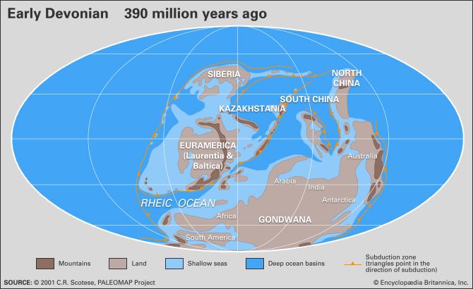
- Terrane Accretion: Since the late Devonian Period, subduction has caused elevated oceanic regions, or terranes, to be scraped off the descending plate and added to the continental margin. This piecemeal addition has significantly widened the western edge of the continent and triggered pulses of mountain building.4
- Ophiolite Emplacement: In some cases, slices of oceanic crust—known as ophiolites—were thrust over the overriding plate rather than being subducted, providing evidence of these ancient tectonic collisions.4
- Uplift and Erosion: While tectonic forces build these structures through uplift, erosional processes continuously sculpt their relief, creating the valleys and ridges seen today.5
What is the significance of the Central Valley to California’s geography?
The Central Valley is a vital geographic and economic feature of California, stretching 450 miles between the Sierra Nevada to the east and the Coast Ranges to the west. Encompassing approximately 18,000 square miles, it is almost entirely enclosed by mountains, with the San Francisco Bay serving as its only outlet to the Pacific Ocean.99
The valley’s significance is defined by its immense agricultural productivity. Supported by a complex system of dams and canals, it produces about one-fourth of the food consumed in the United States, including over 300 different crops such as cotton, fruits, nuts, and vegetables. This output is facilitated by a long growing season and fertile soil, making it one of the most productive farming regions in the country. Additionally, the valley is a major source of natural gas and petroleum, further anchoring its role in the state’s economy.91011
What are the primary tectonic forces shaping California’s mountains?
California’s mountains are shaped by a complex history of plate tectonics, involving several primary forces:
- Transform Faulting: Much of the modern topography in coastal California is defined by the lateral movement of the Pacific Plate against the North American Plate along the San Andreas Fault. This movement causes significant folding, faulting, and seismic activity.2
- Terrane Accretion: Over hundreds of millions of years, oceanic “terranes” were scraped off subducting plates and added to the continental margin. This process, which includes the emplacement of ophiolites (slices of ancient oceanic crust), has significantly widened the western edge of the continent and triggered major pulses of mountain building.412
- Magmatic Intrusion: Large-scale batholiths—massive bodies of igneous rock—formed deep underground during events like the Nevadan orogeny, providing the foundational structure for ranges like the Sierra Nevada.13
- Crustal Uplift: The Sierra Nevada is specifically characterized as an upfaulted, tilted block. Tremendous tectonic pressure caused this massive block to uplift and tilt westward, creating the range’s distinct asymmetric profile.13
Sources
- Diablo Range — Encyclopædia Britannica
- Pacific mountain system - Geology — Encyclopædia Britannica
- Pacific mountain system - Study and exploration — Encyclopædia Britannica
- plate tectonics - Mountains by terrane accretion — Encyclopædia Britannica
- North America - 30 to 2.5 million years ago — Encyclopædia Britannica
- plate tectonics - Mountains by subduction — Encyclopædia Britannica
- tectonic landform — Encyclopædia Britannica
- Pacific mountain system - Physiography — Encyclopædia Britannica
- Central Valley — Encyclopædia Britannica
- California - Agriculture, forestry, and fishing — Encyclopædia Britannica
- San Joaquin Valley — Encyclopædia Britannica
- Sierra Nevada - Geology — Encyclopædia Britannica
- Nevadan orogeny — Encyclopædia Britannica
Published on · 3 min read