Diamantina River
The Diamantina River is an intermittent river located in the east-central region of Australia. It originates in the Kirbys Range, northwest of Longreach…
What is Diamantina River?
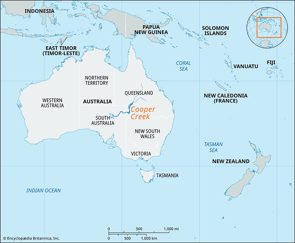
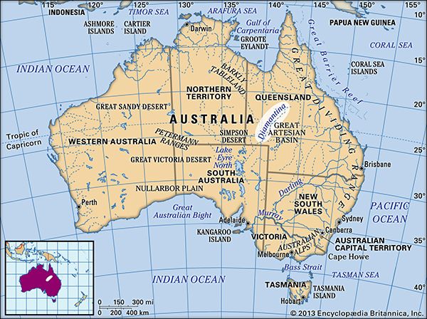
The Diamantina River is an intermittent river located in the east-central region of Australia. It originates in the Kirbys Range, northwest of Longreach, Queensland, and flows seasonally for approximately 560 miles (900 km) southwest through the Channel Country to reach Goyder Lagoon in South Australia.12
The river drains a basin covering 61,000 square miles (158,000 square km). During periods of significant flooding, the Diamantina and the Georgina River merge, eventually draining into Lake Eyre via the channel of Warburton Creek. Its flow is highly variable; while the average annual discharge at Birdsville is 890 cubic feet per second, it can surge to 50,000 cubic feet per second during floods or cease flowing entirely during dry years.1
What is the Channel Country region?
The Channel Country is a pastoral region covering approximately 60,000 square miles (155,000 square km), primarily located in southwestern Queensland, Australia, with smaller portions extending into northeastern South Australia and northwestern New South Wales.2
The region is characterized by flat alluvial terrain drained by several major waterways, including the Georgina, Thomson, Diamantina, and Barcoo rivers, as well as Cooper Creek. Its name is derived from the numerous channels carved into the floodplains by these rivers during periods of high water. Following annual floods—which can last up to six months—the land produces nutritious grasses, making it highly suitable for cattle grazing. First opened to pastoralists in 1877, the region has since developed into a significant cattle-raising area, supported by the construction of specialized beef roads designed to accommodate large, linked cattle trucks.2
How does Lake Eyre function as an endorheic basin?
Lake Eyre functions as an endorheic basin—a closed inland drainage system—because it lacks an outlet to the sea, causing all water that enters the basin to be lost through evaporation rather than flowing into an ocean.6
Key aspects of its function include:
- Internal Drainage: The lake is the lowest point of a vast internal drainage basin covering approximately 500,000 square miles (1,295,000 square km). While numerous river systems, such as the Diamantina River, drain into this region, they are intermittent.671
- High Evaporation Rates: Because the region experiences very low annual rainfall and extreme heat, most water from these rivers evaporates before reaching the lake bed. Consequently, the lake is normally dry, with its surface covered by a thin crust of salt deposited by evaporated water.67
- Structural Origin: The basin was formed by downfaulting in the Earth’s surface about 30,000 years ago, which effectively blocked off any potential outlet to the sea.6
- Periodic Flooding: The lake only fills significantly when heavy rains in the catchment area cause rivers to flood, allowing water to reach the depression.67
What are the challenges of living in an arid river system?
Living in an arid river system presents significant environmental and logistical challenges, primarily driven by the scarcity and variability of water.
Water Scarcity and Variability
Arid river systems are characterized by sparse or highly variable rainfall, leading to extreme fluctuations in water availability. Rivers may range from massive flood events to complete dryness in a single season or over several years. This unpredictability complicates agriculture and municipal planning, often necessitating expensive infrastructure like dams, pumps, and canals to store and transport water.191011
Environmental Degradation
Human intervention in these fragile ecosystems often leads to long-term damage:
- Soil Salinization: Intensive irrigation in arid regions frequently causes mineral residues to rise to the surface as water evaporates, destroying soil fertility and reducing crop yields.10
- Desertification: Overgrazing by livestock can compact soil and destroy vegetation, leaving the land vulnerable to erosion and preventing the regrowth of native grasses.12
- Ecosystem Loss: Modern water-control technologies can lead to the desiccation of marshlands and disrupt natural nutrient replenishment, negatively impacting local biodiversity and human populations.10
Management Challenges
Managing these systems requires balancing human needs with ecological health. While technologies like desalination and wastewater reuse offer potential solutions, they are often energy-intensive and costly. Furthermore, water rights and the depletion of groundwater remain persistent issues for communities in water-stressed regions.1311
We could dive deeper into the specific engineering solutions used to mitigate water scarcity in these regions, or perhaps explore the impact of climate change on these fragile ecosystems.
Sources
- Diamantina River — Encyclopædia Britannica
- Channel Country — Encyclopædia Britannica
- English Channel - Climate — Encyclopædia Britannica
- United Kingdom - Drainage — Encyclopædia Britannica
- English Channel - Hydrology — Encyclopædia Britannica
- Lake Eyre — Encyclopædia Britannica
- Australia - The Interior Lowlands — Encyclopædia Britannica
- Great Artesian Basin — Encyclopædia Britannica
- Tigris-Euphrates river system: Top Questions — Encyclopædia Britannica
- water scarcity - Engineering technologies — Encyclopædia Britannica
- desertification - Grazing lands — Encyclopædia Britannica
- Arizona: Top Questions — Encyclopædia Britannica
- desertification - Causes and consequences of desertification — Encyclopædia Britannica
Published on · 3 min read