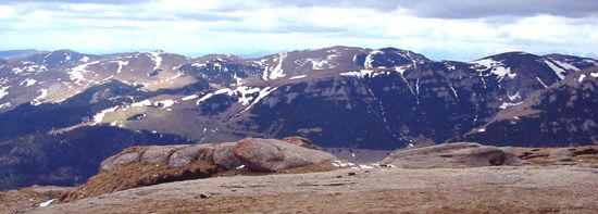
Făgăraş Mountains
The Făgăraș Mountains are the highest section of the Transylvanian Alps, located in south-central Romania. This 30-mile-long range is characterized by its…
What is Făgăraş Mountains?
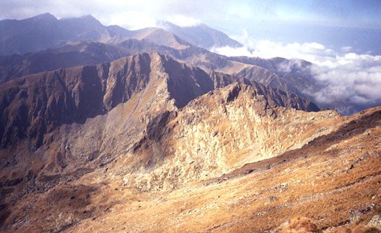
The Făgăraș Mountains are the highest section of the Transylvanian Alps, located in south-central Romania. This 30-mile-long range is characterized by its heavily glaciated terrain, featuring fretted peaks, glacial lakes, and morainic deposits.1
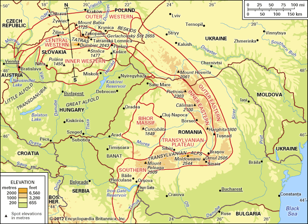
The range is defined by the Olt River breach to the west and the Bran Pass to the east. It contains the two highest peaks in the country: Moldoveanu (8,346 feet/2,544 meters) and Mount Negoiu (8,317 feet/2,535 meters). Compared to other parts of the Transylvanian Alps, the Făgăraș range is notably more isolated and inaccessible. To the north lies the town of Făgăraș, a historic military center known for its 15th-century castle.123
The mountains are structurally linked to neighboring massifs like the Bucegi Massif, which are popular destinations for hiking, climbing, and winter sports.4
What are the Transylvanian Alps?
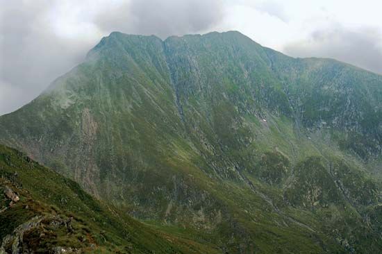
The Transylvanian Alps, also known as the Southern Carpathians, are a mountainous region located in south-central Romania. Stretching approximately 155 miles (250 km), this range extends from the Prahova River valley in the east to the gap formed by the Timiș and Cerna rivers in the west.56
Key characteristics of the region include:
- Physical Structure: Composed primarily of hard crystalline and volcanic rocks, the range is higher, more continuous, and more impassable than the eastern and western segments of the Carpathian Mountains5.6
- Elevation: The region maintains an average elevation between 4,920 and 5,740 feet (1,500–1,750 meters). It contains the highest peaks in Romania, including Mount Moldoveanu (8,346 feet/2,544 meters) and Mount Negoiu, both located in the Făgăraș Mountains.56
- Geography: The area is defined by massive relief forms, ancient erosion platforms, and deep river valleys, such as those of the Olt and Jiu rivers, which serve as vital transportation corridors.6
How do glaciers shape mountain landscapes?
Glaciers act as powerful agents of landscape transformation, significantly reshaping mountain terrain through erosion and deposition.
Erosional Landforms
Glaciers drastically alter pre-existing V-shaped stream valleys by removing debris and eroding bedrock, converting them into characteristic U-shaped valleys with wide, flat bottoms and steep sidewalls. As glaciers flow, they also create several distinct features:89
- Cirques: Amphitheatre-shaped hollows formed at the heads of glacial valleys. Their basins are often scoured deep enough to hold lakes known as tarns.8
- Arêtes and Horns: As cirques erode into a mountain from multiple sides, they leave behind sharp, knife-edge ridges called arêtes. When three or more cirques meet, they form a jagged, pyramid-shaped peak known as a horn, such as the Matterhorn.810
- Hanging Valleys: Because smaller tributary glaciers erode their troughs less deeply than the main glacier, they are left as elevated valleys when the ice melts, often resulting in waterfalls where they meet the main valley.109
Deposition and Legacy
Beyond erosion, glaciers transport and deposit vast quantities of material, including till and moraines, which can create more fertile soils in valley floors.109
What other mountain ranges are found in Romania?
The relief of Romania is dominated by the Carpathian Mountains, which are divided into three major geographical divisions. In addition to the Southern Carpathians (Transylvanian Alps), the country features:5
- Eastern Carpathians: Extending from the Ukrainian border to the Prahova River valley, these mountains consist of parallel crests with a rugged central core of crystalline rocks. This region includes the Rodna Massif, which contains the range’s highest peak, Pietrosu, and a western fringe of volcanic ranges like the Călimani and Harghita mountains.115
- Western Carpathians: Unlike the other divisions, these do not form a continuous range but rather a cluster of massifs, including the Banat Mountains and the Apuseni Mountains. The Apuseni group is centered on the Bihor Massif and is known for its extensive limestone formations and karst scenery.65
- Subcarpathians: This is an outer fringe of rolling, lower-elevation terrain that extends along the exterior of the Carpathian arc, providing a milder climate suitable for agriculture and viticulture.5
Sources
- Făgăraş Mountains — Encyclopædia Britannica
- Moldoveanu — Encyclopædia Britannica
- Bucegi Massif — Encyclopædia Britannica
- Făgăraş — Encyclopædia Britannica
- Transylvanian Alps — Encyclopædia Britannica
- Carpathian Mountains - Physiography of the Carpathian Mountains — Encyclopædia Britannica
- Romania - Relief — Encyclopædia Britannica
- glacial landform - Cirques , tarns, U-shaped valleys, arêtes, and horns — Encyclopædia Britannica
- Alps - Geology — Encyclopædia Britannica
- glacial valley — Encyclopædia Britannica
- Apuseni Mountains — Encyclopædia Britannica
Published on · 3 min read