Finke River
The Finke River is an intermittent river in central Australia that does not serve as a consistent source for large-scale agriculture or a reliable municipal…
What role does the Finke River play in the local water supply and agriculture?
The Finke River is an intermittent river in central Australia that does not serve as a consistent source for large-scale agriculture or a reliable municipal water supply. Because the river is intermittent, it only flows significantly during times of flood, at which point it can spread across vast areas of mudflats and sand flats.1
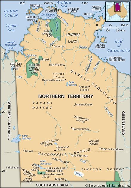
While the river does not support traditional agricultural irrigation, its 400-mile course is characterized by permanent waterholes and underground sources that provide essential hydration for the local environment. These features are critical for sustaining life in the arid landscape of the Northern Territory and along the edge of the Simpson Desert.1
Are there any notable geological or archaeological sites along the Finke River that provide insights into Australia’s past?
The Finke River region contains significant geological features that offer a window into the ancient landscape of central Australia. Notable sites along its course include:
- Glen Helen Gorge: A dramatic passage through the MacDonnell Ranges where the river cuts through the rugged terrain, showcasing the region’s complex geological history.1
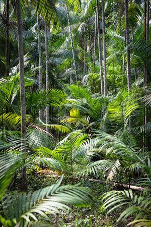
- Palm Valley: Located along the river’s path, this area is renowned for its unique environment and geological formations, serving as a refuge for rare flora that provides insights into the continent’s botanical past.1
- Gorge Systems: The river flows through a 40-mile (65-km) gorge situated between the Krichauff and James ranges, which exposes layers of rock that help geologists understand the structural evolution of the Northern Territory.1
While the river is primarily recognized for its intermittent flow and its role in draining the 44,000-square-mile basin, its path through these ranges and plains highlights the erosional forces that have shaped the Australian interior over millions of years.1
What are the unique geological features of the Finke River?
The Finke River is a major, intermittent river in central Australia defined by several unique geological characteristics:
- Source and Path: The river rises south of Mount Ziel in the MacDonnell Ranges, a system of parallel quartzite and sandstone ridges.13
- Gorge Systems: Along its 400-mile (640-km) course, the river carves through spectacular landscapes, including the Glen Helen Gorge and a 40-mile (65-km) gorge situated between the Krichauff and James ranges.13
- Hydrological Features: The river is characterized by permanent waterholes and underground sources that persist despite its intermittent flow. It only reaches Lake Eyre in South Australia during significant flood events, at which point it spreads across vast mudflats and sand flats.1
- Regional Context: It serves as the western boundary for the Simpson Desert, an arid region noted for its extensive red sand dunes and ridges.142
How long is the Finke River and what are its major tributaries?
The Finke River spans a course of 400 miles (640 km) through central Australia.1
As it emerges from a gorge between the Krichauff and James ranges, the river is joined by its major tributaries, the Palmer and Hugh rivers.1
Sources
- Finke River — Encyclopædia Britannica
- Northern Territory - Drainage and soils — Encyclopædia Britannica
- Simpson Desert — Encyclopædia Britannica
- MacDonnell Ranges — Encyclopædia Britannica
- list of rivers - Australia — Encyclopædia Britannica
Published on · 2 min read