Gilbert and Ellice Islands
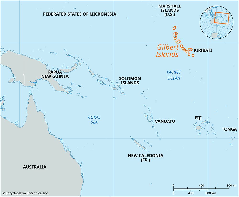
The Gilbert and Ellice Islands was a former British colony located in the west-central Pacific Ocean. The territory comprised the Gilbert Islands, the Ellice…
What is Gilbert and Ellice Islands?
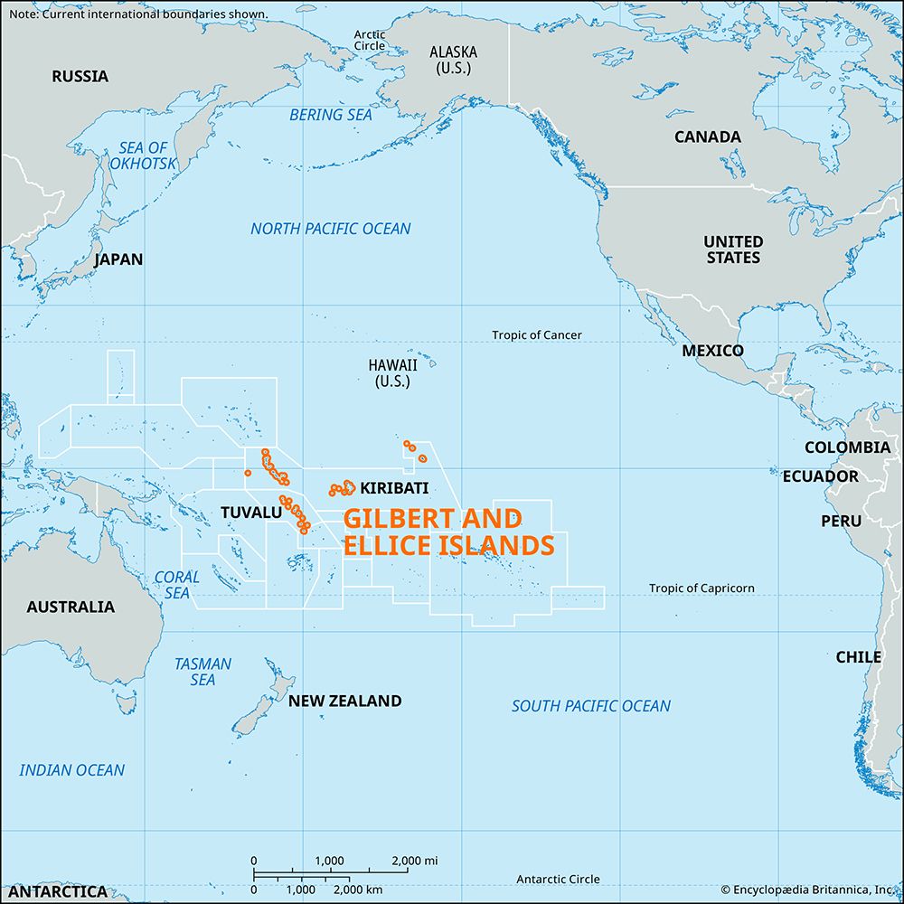
The Gilbert and Ellice Islands was a former British colony located in the west-central Pacific Ocean. The territory comprised the Gilbert Islands, the Ellice Islands (now Tuvalu), and the northern Line Islands and Phoenix Islands.12
Following European contact in the 19th century, the group was declared a British protectorate in 1892 and officially became a crown colony in 1916. By the 1960s, ethnic and political tensions between the Gilbertese and Ellice Islanders led to a movement for separation. Following a 1974 referendum, the colony was divided. The Ellice Islands gained independence as Tuvalu in 1978, and the Gilbert Islands became part of the independent nation of Kiribati in 1979.12
What led to the separation of the Gilbert and Ellice Islands?
The separation of the Gilbert and Ellice Islands colony was primarily driven by ethnic tensions and political rivalries between the two distinct populations within the territory.124
The Gilbert Islands were inhabited by Micronesians, while the Ellice Islands (now Tuvalu) were populated by Polynesians. By the 1960s, these groups experienced increasing friction, particularly regarding employment opportunities and the distribution of colonial resources. These underlying social and political differences led the Ellice Islanders to demand secession from the colony.412
The process of separation unfolded through the following key stages:
- Referendum: In 1974, a referendum was held in which the Ellice Islanders voted in favor of separation.12
- Transition: The colony transitioned into two separate administrative territories between October 1975 and January 1976.12
- Independence: The Ellice Islands achieved full independence as the nation of Tuvalu in 1978, followed by the Gilbert Islands, which became the independent nation of Kiribati in 1979.512
What is the geography of the islands that make up Kiribati and Tuvalu?
The geography of Kiribati and Tuvalu is defined by their status as low-lying coral formations in the Pacific Ocean.
Kiribati
Kiribati consists of 33 islands scattered across a vast oceanic area, comprising the Gilbert Islands, the Phoenix Islands, and the Line Islands. These islands are primarily low-lying coral atolls and reef islands. Because of their low elevation, they face significant threats from rising sea levels associated with climate change, which risk contaminating freshwater supplies and submerging land.78591011
Tuvalu
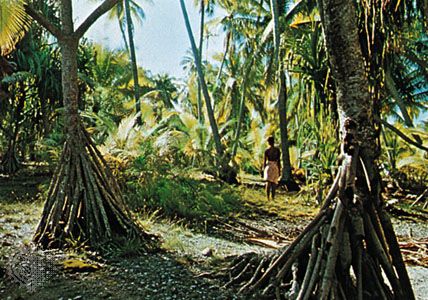
Tuvalu is composed of nine small coral islands stretching northwest to southeast. The group includes both atolls—which feature islets encircling a shallow lagoon—and compact reef islands with fringing reefs. The islands are extremely low-lying, typically reaching only 13 to 16 feet (4 to 5 meters) above sea level. There are no rivers, meaning the population relies entirely on wells and rain catchment for fresh water. Due to porous soils, agriculture is limited to hardy crops like coconut palms, pandanus, and taro.4
How did World War II impact the islands in the Pacific?
World War II profoundly transformed the Pacific Islands, serving as a major theater of conflict that disrupted colonial administration and fundamentally altered the lives of indigenous populations.13
Military Conflict and Occupation
The war brought intense combat to the region as Allied and Japanese forces vied for strategic control. The Gilbert Islands were occupied by Japan in 1941 and subsequently retaken by U.S. forces in 1943, notably during the fierce fighting on Tarawa. Similarly, the Marshall Islands and Mariana Islands became critical battlegrounds, with the U.S. launching massive amphibious operations to secure bases for air power, such as the B-29 bombers stationed on Saipan.14151617
Post-War Consequences
The aftermath of the war led to significant shifts in governance and environmental health:
- Political Change: Colonial powers, recognizing the need for reform, moved toward granting indigenous populations greater political participation and eventual self-government or independence.13
- Nuclear Testing: Following the war, the United States utilized atolls like Bikini and Enewetak for extensive atomic and thermonuclear testing. This resulted in the forced relocation of native populations and severe, long-term radioactive contamination of the environment and local inhabitants.15
Sources
- Gilbert and Ellice Islands — Encyclopædia Britannica
- history of Tuvalu — Encyclopædia Britannica
- Gilbert and Ellice — Merriam-Webster
- history of Kiribati — Encyclopædia Britannica
- Gilbert Islands — Encyclopædia Britannica
- flag of Tuvalu — Encyclopædia Britannica
- Kiribati — Encyclopædia Britannica
- Tuvalu — Encyclopædia Britannica
- Gilbert Islands — Merriam-Webster
- Phoenix Islands — Encyclopædia Britannica
- Kiribati - History of Kiribati — Encyclopædia Britannica
- Line Islands — Encyclopædia Britannica
- Tarawa — Encyclopædia Britannica
- Pacific War - The Central Pacific Islands — Encyclopædia Britannica
- Pacific Islands - World War II and its aftermath — Encyclopædia Britannica
- Pacific War - Casualties and the material cost of the Pacific War — Encyclopædia Britannica
- World War II - The central Pacific — Encyclopædia Britannica
- Micronesian culture - Contemporary Micronesia — Encyclopædia Britannica
- Bikini — Encyclopædia Britannica
Published on · 3 min read