Gilbert Islands
The Gilbert Islands, which form the core of the nation of Kiribati, face significant existential threats due to climate change. The primary impact is the…
How has climate change affected the Gilbert Islands and what are the future projections?
The Gilbert Islands, which form the core of the nation of Kiribati, face significant existential threats due to climate change. The primary impact is the rise in sea levels, which threatens to contaminate freshwater supplies and eventually submerge these low-lying coral atolls.12
To address these future projections, the government has been actively investigating long-term safety and adaptation strategies. Potential measures include:
- Migration and Land Acquisition: The government has explored encouraging the emigration of skilled workers and has already purchased approximately 8 square miles (20 square km) of land on the Fijian island of Vanua Levu. This land is intended to serve as a potential new homeland if the islands become uninhabitable, while currently providing space for supplemental food production.12
- Engineering Solutions: Officials have considered the creation of artificial islets, similar to offshore oil-drilling platforms, to provide alternative living spaces for the population.12
These efforts reflect the urgent need to ensure the safety and future of the nation’s citizens in the face of environmental instability.12
What is the geographical location and composition of the Gilbert Islands?
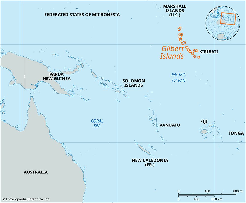
The Gilbert Islands are a group of 16 low-lying coral islands and atolls located in the west-central Pacific Ocean, situated along the Equator. They are positioned approximately 2,800 miles (4,500 km) northeast of Australia and serve as the primary population center for the nation of Kiribati2.2451
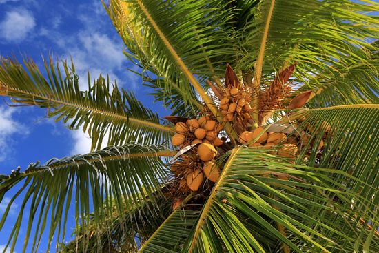
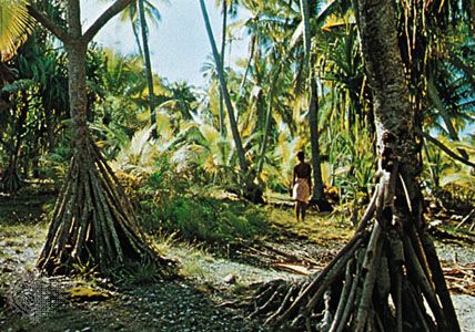
Regarding their composition, the islands are characterized by their low elevation and are covered with coconut palm and pandanus vegetation. The group consists of the following islands and atolls:2
- Makin, Butaritari, Marakei, Abaiang, Tarawa, Maiana, Abemama, Kuria, Aranuka, Nonouti, Tabiteuea, Beru, Nikunau, Onotoa, Tamana, and Arorae.2
The total land area of the group is 108 square miles (280 square km). While the northern islands receive higher annual rainfall, the climate and geography support traditional village life, alongside semiurban government centers located on the islets of South Tarawa.21
What are the main economic activities and resources of the Gilbert Islands?
The economy of the Gilbert Islands is primarily based on subsistence farming and fishing, with copra serving as a major export. While the village economy relies on these traditional activities, the broader national economy of Kiribati includes several other key components:62
- Marine Resources: The nation claims a vast Exclusive Economic Zone and generates revenue through license fees from foreign fishing fleets, including tuna-fishing agreements. Commercial seaweed farming has also emerged as a significant economic activity.6
- Strategic Location: Due to their position along the Equator, the islands are utilized for satellite telemetry and spacecraft-launching facilities, which provide capital and infrastructure improvements.61
- Historical Revenue: Until 1979, the economy was heavily dependent on phosphate mining on Banaba. Today, interest from a reserve fund accumulated during the mining era continues to contribute to government revenue.67
- Manufacturing and Aid: A small manufacturing sector produces furniture, clothing, beverages, and sea salt. Despite these efforts, the country remains dependent on foreign aid for most capital and development expenditures.6
How does the government structure of Kiribati incorporate the Gilbert Islands?
The Gilbert Islands serve as the primary population center and the administrative heart of the Republic of Kiribati, which achieved independence in 1979. The government structure incorporates the islands through a centralized national system combined with local representation:281
- National Government: The capital and primary government centers are located on the islets of South Tarawa within the Gilbert group. These include Bairiki (executive), Ambo (legislative), and Betio (judicial).28
- Legislative Body: The national legislature, the unicameral House of Assembly (Maneaba ni Maungatabu), consists of 42 members, including 40 elected representatives, one appointed member from the Banaban community, and the attorney general.1
- Executive Leadership: A president is elected by the populace from candidates chosen by the House of Assembly. The president appoints up to 10 cabinet ministers from the legislature.1
- Local Administration: Beyond the national level, governance is facilitated through elected island councils, ensuring that local communities across the Gilbert Islands and other groups have a voice in the administration.1
Sources
- Kiribati - History of Kiribati — Encyclopædia Britannica
- Gilbert Islands — Encyclopædia Britannica
- history of Kiribati — Encyclopædia Britannica
- Gilbert Islands — Merriam-Webster
- Kiribati — Encyclopædia Britannica
- Kiribati - Economy — Encyclopædia Britannica
- Kiribati - Land — Encyclopædia Britannica
- Kiribati - Government and society — Encyclopædia Britannica
- flag of Kiribati — Encyclopædia Britannica
Published on · 3 min read