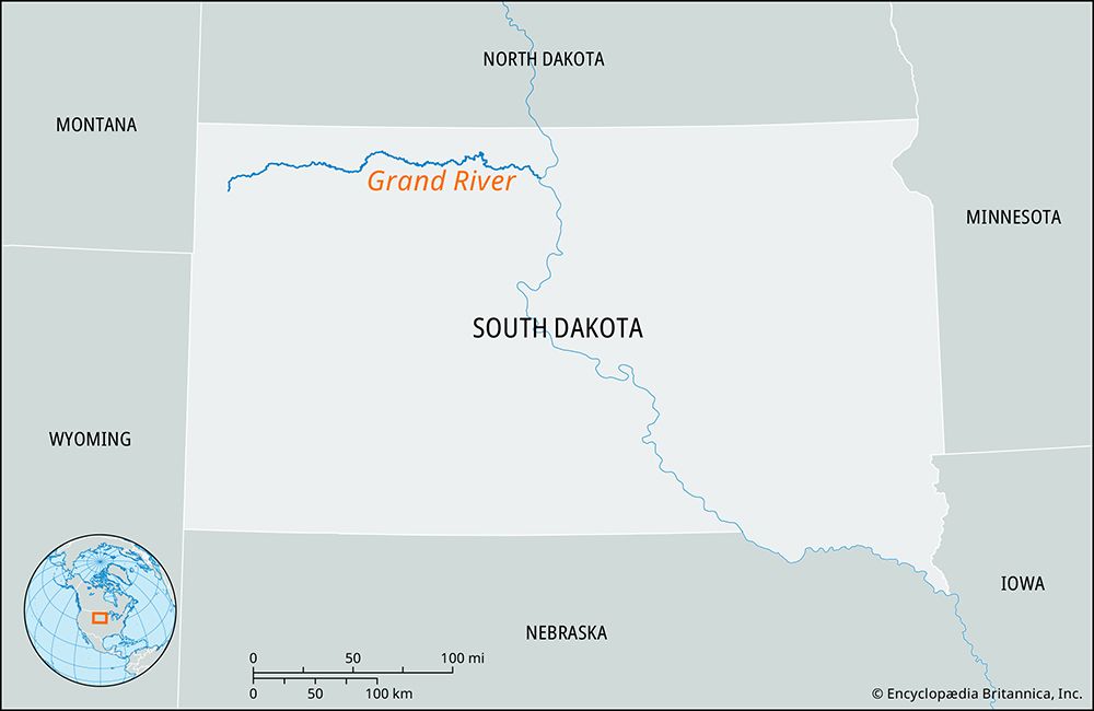
Grand River
The name "Grand River" refers to several distinct waterways in the United States, most notably:
What is Grand River?
The name “Grand River” refers to several distinct waterways in the United States, most notably:
- Iowa and Missouri: A 215-mile-long river that rises in south-central Iowa and flows south into Missouri. It joins the Missouri River near Brunswick. Historically, French explorers referred to it as “La Grande Rivière” and established Fort D’Orleans near its mouth in 1723 to secure military control of the region.1
- Michigan: A river in southwestern Michigan that flows north and west into Lake Michigan. The city of Grand Rapids is situated along this river, which historically provided the waterpower that fueled the city’s early furniture-making and lumber industries.2
Other rivers in the United States, such as those in South Dakota, have also historically carried the name “Grand River,” and the upper portion of the Colorado River was once known by this title as well.3
How do rivers shape the geography of the regions they flow through?
Rivers are the most significant agents in molding Earth’s landscapes, as their ubiquity ensures that fluvial processes influence nearly every region. They function as more than simple transport channels; they actively reshape geologic settings through a continuous cycle of erosion and deposition.6
Mechanisms of Landscape Evolution
Rivers transform topography by moving sediment-laden water. When energy is high, rivers erode the landscape; when energy decreases, they deposit sediment, creating distinct landforms.6
- Floodplains: These are shaped by lateral and vertical accretion. As rivers meander, they erode outer banks while depositing sediment on inner banks to form point bars. Over time, this process creates meander scrolls and other complex microtopography like natural levees and backswamps.7
- Deltas: Where rivers enter standing water, they create deltas. These depositional plains form as the river’s sediment load meets the energy of the shoreline, resulting in diverse shapes and sizes determined by basin characteristics and ocean energy.8
Human and Regional Impact
Beyond physical geography, rivers have historically dictated the location of human civilization. By providing water for irrigation, communication routes, and power, rivers fostered the rise of “hydraulic civilizations” in valleys like the Nile and Tigris-Euphrates. However, human reliance on these systems—through deforestation or irrigation-induced salinization—can also lead to environmental and social degradation.9
What is the difference between a river and a tributary?
The distinction between a river and a tributary is primarily one of hierarchy within a drainage basin.
A river is a large, natural stream of water that serves as a primary passageway for water flowing toward an ocean, lake, or another river. A tributary, by contrast, is a smaller stream or river that flows into a larger body of water, such as a main trunk stream.10111213
The relationship is defined by the flow of water:
- Tributaries contribute their water to a larger system. They are essentially the “branches” that feed the main river.1412
- Rivers act as the main channel that collects the water from these various tributaries.11
It is important to note that size does not always dictate the classification. While a tributary is often smaller than the river it joins, some tributaries are immense; for example, the Missouri River is a tributary to the Mississippi River, despite being thousands of miles long itself.14
Why were rivers historically important for early settlements and trade?
Rivers were fundamental to the development of early human settlements and trade, serving as the lifeblood for what are often called hydraulic civilizations.
Settlement and Agriculture
Early permanent settlements, such as those in the Tigris-Euphrates and Nile valleys, relied on rivers for survival. These waterways provided essential water for irrigation, allowing communities to cultivate crops and manage domesticated animals. The annual flooding of these rivers deposited rich alluvium, which rejuvenated the soil and supported the food surpluses necessary for the rise of towns and cities. Managing these floodplains required sophisticated engineering and community organization, which in turn fostered the development of complex legal codes and social structures.816
Trade and Communication
Rivers acted as the primary corridors for movement, providing the easiest and often the only means of transport for traders, explorers, and settlers.8
- Navigation: Rivers facilitated the movement of goods and people across vast distances. In many regions, they served as the main arteries for commerce, with cities often rising at key crossing points or along navigable stretches.817
- Economic Hubs: Throughout history, from medieval Europe to the expansion into the North American interior, natural waterways directed the lines of settlement and trade. Even today, inland waterways remain a highly economical method for transporting bulk commodities like grain, coal, and ore.818
Sources
- Grand River — Encyclopædia Britannica
- North America - Drainage — Encyclopædia Britannica
- Grand Rapids — Merriam-Webster
- Grand Rapids — Encyclopædia Britannica
- Grand — Merriam-Webster
- river - Rivers as agents of landscape evolution — Encyclopædia Britannica
- river - Floodplain deposits, origins, and features — Encyclopædia Britannica
- river - Significance in early human settlements — Encyclopædia Britannica
- river - Deltas — Encyclopædia Britannica
- tributary — Merriam-Webster
- river — Merriam-Webster
- drainage basin — Encyclopædia Britannica
- river - Braided channels — Encyclopædia Britannica
- tributaries — Merriam-Webster
- Did you know? — Merriam-Webster
- history of technology - Irrigation — Encyclopædia Britannica
- Tigris-Euphrates river system - Navigation — Encyclopædia Britannica
- canals and inland waterways — Encyclopædia Britannica
Published on · 3 min read