Harīrūd
The Harīrūd (also spelled Hari Rud) is a 700-mile (1,100–1,126 km) river located in Central Asia.
What is Harīrūd?
The Harīrūd (also spelled Hari Rud) is a 700-mile (1,100–1,126 km) river located in Central Asia.12
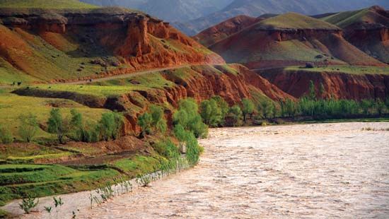
It originates on the western slopes of the Selseleh-ye Kūh-e Bābā range, an outlier of the Hindu Kush mountains in central Afghanistan. The river flows westward past Chaghcharān and the ancient city of Herāt—from which its name is derived—before turning north. In its course, it forms portions of the borders between Afghanistan and Iran, as well as Iran and Turkmenistan.1
Upon entering Turkmenistan, the river is known as the Tejen and eventually terminates in the sands of the Karakum Desert. The Harīrūd plays a vital role in the region by irrigating productive, cultivated land within Afghanistan.12
What are the major mountain ranges in Afghanistan?
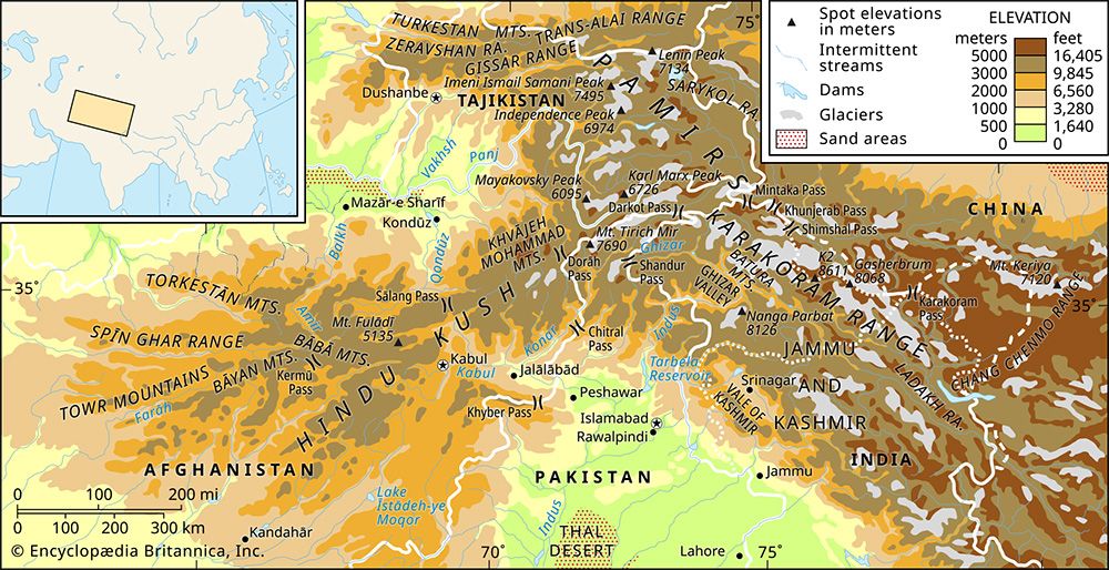
The most prominent geographic feature of Afghanistan is the Hindu Kush, a formidable mountain range that runs from the northeast to the southwest of the country. As it extends roughly 100 miles north of Kabul, the range spreads out into several subsidiary chains.3
Key mountain ranges in Afghanistan include:
- Bābā Mountains (Kūh-e Bābā): Often referred to as the western Hindu Kush, these mountains branch out from the main range near the Shebar Pass branch out from the main range near the Shebar Pass.345
- Bāyan and Sefīd Kūh (Paropamisus): These ranges continue the westward progression of the Hindu Kush.3
- Torkestān Mountains: A spur that extends in a northwestward direction.3
- Sīāh Kūh: Located south of the Harīrūd.3
- Ħeṣār Mountains: These stretch in a northward direction.3
- Mālmand and Khākbād: These ranges extend toward the southwest.3
- Spin Ghar: Located along the eastern frontier with Pakistan, these mountains help isolate the country’s interior from moisture-laden winds.34
How do rivers in Central Asia support agriculture in desert regions?
Rivers in Central Asia are essential for supporting agriculture in arid and desert regions, as they provide the necessary water to transform otherwise infertile land into productive areas for intensive agriculture.67
Mechanisms of Irrigation
In these regions, agriculture relies heavily on the diversion of water from major river systems, such as the Amu Darya, the Syr Darya, and the Harīrūd. This is achieved through:189
- Canal Systems: Massive infrastructure projects, like the Karakum Canal, transport water from rivers across vast distances to reach arid plains and desert zones.8
- Dams and Reservoirs: Complex systems of dams and hydroelectric stations regulate river flow, protecting cultivated fields from floods and ensuring a consistent water supply for crops like cotton, rice, and grains.186
- Alluvial Soil Utilization: Farmers capitalize on the nutrient-rich alluvial soils found in river valleys and deltas, which become highly productive when irrigated.67
Environmental Consequences
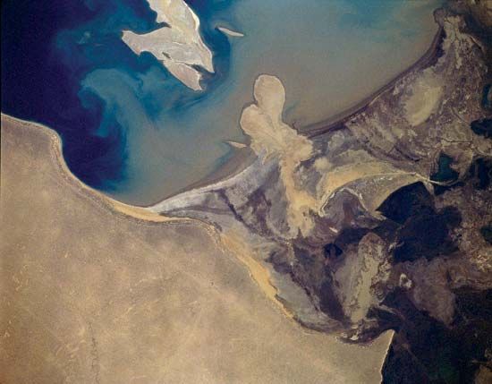
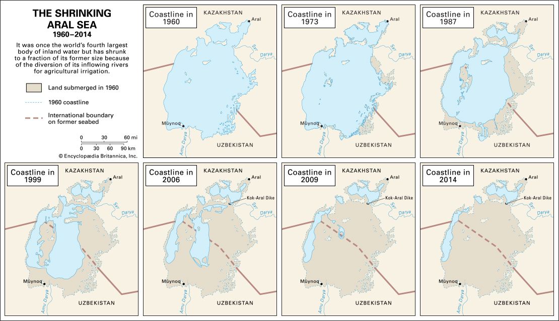
While these irrigation practices enable farming in desert environments, they have also caused significant ecological damage. The diversion of water has led to the shrinking of the Aral Sea, as rivers no longer reach their historic terminus. Furthermore, intensive irrigation on hot, dry floodplains often leads to increased soil salinity, which can render land infertile over time.186
What is the historical importance of the city of Herat?
Herat, located in western Afghanistan along the Harīrūd River, has served as a vital economic, cultural, and strategic crossroads for millennia.1314
Ancient and Medieval Significance
The region, known in antiquity as Ariea, was a significant site mentioned in the Avesta and Achaemenid inscriptions. Alexander the Great conquered the area in 330 BCE, establishing a fortress city. Throughout the centuries, it was held by various powers, including the Parthians, Kushans, and Sasanian dynasty, before falling to Arab forces in the 7th century CE. The city suffered immense destruction during the Mongol invasions of the 13th century.1314
The Timurid Golden Age
Herat reached its historical zenith under Timurid rule in the 15th century. When Shāh Rokh transferred the capital there, the city became a premier center for Persian culture, science, and the arts. It was renowned for its school of miniature painting—exemplified by the master Kamāl al-Dīn Behzād—as well as advancements in calligraphy, book production, and architecture.1315
Modern Era and Strategic Role
Following the Timurid period, Herat was frequently contested between Iranian and Afghan rulers. In the 19th century, it became a focal point of the “Great Game,” as Great Britain sought to prevent Russian encroachment on India by ensuring Herat remained under Afghan control. In the 20th century, the city remained a critical site of conflict, notably during the 1979 uprising against the communist government and the subsequent Soviet invasion of Afghanistan.1314
Sources
- Harīrūd — Encyclopædia Britannica
- Harīrūd — Merriam-Webster
- Afghanistan - The Hindu Kush — Encyclopædia Britannica
- Hindu Kush - Physiography — Encyclopædia Britannica
- Afghanistan - Physiographic regions — Encyclopædia Britannica
- Syr Darya — Encyclopædia Britannica
- Amu Darya — Encyclopædia Britannica
- land reclamation - Reclamation of arid land — Encyclopædia Britannica
- Asia - Cereals and grains — Encyclopædia Britannica
- Asia - Human impact on natural landscapes — Encyclopædia Britannica
- Afghanistan - Drainage of Afghanistan — Encyclopædia Britannica
- Asia - Agriculture of Asia — Encyclopædia Britannica
- Herāt — Encyclopædia Britannica
- Timurid dynasty — Encyclopædia Britannica
- Herāt — Encyclopædia Britannica
Published on · 3 min read