Hawke Bay
Hawke Bay is a large, oval-shaped bay located on the eastern coast of the North Island of New Zealand. It is bounded by the Mahia Peninsula to the northeast…
What is Hawke Bay?
Hawke Bay is a large, oval-shaped bay located on the eastern coast of the North Island of New Zealand. It is bounded by the Mahia Peninsula to the northeast and Cape Kidnappers to the southwest, with depths that do not exceed 600 feet. The bay was named by Captain James Cook in 1769 in honor of Sir Edward Hawke, who served as the First Lord of the Admiralty.1
It is important to distinguish the bay from the Hawke’s Bay region, which is a regional council encompassing the hill country and plains surrounding the bay. This region is well-known for its agricultural productivity, including sheep farming, orchards, and vineyards, particularly on the Heretaunga Plain. Major urban centers in the area include Napier, a significant wool wholesale hub, and Hastings, a center for food processing.21
Who was Captain James Cook and what were his voyages?
James Cook (1728–1779) was a renowned British naval captain, navigator, and explorer who fundamentally transformed global cartography through his three major expeditions to the Pacific Ocean.34
The Three Voyages
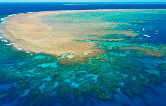
- First Voyage (1768–1771): Commissioned by the Royal Society and the Admiralty, Cook commanded the HMS Endeavour to Tahiti to observe the transit of Venus. He subsequently circumnavigated New Zealand and charted the eastern coast of Australia, successfully navigating the Great Barrier Reef.56
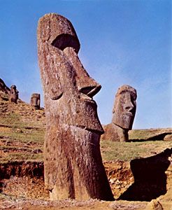
- Second Voyage (1772–1775): Aboard the Resolution and Adventure, Cook performed the first west-east circumnavigation in high latitudes. He disproved the existence of a habitable southern continent (Terra Australis) and charted numerous islands, including Tonga, Easter Island, and New Caledonia.56
- Third Voyage (1776–1779): Searching for a Northwest Passage, Cook explored the North Pacific. He located the Hawaiian Islands, where he was killed in 1779 during a conflict with local inhabitants.56
Cook is celebrated for his scientific rigor, his humane treatment of indigenous peoples, and his revolutionary success in preventing scurvy among his crews.56
What are the main industries in New Zealand’s North Island?
The economy of New Zealand’s North Island is diverse, supported by a mix of primary production, manufacturing, and a robust service sector.
Primary Industries
- Agriculture and Farming: Pastoral farming is a cornerstone of the economy. The North Island features significant dairy farming, particularly in regions like Taranaki and areas surrounding the Volcanic Plateau. Livestock and dairy farming are supported by intensive land development and specialized services.789
- Forestry: The island is a major hub for forestry, utilizing extensive tree plantations to supply large sawmills and pulp and paper plants. This sector is a significant contributor to the regional economy and a supplier of wood products to the Asia-Pacific region.789
- Horticulture and Viticulture: The region benefits from a benign climate that supports horticulture and viticulture, with many local wines achieving international acclaim.7
Manufacturing and Services
- Manufacturing: The manufacturing sector remains a vital employer, producing goods such as concrete and building products, prefabricated metal structures, machinery, and engineering goods. Historically, the sector also focused on food processing and timber products.109
- Tourism: Tourism is a major economic driver, particularly in areas like Rotorua, which attracts visitors with its unique geothermal features and Māori cultural sites.119
- Public Services: As the location of the national capital, Wellington, the North Island serves as the primary base for the public-service sector and government administration.1211
How do mountain ranges influence the climate of a region?
Mountain ranges significantly influence regional climates through their physical structure and impact on atmospheric movement. As elevation increases, atmospheric pressure decreases, causing air to expand and cool through adiabatic processes, which results in lower temperatures at higher altitudes.1415
Mountains also act as major barriers to air masses. When moist air is forced up the windward slopes, it cools and produces orographic precipitation, often leading to heavy rainfall or snow. Conversely, the air that descends on the leeward side is typically drier, creating an arid region known as a rain shadow.161714
Furthermore, the orientation of these ranges dictates their climatic impact. North-south barriers, such as the Andes, can block the movement of cold continental air, leading to milder conditions on western coasts compared to continental interiors. In contrast, east-west ranges offer less resistance to westerly winds, allowing maritime influences to penetrate further inland. Additionally, mountains can funnel winds through valleys and create localized microclimates based on slope exposure to solar radiation.1714
Sources
- Hawke Bay — Encyclopædia Britannica
- Hawke’s Bay — Encyclopædia Britannica
- James Cook: Top Questions — Encyclopædia Britannica
- James Cook — Encyclopædia Britannica
- Pacific Islands - The 18th century — Encyclopædia Britannica
- James Cook - Voyages and discoveries — Encyclopædia Britannica
- New Zealand - Agriculture, forestry, and fishing — Encyclopædia Britannica
- New Zealand - Relief of New Zealand — Encyclopædia Britannica
- New Zealand - Manufacturing — Encyclopædia Britannica
- North Island — Encyclopædia Britannica
- New Zealand - Services — Encyclopædia Britannica
- Cook Islands - Manufacturing and trade — Encyclopædia Britannica
- Rotorua — Encyclopædia Britannica
- Highland climate — Encyclopædia Britannica
- Orographic precipitation — Encyclopædia Britannica
- Why are higher elevations colder? — Encyclopædia Britannica
- Atmosphere - Mountain barriers — Encyclopædia Britannica
Published on · 3 min read