Île Des Pins
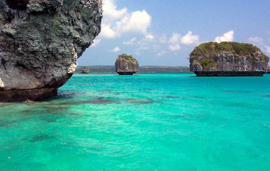
Île des Pins, also known as the Isle of Pines, is an island located in the southwestern Pacific Ocean that forms part of the French overseas country of New…
What is Île des Pins?
Île des Pins, also known as the Isle of Pines, is an island located in the southwestern Pacific Ocean that forms part of the French overseas country of New Caledonia.12
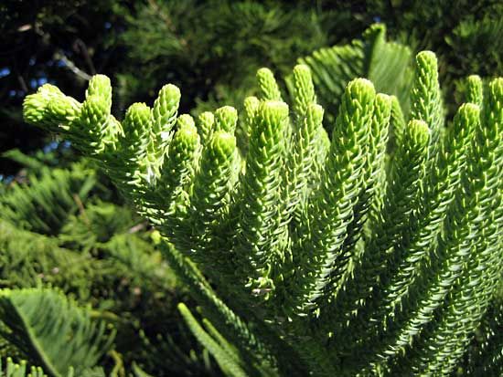
The island derives its name from the Araucaria columnaris, a species of pinelike coniferous tree that covers its landscape. It is a rugged island, reaching an elevation of 870 feet (265 metres) at Nga Peak, and spans an area of approximately 59 square miles (152 square km).1
Historically, the island served as a penal colony, but it has since transitioned into a popular tourist destination. The main town, Vao, is situated on the southern coast, and the local economy includes the export of shrimp and oysters. The island was famously visited by Capt. James Cook in 1774.1
What are the unique characteristics of the Araucaria columnaris tree?
The Araucaria columnaris, commonly known as the New Caledonian pine, is a distinct species native to New Caledonia and the New Hebrides.3
While it is often confused with the Norfolk Island pine (Araucaria heterophylla), the Araucaria columnaris is characterized by its notably tall, columnar growth habit. Like other members of the Araucariaceae family, it is not a true pine, despite its common name.34
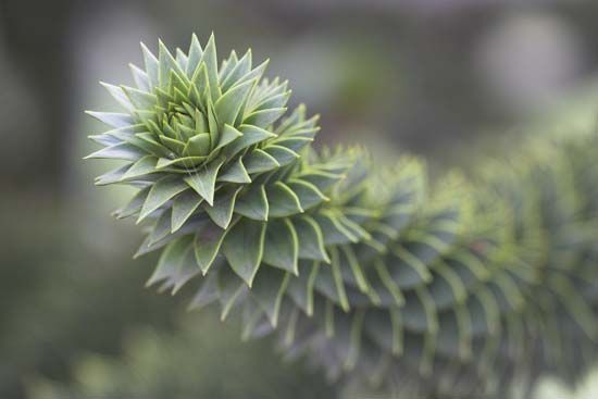
The tree is recognized for its symmetric, whorled branching pattern and characteristically straight trunk. These trees are part of a group of evergreen conifers that exhibit unique developmental traits; for instance, in related species, lateral branches rooted in soil fail to produce an erect stem, instead growing horizontally.4
How did the island function as a penal colony in the past?
France took possession of the Île des Pins in 1853 with the specific intention of utilizing the territory as a penal colony. This initiative was part of a broader colonial strategy in New Caledonia, where the French administration focused on the reception and control of approximately 22,000 convicts transported to the region between 1864 and 1897.15
The penal system was a central concern of the early colonial administration, which sought to manage these convicts while simultaneously attempting to attract free settlers and secure a supply of cheap labor. In addition to common criminals, the territory served as an unlikely home for about 4,000 déportés—political exiles following the 1871 uprising of the Paris Commune. While many convicts remained in the territory after their sentences, few established families, and most political exiles departed once they were granted amnesty.5
What other islands make up the territory of New Caledonia?
The territory of New Caledonia is composed of the main island, known as Grande Terre, and several surrounding island groups and islets.6
The primary components of the territory include:
- Grande Terre: The main island, which houses the capital, Nouméa, and the majority of the population.6
- Loyalty Islands: A limestone coral group comprising Ouvéa, Lifou, and Maré.76
- Bélep Islands: A group located to the north of the main island.6
- Île des Pins: An island famous for its Araucaria columnaris forests.61
Additionally, the territory encompasses numerous remote and largely uninhabited features, including the Huon and Surprise islands, the Chesterfield Islands, the Bellona Reefs, Walpole Island, Beautemps-Beaupré Atoll, and the Astrolabe Reefs. France also maintains a claim over Hunter and Matthew islands, though this is disputed by Vanuatu.6
Sources
- Île des Pins — Encyclopædia Britannica
- Ile des Pins — Merriam-Webster
- New Caledonian pine — Merriam-Webster
- Norfolk Island pine — Encyclopædia Britannica
- New Caledonia - History of New Caledonia — Encyclopædia Britannica
- Loyalty Islands — Encyclopædia Britannica
- New Caledonia — Encyclopædia Britannica
Published on · 2 min read