Indo-Gangetic Plain
The cultural diversity of the Indo-Gangetic Plain is a product of centuries of migration, intermingling, and historical shifts. Ethnically, the region’s…
How has the cultural diversity of the Indo-Gangetic Plain influenced the languages and traditions of the region?
The cultural diversity of the Indo-Gangetic Plain is a product of centuries of migration, intermingling, and historical shifts. Ethnically, the region’s population is of mixed origin, incorporating descendants of early Dravidian or Austroasiatic speakers, later joined by Indo-Aryan groups, and eventually by Turks, Mongols, Afghans, Persians, and Arabs2.
This diversity created an amalgamated linguistic area, or sprachbund, where languages have converged through long-standing contact. While Hindi serves as a lingua franca and official language, the region maintains a rich tapestry of regional languages and dialects, such as Maithili, Bhojpuri, and Magahi. Traditions are equally varied, ranging from ancient Hindu pilgrimage sites like Varanasi to Buddhist centers and tribal festivals that reflect the region’s deep historical and religious pluralism.12345
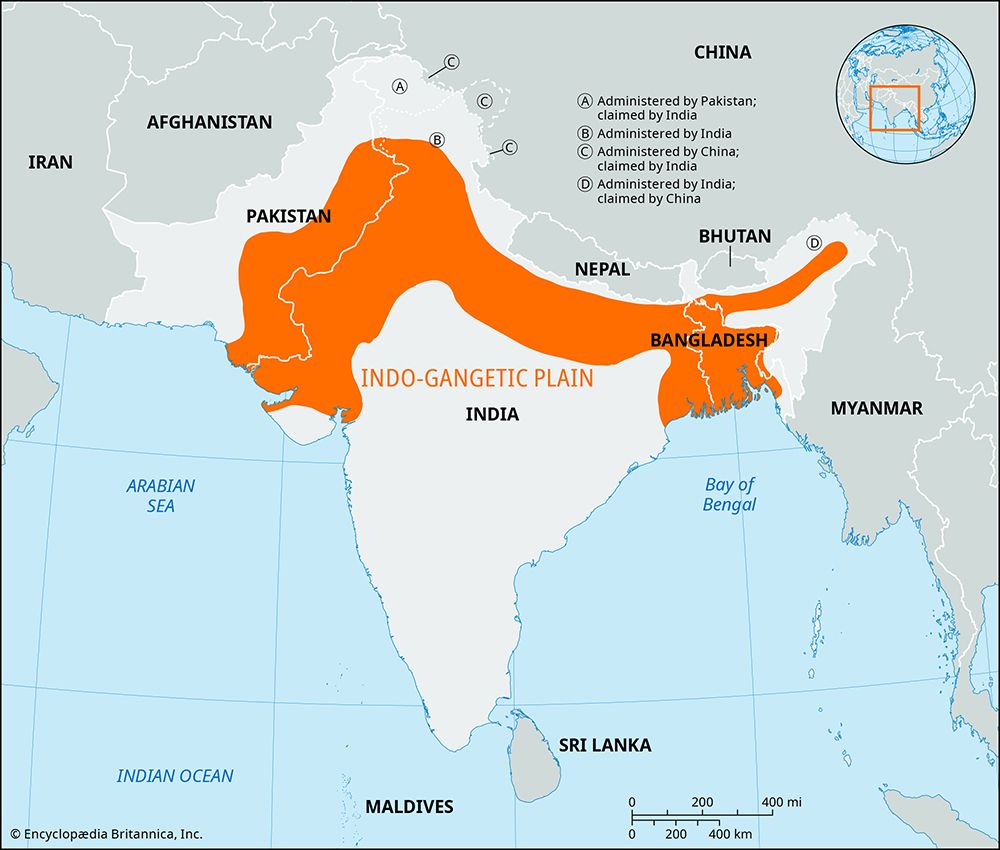
What are some of the major cities located in the Indo-Gangetic Plain, and how have they developed over time?
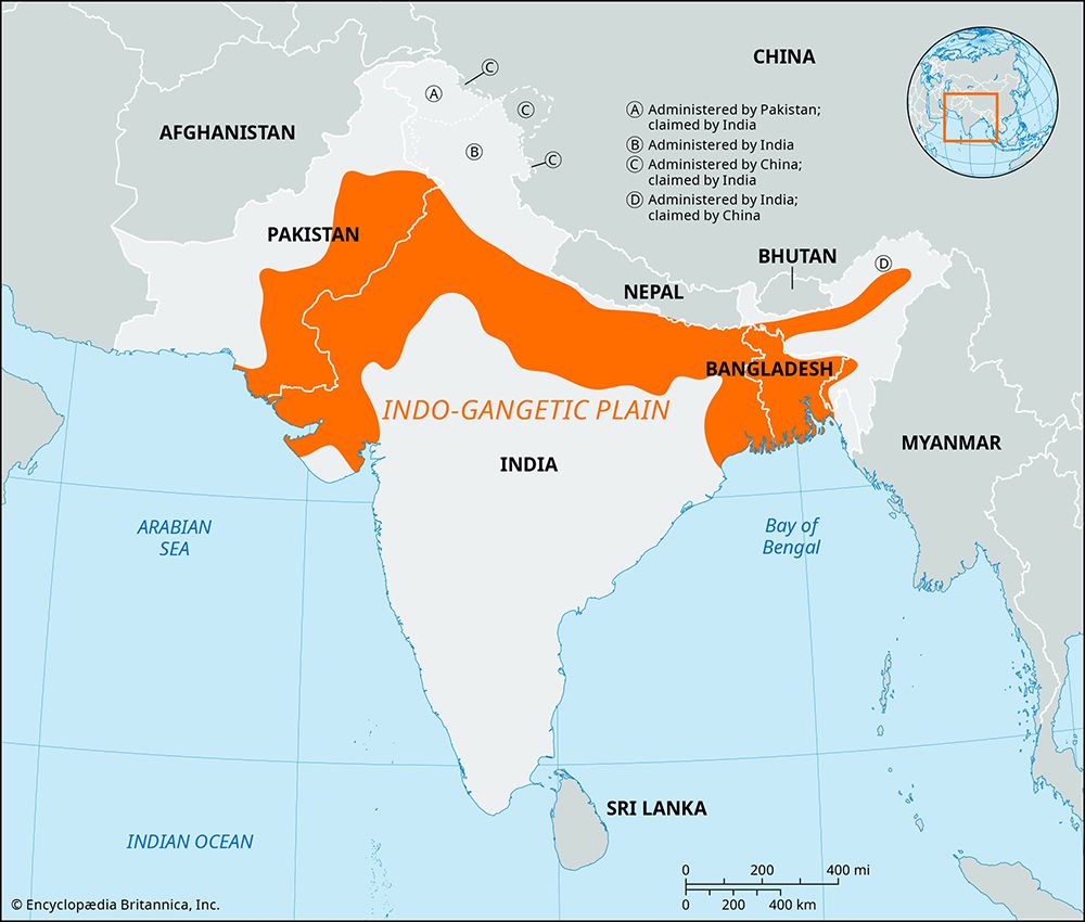
The Indo-Gangetic Plain has served as the heartland of successive Indian civilizations, with its cities evolving from early agricultural settlements into major centers of commerce, religion, and political power.2
Historical Development
The region’s urbanization began in the 1st millennium BCE, driven by the migration of peoples from the Punjab into the Ganges valley and the adoption of iron working, which facilitated land clearing and agricultural expansion. Unlike the earlier Indus civilization, this “second urbanization” proved more lasting, establishing cities that functioned as political and religious hubs. Over centuries, these urban centers grew under various empires:910
- Ancient Era: Patna (ancient Pataliputra) served as the capital of the Mauryan Empire, while Kannauj became the seat of Harsha’s empire.2
- Medieval & Mughal Era: Delhi and Agra rose to prominence as centers of Mughal power, while Dhaka and Murshidabad flourished in the delta region.2
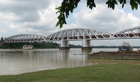
- Colonial Era: The British founded Kolkata in the late 17th century, which grew into a major industrial and commercial hub along the Hugli River.2
Notable Cities and Modern Growth
Today, the plain hosts numerous significant cities, including Lucknow, Kanpur, Varanasi, and Prayagraj. Many of these cities, such as Varanasi and Mathura, remain vital centers of Hindu pilgrimage, drawing millions of devotees. Modern urban development, particularly in the Kolkata metropolitan area, has often been haphazard, leading to challenges in infrastructure and municipal management as populations concentrate along riverbanks.2111213
How was the Indo-Gangetic Plain formed, and what are its main geological features?
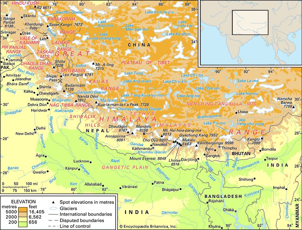
The Indo-Gangetic Plain was formed as a foreland basin, a structural depression created by the collision between the Indian-Australian Plate and the Eurasian Plate. As the Himalayas rose, their immense weight flexed the underlying lithospheric plate downward, creating a deep trough that has been filled with river-borne sediment over millions of years.117
Geological Features
- Alluvial Deposits: The plain is characterized by vast depths of alluvium, which can reach up to 25,000 feet (7,600 meters) in some areas. This sediment is primarily deposited by the Indus, Ganges, and Brahmaputra river systems.18119
- Soil Classification: The landscape is distinguished by two types of alluvium: khadar, which is fresh, highly fertile soil found on low-lying floodplains, and bhangar, which consists of slightly elevated, older alluvial terraces.1820
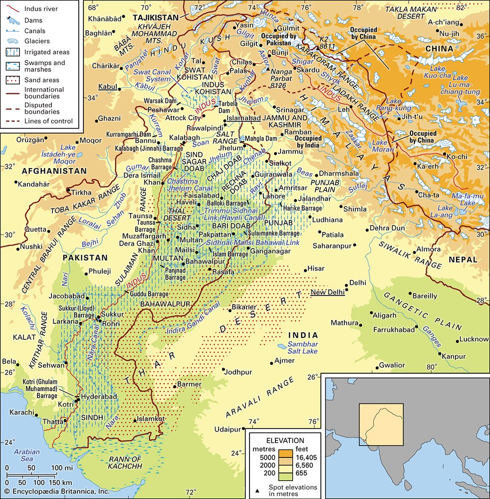
- Topography: The region features a remarkably gentle gradient, averaging only about 6 inches per mile in the Ganges basin. While largely monotonous, the terrain includes unique features such as the gullied badlands of the Chambal River and the arid, dune-dominated landscape of the Thar Desert in the southwest.18
What are the primary agricultural activities and crops grown in the Indo-Gangetic Plain?
The Indo-Gangetic Plain is one of the most fertile and intensively cultivated regions in the world, with over nine-tenths of its land often dedicated to agriculture. The region’s productivity is supported by rich alluvial soils and extensive irrigation systems, which have been significantly enhanced since the mid-20th century by the Green Revolution.122
Primary Crops
Agriculture in the plain is dominated by cereal grains, which account for more than three-fifths of the cultivated area.23
- Rice: The dominant crop in areas with high precipitation or reliable irrigation, typically grown during the kharif (summer) season.2324
- Wheat: The second most important grain, primarily grown as a rabi (cool-season) crop. The adoption of high-yielding varieties (HYVs) has made it a cornerstone of the region’s food security.2322
- Other Cereals: Important supplementary crops include corn (maize), barley, sorghum (jowar), and pearl millet (bajra).2324
- Pulses: Leguminous crops, particularly the chickpea (gram), are vital as the primary protein source for the population.2324
- Cash Crops: Sugarcane is widely cultivated in specific belts, while jute is grown in the moist lowlands of the east. Other important products include oilseeds (such as mustard and rapeseed), tobacco, chilies, and a variety of fruits and vegetables, including mangoes and potatoes.2324
Sources
- Indo-Gangetic Plain — Encyclopædia Britannica
- Ganges River - People — Encyclopædia Britannica
- Indo-Aryan languages - The modern Indo-Aryan stage — Encyclopædia Britannica
- Bihar - Cultural life — Encyclopædia Britannica
- South Bihar Plains — Encyclopædia Britannica
- India - Languages — Encyclopædia Britannica
- Bihārī languages — Encyclopædia Britannica
- Hindi language - History and varieties — Encyclopædia Britannica
- Yamuna River — Encyclopædia Britannica
- Ganges River - Irrigation — Encyclopædia Britannica
- city - Ancient world — Encyclopædia Britannica
- India - The late 2nd millennium and the reemergence of urbanism — Encyclopædia Britannica
- Kolkata - City layout — Encyclopædia Britannica
- Kolkata - City site — Encyclopædia Britannica
- India - From c. 1500 to c. 500 bce — Encyclopædia Britannica
- India - The rise of urbanism in the Indus valley — Encyclopædia Britannica
- India - The Indo-Gangetic Plain — Encyclopædia Britannica
- Himalayas - Geologic history — Encyclopædia Britannica
- tectonic basins and rift valleys - Foreland basins — Encyclopædia Britannica
- India - Alluvial soils — Encyclopædia Britannica
- Indo-Gangetic Plain — Merriam-Webster
- India - Agriculture — Encyclopædia Britannica
- India - Crops — Encyclopædia Britannica
- Bihar - Agriculture — Encyclopædia Britannica
- Green revolution — Encyclopædia Britannica
Published on · 4 min read