Kathiawar Peninsula
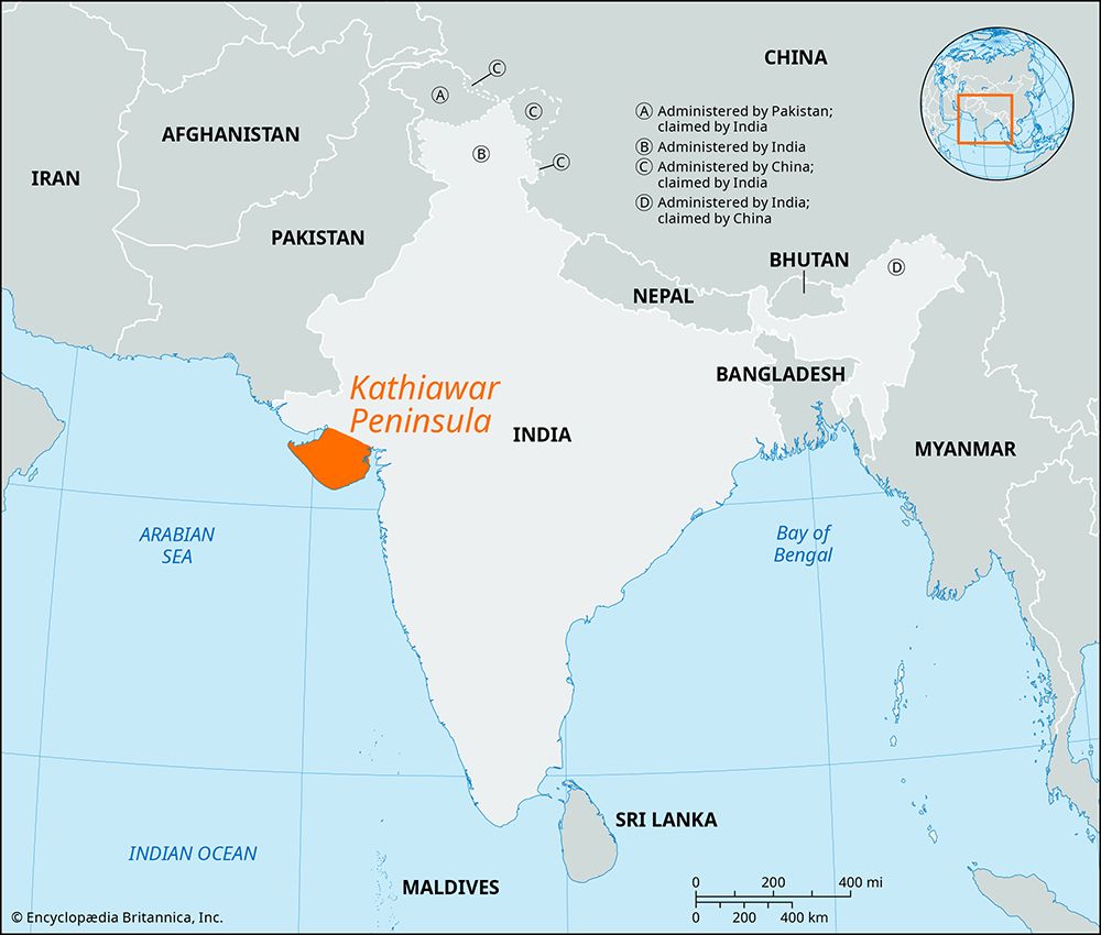
The political landscape of the Kathiawar Peninsula has been shaped by a succession of empires and regional powers since the 3rd millennium BCE. Early history…
How has the political landscape of the Kathiawar Peninsula changed throughout history?
The political landscape of the Kathiawar Peninsula has been shaped by a succession of empires and regional powers since the 3rd millennium BCE. Early history saw the region integrated into the Mauryan Empire by the 3rd century BCE, followed by the rule of the Shakas and the Gupta empire.12
By the 5th century CE, the Maitraka dynasty established a kingdom centered at Valabhi, which became a significant cultural hub. Subsequent centuries saw the influence of the Gurjara-Pratiharas and the Solanki dynasty. Following the defeat of the Vaghela dynasty in the late 13th century, the region fell under Muslim rule, eventually becoming part of the Mughal Empire.12
In the 18th century, the Marathas overran the area, which later transitioned to British paramountcy after 1820. Following Indian independence in 1947, the peninsula was incorporated into the state of Bombay before becoming part of the newly formed state of Gujarat in 1960.12
How has the Kathiawar Peninsula’s unique geography influenced its climate and ecosystem?
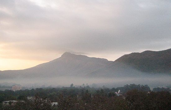
The Kathiawar Peninsula’s geography, characterized by its low-lying coastal plains and isolated hilly ranges, plays a fundamental role in shaping its climate and diverse ecosystems.
Climate Influences
The peninsula experiences a hot, dry climate, with rainfall patterns significantly influenced by its position and topography. While the region generally receives about 40 inches (1,000 mm) of annual rainfall in its central areas, the climate varies across the peninsula. The proximity to the sea and the presence of the Gir Range and Girnar Hills create localized environmental conditions, contrasting with the much drier, arid regions found further north in the Rann of Kachchh.13
Ecosystems and Vegetation
The peninsula’s varied terrain supports distinct ecological zones:
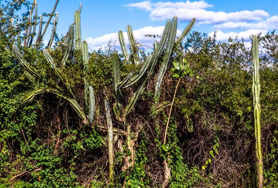
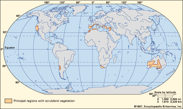
- Thorn Forests and Scrubland: Much of the peninsula is defined by dry thorn forest and scrubland, which thrive in the hot, arid environment.14
- Forest Reserves: The hilly regions, particularly within the Gir National Park, feature a mix of teak and deciduous trees, such as sal and dhak, providing a critical habitat for wildlife.45
- Coastal Habitats: Low-lying coastal areas, influenced by tidal activity, support mangrove stands.1
These ecosystems are vital for biodiversity, most notably serving as the last natural refuge for the Asiatic lion.14
Are there any unique cultural practices or festivals specific to the Kathiawar region?
The cultural practices of the Kathiawar region are deeply rooted in the broader traditions of Gujarat, heavily influenced by the mythology surrounding the Hindu deity Krishna.
Festivals and Dance
- Navratri: This festival, held in September–October, is a major cultural event honoring the divine feminine. It is the primary setting for the popular folk dance known as garba, where participants move in a circle, singing and clapping to keep time.
- Bhavai: Often performed during Navratri, bhavai is a traditional, rural comic drama that depicts various aspects of village life. Historically, all roles in these performances—both male and female—are played by men.
Craft and Architecture
The region is renowned for its highly skilled craftsmanship, which serves as a vital cultural institution. Notable practices include:
- Textile Arts: The region is famous for bandhani (tie-dyeing) fabrics and intricate hand-loomed products.
- Guilds: Cultural and economic life is often supported by mahajans, which are autonomous trade and craft guilds that have historically resolved disputes and encouraged artistic activities.
- Architecture: The peninsula features a rich architectural heritage, including ancient stepwells and intricate temples found in locations such as the Girnar Hills, Somnath, and Porbandar.
What are the major cities and economic activities on the Kathiawar Peninsula?
The Kathiawar Peninsula serves as a vital economic hub in Gujarat, supported by a mix of traditional agriculture, industrial manufacturing, and resource extraction.
Major Cities
- Bhavnagar: Identified as the peninsula’s principal port and city, it serves as a key gateway for trade.1
- Jamnagar: Located in the northwest, this city is a major industrial center home to two of India’s largest oil refineries. It is also a hub for textiles, metalware, and traditional crafts like bandhani.9
- Rajkot: Situated in the center of the peninsula, Rajkot is a significant commercial and industrial junction known for manufacturing textiles, diesel engines, ceramics, and water pump sets.10
- Porbandar: Renowned for its namesake stone, a wind-deposited sand concretion widely used as a high-quality building material.111
Economic Activities
- Agriculture: Farming is the chief occupation, with primary crops including wheat, millet, cotton, peanuts (groundnuts), sugarcane, and potatoes.1910
- Industry and Manufacturing: The region produces cement, pottery, textiles, and machinery.910
- Resource Extraction: The peninsula is rich in minerals, including limestone, bauxite, and gypsum, and contributes significantly to India’s national yield of salt and soda ash.11
Sources
- Kathiawar Peninsula — Encyclopædia Britannica
- Gujarat - History of Gujarat — Encyclopædia Britannica
- Gir National Park — Encyclopædia Britannica
- Gir Range — Encyclopædia Britannica
- Gujarat - Climate — Encyclopædia Britannica
- Gujarat - Cultural life — Encyclopædia Britannica
- South Asian arts - The kathak school — Encyclopædia Britannica
- South Asian arts - The kathakali school — Encyclopædia Britannica
- Gujarat - Resources and power — Encyclopædia Britannica
- Jamnagar — Encyclopædia Britannica
- Rajkot — Encyclopædia Britannica
Published on · 4 min read