Konda River
The Konda River is a waterway located in the western Khanty-Mansi autonomous okrug of the Tyumen oblast in Russia. Originating in swampy terrain, the river…
What is Konda River?
The Konda River is a waterway located in the western Khanty-Mansi autonomous okrug of the Tyumen oblast in Russia. Originating in swampy terrain, the river flows for approximately 715 miles (1,097 km) in a generally west-to-east and eventually northeast direction before emptying into the Irtysh River at Repolovo.1
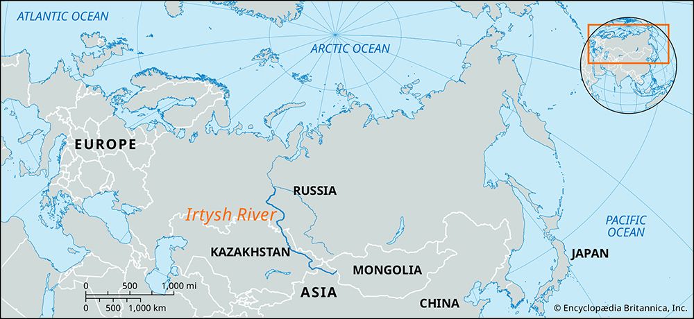
The Konda serves as one of the primary left-bank tributaries of the Irtysh, which is a major river system in west-central and western Asia.2
What is the significance of the Irtysh River system?
The Irtysh River is a vital waterway in west-central and western Asia, serving as the principal tributary of the Ob River. Together, they form the world’s seventh-longest river system.2
The significance of the Irtysh system includes:
- Hydrological Scale: Stretching 2,640 miles (4,248 km), the Irtysh drains approximately 615,000 square miles (1,593,000 square km), an area larger than that drained by the upper and middle Ob combined.23
- Navigation and Commerce: The river is navigable for most of its course, supporting major river ports such as Omsk, Tobolsk, and Khanty-Mansiysk in Russia, as well as Pavlodar and Semey in Kazakhstan.2
- Energy Production: The river is a source of hydroelectric power, with significant stations located at Öskemen and Buqtyrma in Kazakhstan.2
- Water Management: Tributaries like the Ishim River are critical for regional infrastructure, providing water to farm settlements through extensive water mains.4
What are the characteristics of the West Siberian Plain?
The West Siberian Plain is one of the world’s largest regions of continuous flatland, covering nearly 1,200,000 square miles (3,000,000 square km) in central Russia.5
Geography and Relief
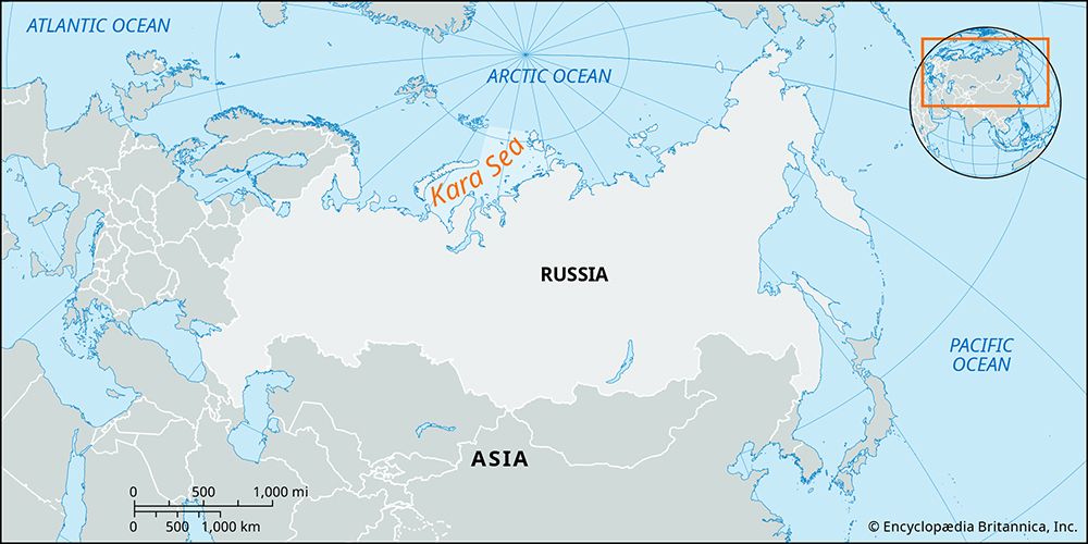
The plain is bounded by the Ural Mountains to the west, the Yenisey River valley to the east, the Kara Sea to the north, and the Kazakh Uplands and Altai Mountains to the south. It is characterized by its exceedingly flat and featureless terrain, resulting from prolonged crustal subsidence and the accumulation of horizontal deposits over millions of years. While some glacial deposits form low hills and ridges in the south, the region is generally marked by very poor drainage.56
Climate and Vegetation
The plain features distinct vegetation zones that extend east-west:
- Tundra: Found in the north, characterized by cold-tolerant, low-lying vegetation.78
- Taiga: A vast belt of coniferous boreal forest covering much of the lowland.57
- Forest-Steppe and Steppe: Located in the southwestern portions of the region.78
Resources and Drainage
The region is drained by the Ob and Irtysh river systems, which often meander slowly across immense, poorly drained floodplains, leading to the formation of extensive swamps and peat bogs. Additionally, the plain is underlain by significant oil and natural gas deposits, making it a critical area for energy production.597
How do rivers like the Konda impact the local environment in Russia?
Rivers like the Konda River play a significant role in shaping the environment of western Russia, particularly within the Khanty-Mansi autonomous okrug. Rising amid vast swamps, the Konda exemplifies the hydrological characteristics of the region, where rivers meander slowly across immense, poorly drained floodplains.110
The environmental impact of these river systems is defined by several key factors:
- Landscape Formation: Because many Siberian rivers flow northward, their upper reaches often thaw before their lower sections. This creates extensive seasonal flooding, which is a primary driver in the development of massive wetlands and peat bogs, such as the Vasyuganye Swamp.10
- Ecosystem Connectivity: These rivers act as vital arteries within the taiga biome. However, the presence of these poorly drained, peaty wetlands often precludes the growth of closed-canopy forests, creating a complex mosaic of vegetation.11
- Human-Induced Risks: The river basins in Russia are increasingly vulnerable to industrial activity. In regions like the republic of Komi, river basins have suffered significant environmental degradation due to leaking oil pipelines and illegal pipeline tapping, which have resulted in major crude oil spills.12
Sources
- Konda River — Encyclopædia Britannica
- Irtysh River — Encyclopædia Britannica
- Ob River - Physiography — Encyclopædia Britannica
- Ishim River — Encyclopædia Britannica
- West Siberian Plain — Encyclopædia Britannica
- Russia - Rivers — Encyclopædia Britannica
- Siberia — Encyclopædia Britannica
- Asia - North Asia — Encyclopædia Britannica
- Asia - North and Central Asia — Encyclopædia Britannica
- Taiga - Distribution — Encyclopædia Britannica
- Taiga - Effects of human use and management of the taiga — Encyclopædia Britannica
- Asia - Human impact on natural landscapes — Encyclopædia Britannica
Published on · 3 min read