Lewes River
The Lewes River is the former name for the upper course of the Yukon River in Yukon, Canada.
What is Lewes River?
The Lewes River is the former name for the upper course of the Yukon River in Yukon, Canada.
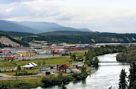
Flowing northward from Tagish Lake on the British Columbia border, it travels past Whitehorse for approximately 340 miles (550 km) before joining the Pelly River at Selkirk. During the gold-rush era, the river served as a vital transportation artery for prospectors. It was originally named in 1843 to honor John Lee Lewes, an agent for the Hudson’s Bay Company, but the name was officially changed to the Yukon River in the early 1950s.1
It is important to distinguish this waterway from other places named Lewes, such as the town in Delaware or the district and town in East Sussex, England, which are unrelated to the river in Canada.234
What was the significance of the Yukon River during the Klondike Gold Rush?
During the Klondike Gold Rush, the Yukon River served as the primary transportation artery for prospectors and freight heading to the booming settlement of Dawson.5
The river’s significance was defined by two main routes:
- The Northern Route: In 1898, at least 20 vessels navigated the lower Yukon River from the Bering Sea to reach Dawson City.5
- The Southern Route: Prospectors traveled through the Coast Mountains from Skagway, Alaska, to Bennett Lake. There, they constructed crude boats or rafts to float downstream to the rapids near Whitehorse. From Whitehorse, riverboats transported passengers and supplies the remaining distance to the gold fields.5
The river was essential for sustaining the rapid population growth of the region, which saw Dawson grow into a city of approximately 25,000 people at the peak of the rush. As mining activity transitioned from individual “stampeders” to large-scale mechanical operations, the river remained a critical logistical link until the mid-20th century, when it was eventually replaced by road and air transport.65
Who was John Lee Lewes and why was the river named after him?
John Lee Lewes was an agent for the Hudson’s Bay Company, a prominent fur-trading enterprise that played a significant role in the early exploration of the Canadian North.19
The upper course of the Yukon River was named the Lewes River in 1843 to honor him for his service and contributions to the company’s operations in the region. While the river was a vital transportation route for prospectors during the gold-rush era, the name was eventually changed to the Yukon River in the early 1950s to align with the name of the entire river system.1
How does the geography of the Yukon territory influence its river systems?
The geography of the Yukon territory profoundly shapes its river systems through a combination of mountainous terrain, glacial activity, and subarctic climate conditions.
Topographic Influence
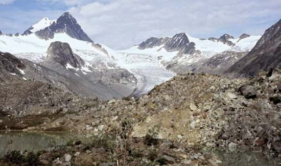
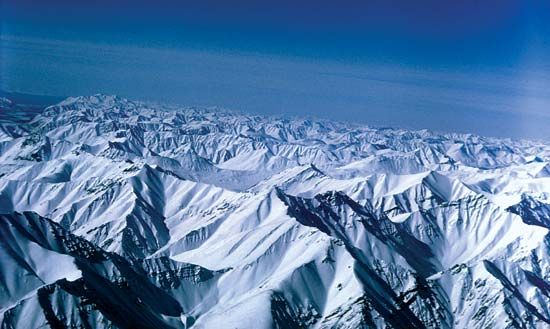
The Yukon River and its tributaries are fed by a vast semicircle of high mountains, including the St. Elias Mountains, the Mackenzie Mountains, and the Brooks Range. These ranges dictate the flow patterns of the rivers, often forcing them to detour around rugged terrain or carve through narrow gorges, such as the ramparts in Alaska. In the central territory, the river flows through broad, flat-bottomed valleys where it meanders, creating numerous sandbars and small islands.1011
Glacial and Seasonal Hydrology
Glaciers play a critical role in the river’s hydrology. Streams fed by glacial meltwater, such as the White River, experience their peak runoff in July, later than snow-fed tributaries that crest in June. This glacial melt carries heavy loads of suspended sediment, which deposits in riverbeds, causing frequent channel shifts and creating dynamic, fertile floodplains.1012
Climate and Permafrost
The region’s subarctic climate leads to significant seasonal variations in water volume. Rivers are frozen for much of the winter, with ice breakup occurring in early May. Because annual precipitation is low, the rivers rely heavily on seasonal melt. Furthermore, the presence of permafrost influences drainage; where surface drainage is impeded by frozen ground, wetlands and mires often develop, while river terraces remain more productive for vegetation.10812
Sources
- Lewes River — Encyclopædia Britannica
- Lewes — Merriam-Webster
- Lewes — Encyclopædia Britannica
- Lewes — Encyclopædia Britannica
- Yukon River - History — Encyclopædia Britannica
- Yukon - The gold rush and territorial status — Encyclopædia Britannica
- Klondike River — Encyclopædia Britannica
- Yukon River — Encyclopædia Britannica
- Yukon - Early inhabitants and nonnative settlers — Encyclopædia Britannica
- Yukon River - Physiography and hydrology — Encyclopædia Britannica
- Yukon River - Climate — Encyclopædia Britannica
- Taiga - Soils — Encyclopædia Britannica
Published on · 3 min read