Obey River
The Obey River is a 60-mile-long (100 km) waterway located in north-central Tennessee, U.S. It is formed by the confluence of the East Fork and West Fork…
What is Obey River?
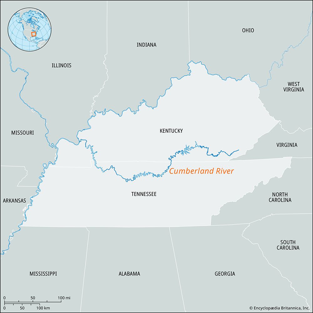
The Obey River is a 60-mile-long (100 km) waterway located in north-central Tennessee, U.S. It is formed by the confluence of the East Fork and West Fork Obey rivers in southern Pickett County and flows north and west until it joins the Cumberland River at Celina.12
The river’s course is largely impounded by the Dale Hollow Dam, which was completed in the mid-20th century to create Dale Hollow Lake. This reservoir covers most of the river’s length and features approximately 620 miles (1,000 km) of shoreline, offering various recreational opportunities. The Obey River watershed drains an area of about 780 square miles (2,000 square km) and is situated near Standing Stone State Park.12
What is the purpose of the Dale Hollow Dam?
The Dale Hollow Dam, completed in 1953, serves as a large power dam on the Obey River near Celina, Tennessee. It is part of a series of dams developed on the Cumberland River system to provide hydroelectric power. Additionally, the dam impounds the Obey River to create Dale Hollow Lake, which offers numerous recreation sites along its 620 miles of shoreline.12
How do dams affect local river ecosystems?
Dams significantly alter local river ecosystems by transforming natural environments to serve human needs, often resulting in the destruction of local flora and fauna. The environmental impacts of these structures are wide-ranging and include:3
- Disruption of Migratory Fish: Dams frequently block or impede the passage of fish traveling to spawning grounds. While technologies like fish passes—such as fish ladders and locks—have been implemented to mitigate these effects, they have not always been successful in preventing dramatic population declines.34
- Habitat Inundation: The creation of reservoirs leads to the flooding of vast areas, which can destroy pristine landscapes, cultural homelands, and terrestrial habitats.35
- Sedimentation and Erosion: Reservoirs trap sediment that would naturally flow downstream, which can reduce the reservoir’s storage capacity over time. Conversely, the water released from dams often has a renewed capacity to transport sediment, leading to increased erosion of the stream channel below the structure.5
- Water Quality Changes: Dams can alter water temperatures and flow patterns, which may negatively impact native species.6
While human-made dams often cause ecological degradation, it is important to note that some natural structures, such as beaver dams, act as positive “ecosystem engineers” by creating ponds and wetlands that support diverse aquatic life.7
What are the main tributaries of the Cumberland River?
The Cumberland River is fed by several significant tributaries, all of which join the main river downstream from the Cumberland Falls. These tributaries include:
- In Kentucky: The Laurel, Rockcastle, and South Fork, as well as the Little River in the western part of the state.
- In Tennessee: The Obey River, Caney Fork, Stones, Harpeth, and Red rivers.
These waterways contribute to the river’s total drainage area of 18,080 square miles as it flows through the central limestone basin of Tennessee and the plains of western Kentucky before joining the Ohio River.2
Sources
- Obey River — Encyclopædia Britannica
- Cumberland River — Encyclopædia Britannica
- dam - Rise of environmental and economic concerns — Encyclopædia Britannica
- dam - Fish passes — Encyclopædia Britannica
- Why do beavers build dams? — Encyclopædia Britannica
- reservoir — Encyclopædia Britannica
- dam - Basic problems in dam design — Encyclopædia Britannica
- river - Environmental problems attendant on river use — Encyclopædia Britannica
Published on · 2 min read