Libyan Desert
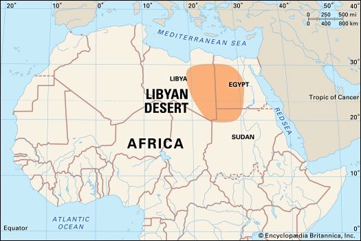
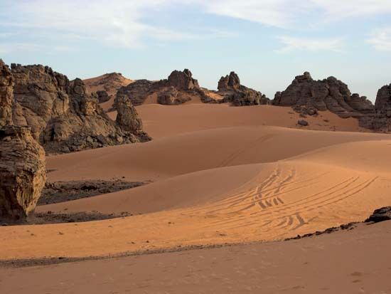
The Libyan Desert is the northeastern portion of the Sahara, spanning eastern Libya, southwestern Egypt, and the extreme northwest of Sudan.
What is Libyan Desert?
The Libyan Desert is the northeastern portion of the Sahara, spanning eastern Libya, southwestern Egypt, and the extreme northwest of Sudan.1
Characterized by harsh, arid, and inhospitable conditions, the region consists of bare rocky plateaus and vast stony or sandy plains. Notable geographical features include:1
- Mount Al-ʿUwaynāt: The highest point in the desert, reaching 6,345 feet (1,934 metres) at the junction of Libya, Egypt, and Sudan.12
- Qattara Depression: A significant basin in Egypt that descends to 436 feet (133 metres) below sea level.13
- Oases: Human habitation is extremely sparse, concentrated primarily in Egyptian oases like Siwa and Al-Khārijah, and the Libyan oasis of Al-Kufrah the Libyan oasis of Al-Kufrah.1
In Egypt, this region is known as the Western Desert and served as a critical theater of operations during World War II. The area is also noted for its Nubian sandstone formations, which are associated with important regional aquifers.13
How do people survive in the harsh environment of an oasis?
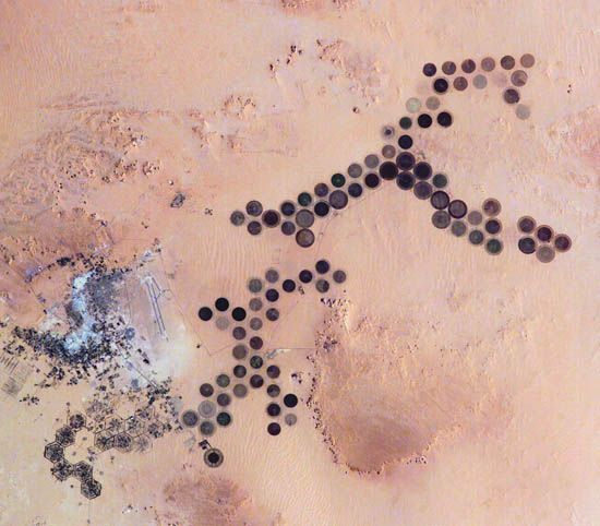
Survival in an oasis depends primarily on the management of a perennial supply of fresh water, which is typically sourced from underground sandstone aquifers. This water is accessed through springs, wells, or foggaras—inclined underground tunnels designed to tap into dispersed groundwater.
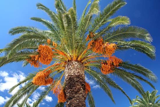
Sedentary populations in these environments rely on irrigation to maintain small, labor-intensive “gardens.” The date palm serves as the essential foundation of the food supply, providing shade that allows for the cultivation of:
- Fruits: Citrus, figs, peaches, and apricots.
- Cereals: Wheat, barley, and millet.
- Vegetables: Various crops and specialty items like henna.
While ancient methods like the shadoof or animal-driven noria were historically used to lift water, many modern oases now utilize motorized pumps. However, survival remains a fragile ecological balance; water availability strictly limits expansion, and communities must contend with the constant threats of soil salinization and encroaching sand.
What are the different types of sand dunes found in the Sahara?
The Sahara features a diverse array of sand dunes, which are shaped by wind patterns, sand availability, and topography. These formations range from small ripples to massive, complex structures known as compound dunes or draa, which can reach heights of up to 1,000 feet.910
Common types of dunes found in the Sahara include:
- Barchan Dunes: Crescent-shaped dunes that form where wind blows consistently from one direction. They are asymmetrical, with a gentle windward slope and a steeper slip face on the leeward side.911
- Seif Dunes: Long, narrow, sword-like ridges that extend parallel to the prevailing wind or result from winds blowing at acute angles. These can reach heights of 300 feet and lengths of up to 100 kilometers.102
- Transverse Dunes: Ridges oriented at right angles to the wind, often composed of alternating crescentic elements.910
- Tied Dunes: Formed in the sheltered lee of hills or other topographic obstacles.10
- Star or Pyramidal Dunes: Massive, stable accumulations of sand with sharp-crested ridges rising to a central peak, formed by winds blowing from various directions.1012
- Echo Dunes: Large dunes deposited on the upwind side of high scarps or massifs, separated by a corridor kept clear by rolling air eddies.9
Why was the Western Desert a significant location during World War II?
The Western Desert was a critical theater during World War II primarily because of its strategic proximity to the Suez Canal. As the shortest maritime route between Europe and the Indian and Pacific Oceans, the canal was a vital artery for Allied shipping, and its protection was a central objective for British forces in the Middle East.15
The significance of the region was defined by several key factors:
- Strategic Control: Control of the Western Desert meant control over the gateway to Egypt and the Suez Canal. Axis forces, led by Erwin Rommel, sought to capture these positions to cut off British supply lines and secure a major victory in the Mediterranean theater.1617
- Mobile Warfare: The desert environment necessitated a unique style of combat characterized by high mobility, where armored divisions engaged in long-range maneuvers across vast, open terrain. This led to significant clashes, such as the Battles of El-Alamein, which ultimately halted the Axis advance toward the Nile.1617
- Intelligence and Logistics: Units like the Long Range Desert Group provided essential reconnaissance behind enemy lines, while the ability to maintain supply chains across the harsh, arid landscape often determined the success or failure of major offensives.1617
Sources
- Libyan Desert — Encyclopædia Britannica
- Sahara - Physiography — Encyclopædia Britannica
- Libya - Climate of Libya — Encyclopædia Britannica
- Libya - History of Libya — Encyclopædia Britannica
- Libya - Relief — Encyclopædia Britannica
- oasis — Encyclopædia Britannica
- Sahara - People of the Sahara — Encyclopædia Britannica
- Arabian Desert - People of the Arabian Desert — Encyclopædia Britannica
- sand dune - Dune and sheet patterns — Encyclopædia Britannica
- barchan — Encyclopædia Britannica
- sand dune — Encyclopædia Britannica
- seif — Encyclopædia Britannica
- seif — Merriam-Webster
- sand mountain — Encyclopædia Britannica
- North Africa campaigns - Egypt and Libya (Autumn 1941–January 1943) — Encyclopædia Britannica
- Operation Torch - Planning the invasion of French North Africa — Encyclopædia Britannica
- World War II - Libya and Egypt , autumn 1941–summer 1942 — Encyclopædia Britannica
- North Africa campaigns - Egypt and Cyrenaica (June 1940–June 1941) — Encyclopædia Britannica
- Suez Canal — Encyclopædia Britannica
- Suez Crisis — Encyclopædia Britannica
- T.E. Lawrence on guerrilla warfare - The desert and the sea — Encyclopædia Britannica
Published on · 3 min read