Mamoré River
The Mamoré River serves as a regional transport route, though its utility for trade is significantly limited by the presence of rapids along its course.…
What role does the Mamoré River play in transportation and trade in the region?
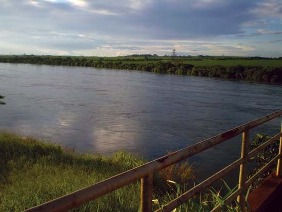
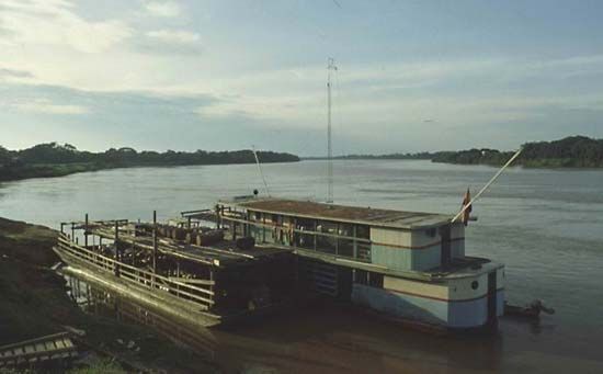
The Mamoré River serves as a regional transport route, though its utility for trade is significantly limited by the presence of rapids along its course. While the river remains navigable through the Moxos plain and tropical forest up to Guajará-Mirim, Brazil, its broader potential for transit has historically required alternative infrastructure.1
To circumvent the falls and rapids that obstruct passage, the Madeira-Mamoré Railway was constructed to link the upper course of the Madeira River with the Mamoré. Although this railway is now defunct and largely replaced by highways, it was once a vital connection for the region. Today, the river’s role in the local economy is also supported by increasing tourism, with various towns offering boat cruises for visitors. Additionally, the riverbanks have historically supported communities engaged in gathering forest products, such as rubber and Brazil nuts, alongside more recent agricultural and ranching activities.12
What is the ecological importance of the Mamoré River and its surrounding areas?
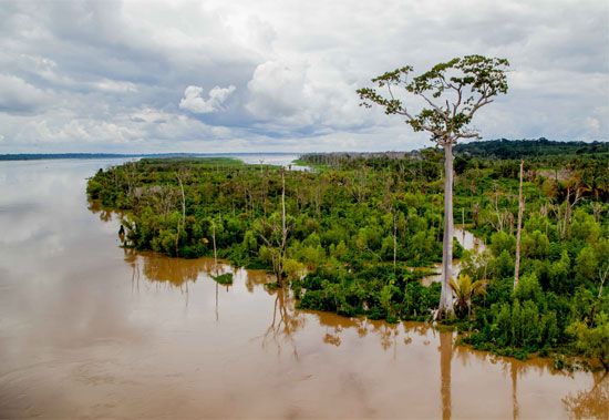
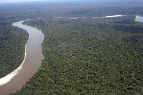
The Mamoré River is ecologically significant as a major component of the Amazon basin drainage system. Originating in the Andean cordilleras, the river and its headwaters, such as the Grande River, drain the Moxos plain—an ancient lake bed—before flowing through expansive tropical rainforest environments.1
The river is characterized as a “whitewater” system, meaning it carries heavy loads of sediment derived from the geologically youthful and tectonically active Andes. This high sediment content contrasts sharply with its largest affluent, the Guaporé River, which is noted for its unusually clear water. The confluence of these distinct water types highlights the complex hydrological diversity of the region, where the silt-laden Mamoré contributes to the broader sediment transport processes that shape the Amazonian landscape.34
Beyond its physical features, the river supports diverse ecosystems and indigenous communities that have historically relied on the surrounding forests for resources, including rubber and Brazil nuts.134
How do local communities use and depend on the Mamoré River?
Local communities have long relied on the Mamoré River as a central feature of their environment and livelihoods. The riverbanks are home to numerous indigenous groups, as well as mestizo populations, who have historically sustained themselves by gathering forest products such as rubber and Brazil nuts from the surrounding tropical rainforest.142
In the latter half of the 20th century, these traditional activities were supplemented by the arrival of farmers and ranchers who settled along the river to pursue agricultural and livestock operations. While the river serves as a natural transport route, its utility for trade is constrained by rapids, which historically necessitated the construction of the Madeira-Mamoré Railway to bypass impassable sections. Today, that infrastructure has largely been replaced by highways.21
Beyond subsistence and industry, the river has become an increasingly important site for tourism. Local towns now leverage the river’s scenic landscape to offer boat cruises, providing a modern economic dimension to the communities living along its course.1
How has the Mamoré River influenced the history and development of the regions it flows through?
The Mamoré River has been a pivotal force in the historical and developmental trajectory of the borderlands between Bolivia and Brazil. Historically, the region served as a theater for colonial power struggles, marked by conflicts between Spanish and Portuguese forces and their encounters with indigenous populations. The 18th-century Forte Príncipe da Beira, built near the confluence of the Mamoré and Guaporé River, remains a significant landmark of this era of frontier expansion and defense.14
Development in the region was long dictated by the river’s navigability. While the Mamoré allows for transport through the Moxos plain, its path is obstructed by rapids, which hindered trade and movement. This geographical challenge necessitated the construction of the Madeira-Mamoré Railway, a vital link designed to bypass impassable sections between Guajará-Mirim and Pôrto Velho. Although the railway was abandoned in the 1970s and replaced by highways, it remains a defining element of the region’s infrastructure history.12
Sources
- Mamoré River — Encyclopædia Britannica
- Madeira River — Encyclopædia Britannica
- Amazon River - Physiography of the river course — Encyclopædia Britannica
- Guaporé River — Encyclopædia Britannica
Published on · 3 min read