Massif Central
The Massif Central is a predominantly rural region in south-central France known for its distinctive agricultural and artisanal products.
What are some unique regional specialties or products associated with the Massif Central?
The Massif Central is a predominantly rural region in south-central France known for its distinctive agricultural and artisanal products.
Agricultural Specialties
- Cheeses: The region is famous for its dairy production. In the central uplands of Auvergne, producers craft distinctive cheeses such as Cantal and Bleu Saint-Nectaire. In the Grands-Causses, the well-known Roquefort cheese is produced from ewe’s milk.1
- Livestock: Agriculture is heavily focused on cattle rearing, with beef cattle concentrated in the northern areas and dairy farming prevalent in the central and eastern parts of the massif. Sheep are also commonly grazed in the Causses and Haute-Vienne grazed in the Causses and Haute-Vienne.12
- Viticulture: Along the eastern border of the region, the hillsides are utilized for vineyards, most notably in the Beaujolais area.13
Industrial and Artisanal Products
- Cutlery: The town of Thiers is historically and currently renowned for its high-quality cutlery production.2
- Manufacturing: While traditional coal mining and metallurgy have declined, the region maintains a diverse industrial base, including the manufacture of tires, electronics, pharmaceuticals, and armaments.12
How has human activity, such as agriculture and tourism, shaped the landscape of the Massif Central?
Human activity has significantly shaped the landscape of the Massif Central, transforming its rugged terrain into a region defined by specialized agriculture, industrial heritage, and protected natural spaces.
Agricultural Influence
Agriculture is the primary shaper of the rural landscape. The region’s topography dictates land use:
- Livestock and Fodder: Cattle rearing dominates the northern and central areas, while sheep are grazed in the Causses and Haute-Vienne. Large portions of the land are dedicated to cultivating cereals and fodder crops specifically to support this livestock.1
- Valley Cultivation: Fertile valley floors are intensively used for fruits and vegetables, while the slopes of the eastern borders are terraced for vineyards, such as those in Beaujolais.1
- Forestry: Large areas of the massif remain forested, supporting a significant wood-related industry that influences land management.1
Industrial and Tourism Development
- Industrial Legacy: Early industrialization, driven by coal mining in areas like Saint-Étienne and Alès, altered the landscape through extraction and the development of metallurgical sites. While many of these sites have declined, they left a legacy of infrastructure that has been repurposed.12
- Infrastructure and Tourism: The construction of modern highways has improved access to previously isolated areas, facilitating the growth of tourism. The landscape is now actively managed through the establishment of a national park (Cévennes) and four regional parks, which balance conservation with visitor access to volcanic sites and mineral springs.1
- Energy: Human intervention is also visible in the form of hydroelectric power installations along major rivers like the Dordogne, Lot, and Tarn, which have modified local water systems.1
How do the rivers originating in the Massif Central impact France’s waterways?
The Massif Central serves as a critical hydrological divide for France. Its elevated terrain acts as a primary watershed, where a major drainage divide runs along the massif’s eastern and southeastern edges, determining the flow of many of the country’s major river systems.1
Impact on Waterways
- Source of Major Rivers: The massif is the origin point for significant waterways, including the Loire River, which flows north from the region. Additionally, the Dordogne River rises in the central uplands before flowing west to join the Garonne system.5162
- Tributary Contributions: The Garonne system, while originating in the Pyrenees, relies heavily on the Massif Central for its primary tributaries, including the Tarn, Aveyron, Lot, and Dordogne rivers.2
- Energy Production: Beyond their role in natural drainage, these rivers are vital for hydroelectric power generation. Dams along the Dordogne, Lot, and Tarn rivers have significantly modified local water systems to support energy needs.56
What is the Massif Central and where is it located in France?
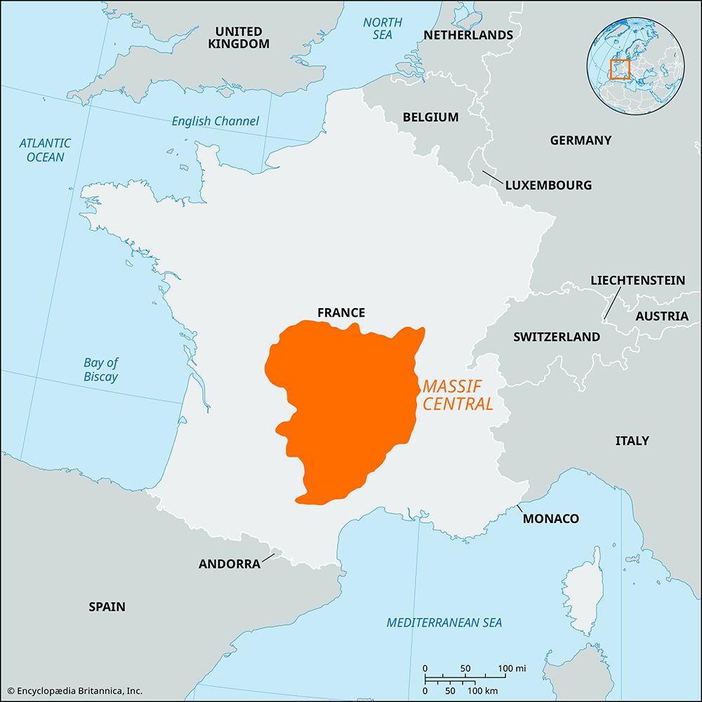
The Massif Central is a vast upland region in south-central France that covers approximately 33,000 square miles (86,000 square km), accounting for about one-sixth of the country’s total area.28
Located in the heart of the nation, the region is defined by the following boundaries:
- North: The Paris Basin and the Loire River valley.28
- East: The Rhône-Saône river valley.28
- South: The Mediterranean coastlands of Languedoc.28
- West: The Aquitaine Basin.28
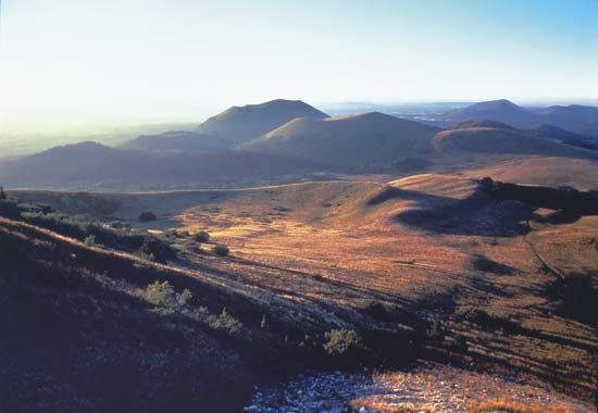
Physiographically, the massif consists primarily of plateaus ranging from 2,000 to 3,000 feet (600 to 900 meters) in elevation, featuring complex volcanic structures and crystalline rock formations. Its highest point is Sancy Hill (Puy de Sancy), which reaches 6,184 feet (1,885 meters). The region is characterized by its rural landscape, volcanic history, and role as a major watershed for several of France’s primary river systems.82
Sources
- Massif Central — Encyclopædia Britannica
- France - The Massif Central — Encyclopædia Britannica
- Auvergne — Encyclopædia Britannica
- Périgord — Encyclopædia Britannica
- France - Drainage of France — Encyclopædia Britannica
- Dordogne River — Encyclopædia Britannica
- France - The Garonne system — Encyclopædia Britannica
- Massif Central — Merriam-Webster
Published on · 4 min read