McArthur River
The McArthur River is a river located in the northeastern region of the Northern Territory, Australia.
What is McArthur River?
The McArthur River is a river located in the northeastern region of the Northern Territory, Australia.1
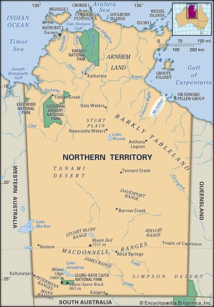
It originates approximately 45 miles (70 km) south of Anthony Lagoon along the northern edge of the Barkly Tableland and flows northwest for 150 miles (240 km) before reaching Port McArthur on the Gulf of Carpentaria of Carpentaria](https://www.britannica.com/place/Gulf-of-Carpentaria). The river’s lower course is bordered by swamp and jungle and is navigable by barge for 40 miles (64 km).1
Fed by the Kilgour and Clyde rivers and Tooganginie Creek, the river is prone to summer flooding. It was first visited by the explorer Ludwig Leichhardt in 1845, who named the waterway after James and William McArthur, sheep ranchers from Camden, New South Wales.1
Who was the explorer Ludwig Leichhardt?
Ludwig Leichhardt (1813–1848) was a Prussian-born naturalist and explorer who became one of Australia’s earliest heroes. After studying natural science in Europe, he arrived in Sydney in 1842 with the goal of exploring the Australian interior.2
Leichhardt is best known for his 1844–1845 expedition from the Darling Downs to Port Essington. Although his party was presumed dead, their successful return in 1845 was met with national acclaim, and his published journal brought him international recognition, including awards from the Geographical Society of Paris and the Royal Geographical Society.
His subsequent attempts to cross the continent were less fortunate. In 1848, he led an expedition that vanished without a trace after departing from near the town of Roma. Despite extensive search efforts that continued into the 1930s, his fate remains a mystery. His legacy as an explorer who identified land suitable for settlement and his dramatic disappearance inspired Patrick White’s novel Voss.2
What is the geography of the Barkly Tableland?
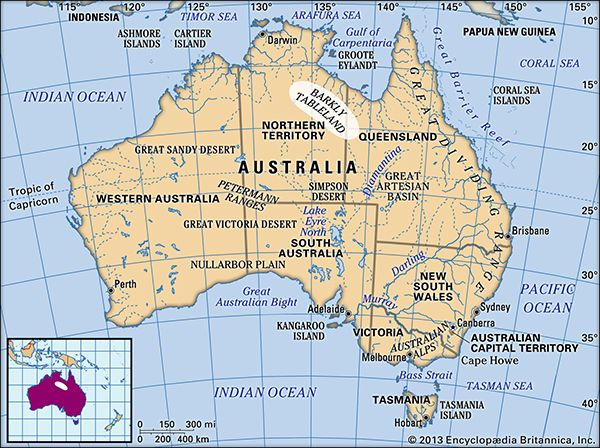
The Barkly Tableland is a vast, grassy, undulating upland region in Australia that spans approximately 50,000 square miles (130,000 square km). Extending about 350 miles (560 km) southeast from Newcastle Creek in the Northern Territory to Camooweal in Queensland, the region maintains an average elevation of 1,000 feet (300 metres).34
Geologically, the tableland is characterized as a high plain of remarkable flatness. It is partly eroded into Cambrian sedimentary rocks and partly underlain by Neogene and Paleogene swamp deposits. The region is nourished by subartesian water and seasonal watercourses, and its soil composition is notable for the prevalence of cracking clays.536
Historically, the area featured a large swamp, and while it is now a grassy upland, it remains a significant pastoral region containing some of Australia’s largest landholdings. The Barkly Highway crosses the region from east to west.35
What kind of wildlife lives in the Gulf of Carpentaria?
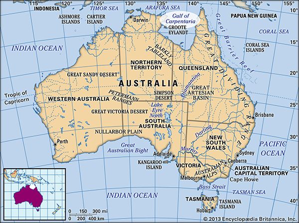
The Gulf of Carpentaria is a shallow epicontinental sea that supports significant marine life, most notably prawn (shrimp) populations. The region has become a major center for the commercial fishing industry, with banana prawns serving as the primary catch.7
While the provided information highlights the economic importance of these crustaceans, it does not detail the broader spectrum of wildlife inhabiting the gulf’s waters or its surrounding coastal ecosystems.
Sources
- McArthur River — Encyclopædia Britannica
- Ludwig Leichhardt — Encyclopædia Britannica
- Barkly Tableland — Encyclopædia Britannica
- Australia - The Western Plateau — Encyclopædia Britannica
- Northern Territory - Drainage and soils — Encyclopædia Britannica
- Northern Territory - Relief — Encyclopædia Britannica
- Gulf of Carpentaria — Encyclopædia Britannica
- Gulf Country — Encyclopædia Britannica
Published on · 2 min read