Mount Katahdin
Mount Katahdin is the highest point in Maine, reaching an elevation of 5,268 feet (1,606 meters). Located within Baxter State Park in Piscataquis County…
What is Mount Katahdin?
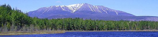
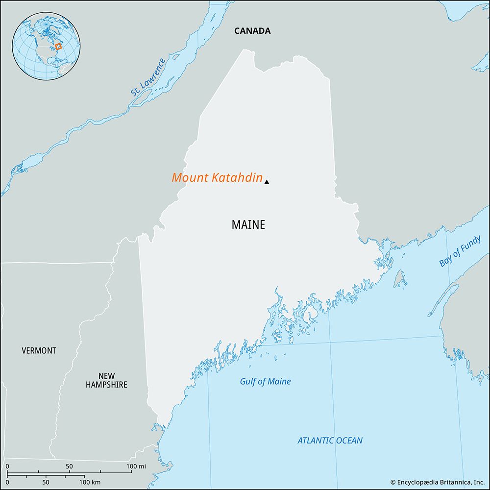
Mount Katahdin is the highest point in Maine, reaching an elevation of 5,268 feet (1,606 meters). Located within Baxter State Park in Piscataquis County, this rugged mountain is composed of several summits, the tallest of which is Baxter Peak.12
The name “Katahdin” originates from an Abenaki term meaning “main mountain”. Beyond its status as a prominent geographical landmark, it is widely recognized as the northern terminus of the Appalachian National Scenic Trail, which stretches southwest to Georgia.12
What is the history of the Appalachian Trail?
The Appalachian National Scenic Trail was conceived by Benton MacKaye, a regional planner from Massachusetts, who published a proposal for the trail in 1921. Following this vision, the first section of the footpath opened in New York in October 1923.
Construction was a collaborative effort involving volunteers from hiking clubs, the Civilian Conservation Corps, and federal agencies, all coordinated by the Appalachian Trail Conference (now the Appalachian Trail Conservancy). The trail was officially completed in 1937.34
Over the decades, the route has been modified and rerouted to improve scenery or respond to land development and natural disasters. In 1968, the U.S. Congress designated it as one of the two initial units of the National Trail System. Today, the trail remains managed primarily by volunteers, serving as a premier destination for both short-term hikers and those attempting the full journey.3

How was Mount Katahdin formed geologically?
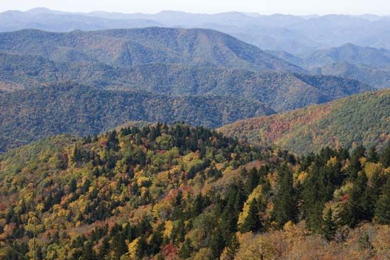
Mount Katahdin, like the broader Appalachian Mountains, is a product of ancient geological processes involving crustal upheaval and long-term erosion. Its formation is tied to the complex history of the Appalachian orogenic belt, which was shaped by the collision of continental blocks and island arcs over hundreds of millions of years.12
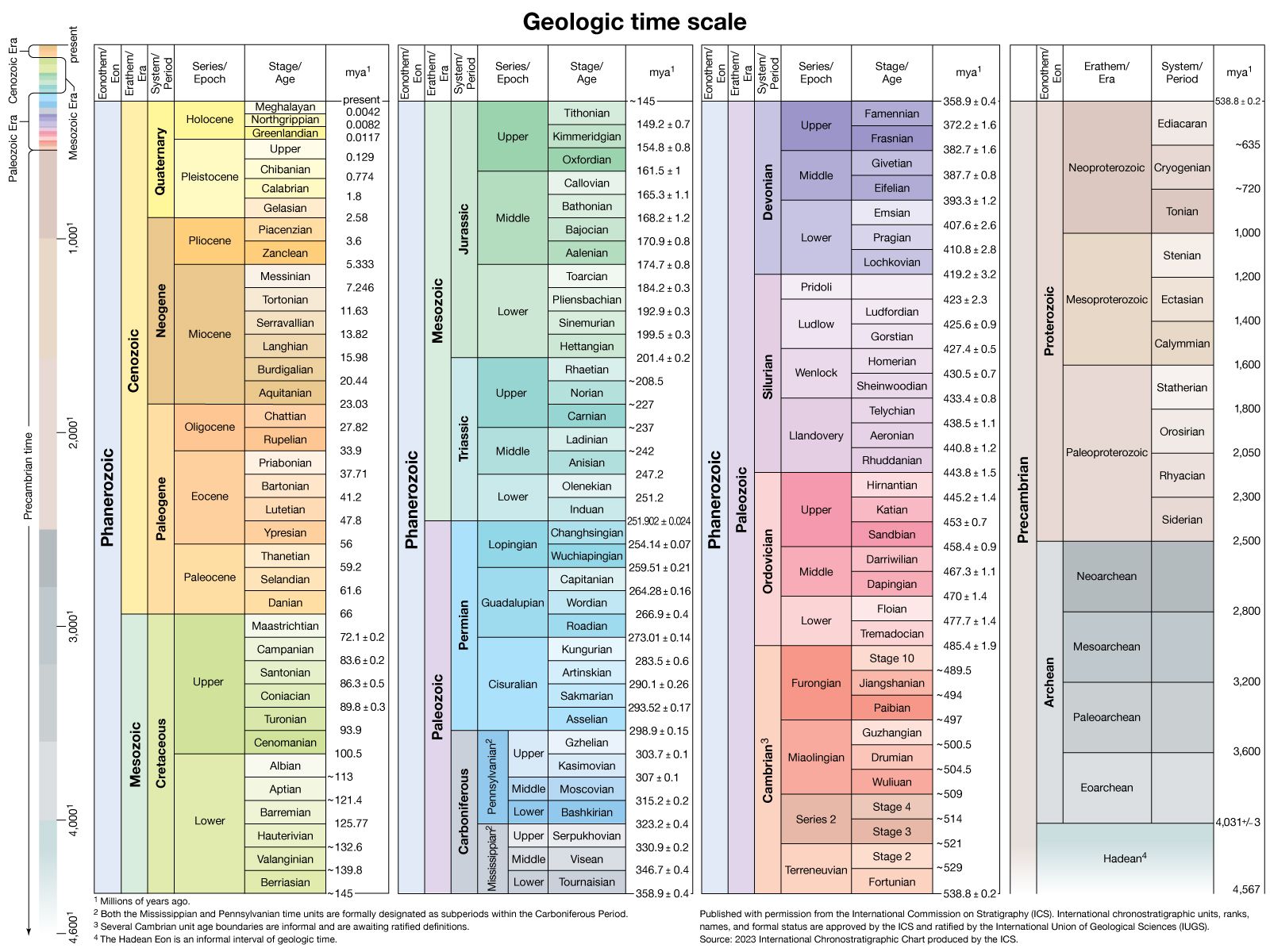
The region is characterized by ancient crystalline rocks that date back to the Precambrian era. These rocks were subjected to extreme heat and pressure, transforming them into metamorphic sequences such as gneiss and granite. The mountain’s structure was further defined by three major orogenies—the Taconic, Acadian, and Alleghenian—which involved the subduction of the ancient Iapetus Ocean and the subsequent building of the mountain range.12
In more recent geological history, the landscape was significantly sculpted by glacial forces during the Pleistocene Epoch. Continental ice sheets moved over New England, stripping topsoil, polishing peaks, and carving out the deep ravines and valleys that define the mountain’s rugged appearance today.1
What wildlife lives in Baxter State Park?
Sorry, the Britannica knowledge base does not contain this information.
Sources
- Mount Katahdin — Encyclopædia Britannica
- Katahdin, Mount — Merriam-Webster
- Appalachian National Scenic Trail — Encyclopædia Britannica
- Appalachian Trail — Merriam-Webster
- Appalachian Mountains - Geology of the Appalachian Mountains — Encyclopædia Britannica
- Appalachian orogenic belt — Encyclopædia Britannica
Published on · 2 min read