Mount Mansfield
Mount Mansfield is the highest point in Vermont, reaching an elevation of 4,393 feet (1,339 metres). Located 20 miles northeast of Burlington, it is part of…
What is Mount Mansfield?
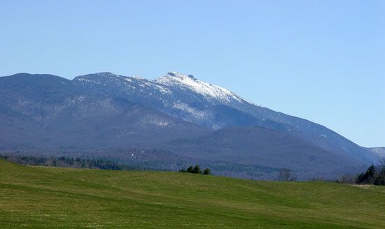
Mount Mansfield is the highest point in Vermont, reaching an elevation of 4,393 feet (1,339 metres). Located 20 miles northeast of Burlington, it is part of the Green Mountains, which are a segment of the Appalachian Mountains.1
The mountain is characterized by a series of summits that resemble a human face, with individual peaks named the Adam’s Apple, Forehead, Nose, Upper and Lower Lips, and the Chin, which serves as the highest point. On its western side, the mountain drops over 4,000 feet toward Lake Champlain. Today, the area is a popular destination for winter sports and is traversed by the Appalachian National Scenic Trail.1
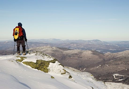
How were the Green Mountains formed?
The Green Mountains were formed as part of the broader development of the Appalachian Mountains through a series of tectonic collisions during the Paleozoic Era. Their formation was driven by the accretion of volcanic island arcs and continental fragments to the margin of the ancient continent Laurentia.2
Key geological events contributing to this process include:
- Taconic Orogeny: Occurring between approximately 470 and 460 million years ago, this event involved the collision of a volcanic arc with the Appalachian margin, resulting in significant deformation.2
- Acadian Orogeny: Between about 450 and 410 million years ago, additional volcanic arcs and crustal strips were accreted to the margin, further building the mountain system.2
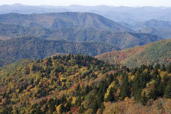
These tectonic processes caused crustal thickening and deformation, creating the rugged, north-south backbone that defines the landscape of Vermont today. The resulting mountains are characterized by a rocky, tilted terrain that has been shaped over millions of years.23
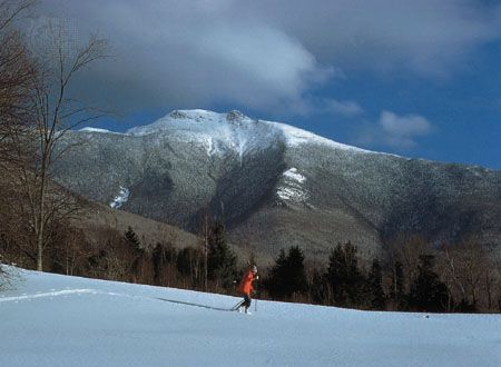
What makes the Appalachian Trail unique?
The Appalachian National Scenic Trail is unique for its immense scale and collaborative management. Spanning approximately 2,190 miles, it is one of the longest continuously marked footpaths in the world, traversing 14 states from Maine to Georgia.5
Several factors distinguish the trail:
- Collaborative Stewardship: Conceived by Benton MacKaye, the trail was completed in 1937 through a massive joint effort between volunteers, hiking clubs, federal agencies, and the Civilian Conservation Corps. Today, it remains primarily managed by volunteers.5
- Diverse Ecosystems: The path crosses 8 national forests and 6 units of the national park system, offering varied terrain ranging from the rugged, exposed peaks of the White Mountains to the grassy “balds” of the southern Appalachians.5
- National Significance: Established as one of the first two units of the U.S. National Trail System in 1968, it serves as both a destination for short-term hikers and a monumental challenge for “thru-hikers” who traverse its entire length.5
What are the characteristics of alpine tundra ecosystems?
Alpine tundra ecosystems are high-elevation environments characterized by conditions that prevent the growth of trees, such as low temperatures and strong winds. These ecosystems cover approximately 3 percent of Earth’s land surface and are found in mountainous regions worldwide.7
Key characteristics include:
- Climate: Alpine tundra features a moderate climate compared to the Arctic, with cool summers (3–12 °C) and moderate winters that rarely drop below –18 °C. However, these areas experience intense winds, which can reach speeds of 120 to 200 km per hour in high mountain reaches.8
- Vegetation: Plant life is influenced by localized microclimates, soil drainage, and snow cover. Vegetation often includes cushion plants on windswept ridges, extensive meadows on gentle slopes, and mosses or lichens on rocky peaks. Because the growing season is limited to two to four months, many plants are perennials that complete their life cycles rapidly.9
- Atmospheric Conditions: Due to higher altitudes, alpine tundras have thinner air and lower levels of carbon dioxide (CO2) than Arctic regions, leading alpine plants to be more efficient at photosynthesis.10
- Sensitivity: These ecosystems are highly sensitive to climate change, which can lead to increased shrub density, earlier spring thaws, and the migration of tree species into higher elevations.11
Sources
- Mount Mansfield — Encyclopædia Britannica
- Green Mountains — Encyclopædia Britannica
- North America - 600 to 250 million years ago — Encyclopædia Britannica
- Vermont - Relief — Encyclopædia Britannica
- Appalachian National Scenic Trail — Encyclopædia Britannica
- Appalachian Trail — Merriam-Webster
- Tundra - Plant life — Encyclopædia Britannica
- Tundra - Distribution — Encyclopædia Britannica
- Tundra - Use of sunlight and carbon dioxide — Encyclopædia Britannica
- Tundra - Climate — Encyclopædia Britannica
- Tundra - Effects of human activities and climate change — Encyclopædia Britannica
Published on · 3 min read