Nakdong River
The Nakdong River is a vital resource for southeastern South Korea, serving as a primary source of water for both urban and agricultural needs.
How does the Nakdong River contribute to South Korea’s water resources and agriculture?
The Nakdong River is a vital resource for southeastern South Korea, serving as a primary source of water for both urban and agricultural needs.
The river’s basin, which spans 9,200 square miles (23,800 square km), supports significant agricultural activity; approximately one-fourth of this area is dedicated to the cultivation of crops, aided by the fertile delta plain formed along Jin Bay. Beyond its role in farming, the river is essential for municipal water supply, providing water to the various cities located along its course.1
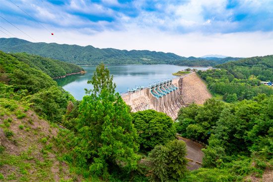
Infrastructure development has further enhanced the river’s utility. For instance, a multipurpose dam was constructed in 1968 on the Nam River—a principal tributary—near Jinju, which helps manage water resources for the region.1
What is the historical significance of the Nakdong River in Korean culture and development?
The Nakdong River holds significant historical and developmental importance in South Korea, serving as both a vital economic artery and a critical site of military history.
Economic and Developmental Role
As the second-longest river in the country, the Nakdong has long supported the development of the Yeongnam region. Its basin, covering 9,200 square miles, is a cornerstone of regional agriculture; approximately one-fourth of this area is utilized for crop cultivation, supported by the fertile delta plain near Jin Bay. Furthermore, the river is essential for modern infrastructure and urban sustainability, providing water to cities along its course and supporting water management through projects like the multipurpose dam near Jinju, constructed in 1968.
Military Significance
The river gained profound historical prominence during the Korean War. In the summer of 1950, the middle section of the Nakdong River became the primary defensive line—known as the “Pusan Perimeter”—for South Korean and United Nations forces. This line was essential in halting the North Korean advance, allowing the United Nations Command to consolidate its position and eventually shift the strategic balance of the war.
What role did the Nakdong River play during the Korean War?
During the Korean War, the Nakdong River served as a critical strategic barrier. By the summer of 1950, as South Korean and United Nations forces retreated to the southeastern corner of the peninsula, the middle section of the river became the primary defensive line known as the “Pusan Perimeter.”21
This defensive line was essential for halting the North Korean advance. In August 1950, North Korean forces attempted a major offensive against the Nakdong River–Taegu–Yŏngdŏk line, aiming to envelop Taegu and reach the coastal anchors of the perimeter. However, these efforts failed to achieve their objectives. By mid-September, the North Korean People’s Army had been driven back in most areas west of the river, effectively shifting the strategic balance of the war in favor of the United Nations Command.2
Tragically, the river area was also the site of civilian suffering; in late July 1950, U.S. forces fired on refugees at a railroad viaduct located west of the Nakdong River, resulting in hundreds of deaths.2
How long is the Nakdong River, and what are its major tributaries?
The Nakdong River is 325 miles (523 km) long, making it the second-longest river in South Korea. While one source identifies it as the country’s longest river, it is officially recognized as the second-longest after the Han River in broader geographical contexts.134
The river’s principal tributaries include:
- Naeseongcheon
- Banbyeoncheon
- Wicheon
- Geumho
- Namgang1
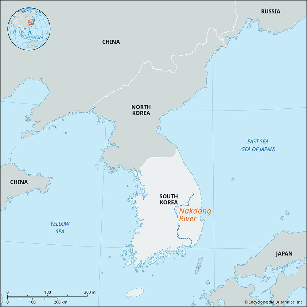
Together with these tributaries, the Nakdong River maintains a drainage basin of 9,200 square miles (23,800 square km). It originates in the Taebaek Mountains and flows southward to empty into the Korea Strait at Busan.13
Sources
- Nakdong River — Encyclopædia Britannica
- Korean War - South to Pusan — Encyclopædia Britannica
- South Korea - Drainage — Encyclopædia Britannica
- Han River — Encyclopædia Britannica
Published on · 3 min read