North Canadian River
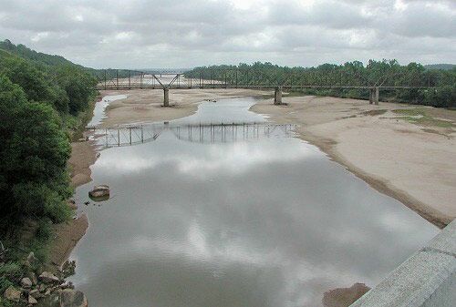
The North Canadian River is the primary tributary of the Canadian River in the south-central United States. Stretching 800 miles (1,287 km), it originates on…
What is North Canadian River?
The North Canadian River is the primary tributary of the Canadian River in the south-central United States. Stretching 800 miles (1,287 km), it originates on a high plateau in Union County, New Mexico.1
The river flows eastward through the Texas and Oklahoma panhandles, passing through Oklahoma City before joining the Canadian River at the Eufaula Reservoir in Oklahoma1. Along its upper course, above the mouth of its tributary Wolf Creek, the river is known as the Beaver River.21
Water management along the river includes the Canton Dam (1948) on the main stream and the Fort Supply Dam (1942) on Wolf Creek, which create important irrigation lakes. The river drains a total area of 14,290 square miles (37,011 square km).1
What is the difference between the North Canadian River and the Canadian River?
The North Canadian River and the Canadian River are distinct but connected waterways in the south-central United States. The primary difference is their relationship: the North Canadian River is a tributary that flows into the Canadian River.12
Key distinctions include:
- Hierarchy and Confluence: The Canadian River is the larger system, ultimately flowing into the Arkansas River. The North Canadian River joins the Canadian River near Eufaula, Oklahoma, within the Eufaula Reservoir.21
- Origins: The Canadian River rises in the Sangre de Cristo Mountains of New Mexico. The North Canadian River originates on a high plateau in Union County, New Mexico.21
- Scale: The Canadian River is longer, spanning 906 miles (1,458 km) and draining 46,900 square miles (121,500 square km). The North Canadian River is 800 miles (1,287 km) long and drains 14,290 square miles (37,011 square km).21
- Characteristics: The Canadian River is largely a braided stream, while the North Canadian is known as the Beaver River along its upper course.12
How do dams like the Canton Dam affect the river’s ecosystem?
Dams like the Canton Dam significantly alter river ecosystems by transforming natural flow patterns into managed reservoirs. These structures impact the environment in several critical ways:
- Sediment Trapping: Dams impound water, causing flow velocity to decrease and sediment to settle in the reservoir. This reduces the sediment load downstream, which can lead to increased erosion of the stream channel below the dam as the water regains its transporting capacity.4
- Habitat Disruption: Large-scale impoundments can destroy existing fish habitats and ecosystems. Dams often act as physical barriers that block or impede the movement of migrating or spawning fish, leading to potential population declines.546
- Hydrological Changes: By storing water during high flows and releasing it gradually, dams alter the natural timing and volume of river flow. While this helps with flood control and irrigation, it fundamentally changes the riparian environment.4
- Water Loss: Reservoirs are subject to significant water loss through evaporation and seepage, which can further impact the availability of water for downstream flora and fauna.4
What role did rivers play in the development of pioneer trails in the American West?
Rivers were fundamental to the development of pioneer trails in the American West, serving as both essential lifelines and natural navigational guides for westward expansion.
Navigational Arteries
Access to water was of paramount importance for survival, and major trails were often dictated by the geography of river systems. For instance, the Oregon Trail followed the courses of the Platte River, the North Platte River, the Snake River, and the Columbia River for much of its 2,000-mile length. Similarly, the Canadian River valley provided a critical corridor for the Santa Fe Trail and other pioneer routes.89210
Essential Resources
Beyond navigation, rivers provided critical resources for travelers:
- Sustenance: Rivers and streams were abundant with fish, providing a necessary food source for pioneers.8
- Livestock Support: The valleys along these rivers offered water and grazing land for the emigrants’ livestock, which was vital for the success of the long journey.8
- Transportation: When overland roads became impassable due to weather, rivers often served as alternative routes for transporting people and goods.11
Sources
- North Canadian River — Encyclopædia Britannica
- Canadian River — Encyclopædia Britannica
- Red River of the North — Encyclopædia Britannica
- dam - Fish passes — Encyclopædia Britannica
- river - Environments of deposition — Encyclopædia Britannica
- reservoir — Encyclopædia Britannica
- dam - Rise of environmental and economic concerns — Encyclopædia Britannica
- American frontier - Early roads — Encyclopædia Britannica
- Oregon Trail - The trail — Encyclopædia Britannica
- How long was the Oregon Trail? — Encyclopædia Britannica
- Oregon Trail — Encyclopædia Britannica
Published on · 3 min read