Petermann Ranges
The Petermann Ranges are a chain of low mountains stretching approximately 200 miles (320 km) from east-central Western Australia into the southwestern…
What is Petermann Ranges?
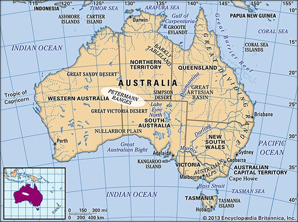
The Petermann Ranges are a chain of low mountains stretching approximately 200 miles (320 km) from east-central Western Australia into the southwestern corner of the Northern Territory.1
These mountains, which reach an elevation of 3,800 feet (1,158 meters), are composed of granite and gneiss and serve as a geological continuation of the Musgrave Ranges located to the southeast. The range was visited by explorer Ernest Giles in 1874 and named in honor of the German geographer August Petermann.1
The eastern portion of the mountains is situated within the Petermann Aboriginal Land Trust’s territory. The region is also geographically near iconic landmarks such as Uluru/Ayers Rock and the Olgas (Kata Tjuta), which are protected within the Uluru–Kata Tjuta National Park, a designated World Heritage site.1
What are the Musgrave Ranges?
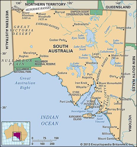
The Musgrave Ranges are a series of granite hills located in northwestern South Australia, stretching 130 miles (210 km) parallel to the Northern Territory border.2
Key features of the ranges include:
- Elevation: The bare rock surfaces feature several peaks exceeding 3,500 feet (1,100 m), including Mount Woodroffe, which stands at 4,708 feet (1,435 m) and serves as the highest point in South Australia.2
- Exploration: The hills were sighted in 1873 by English explorer William C. Gosse and were crossed later that year by both Gosse and Ernest Giles. They were named after Sir Anthony Musgrave, the former lieutenant governor of South Australia.2
- Cultural Significance: The area has traditionally served as a site of initiation for the Pitjantjatjara Aborigines, and much of the region was the subject of an Aboriginal land-rights claim in the mid-1980s.2
- Geological Context: The ranges are geologically linked to the Petermann Ranges to the northwest.1
Who was the explorer Ernest Giles?
Ernest Giles was a prominent 19th-century explorer recognized for his significant contributions to the mapping of the Australian interior during the 1870s.3
His notable expeditions include:
- Gibson Desert: Giles penetrated this arid region in 1874 and successfully completed the first crossing of the desert in 1876. The desert was named in honor of Alfred Gibson, a member of his expedition who perished while searching for water.1
- Petermann Ranges: In 1874, Giles visited this mountain chain, which he named after the German geographer August Petermann.4
- Musgrave Ranges: Giles, alongside William C. Gosse, crossed these ranges in 1873.1
Due to these extensive journeys, Giles is celebrated as one of the key figures in the history of Australian exploration.3
What is the significance of the Petermann Aboriginal Land Trust?
The Petermann Aboriginal Land Trust is significant primarily for its role in the stewardship of the eastern section of the Petermann Ranges. These low mountains, which extend 200 miles across the border of Western Australia and the Northern Territory, are composed of granite and gneiss formations that are geologically linked to the Musgrave Ranges located to the southeast.1
By holding territory that encompasses these geological features, the Land Trust plays a vital role in the management and preservation of lands situated near other iconic Australian landmarks, such as Uluru/Ayers Rock and the Olgas (Kata Tjuta), which are protected within the Uluru–Kata Tjuta National Park.1
Sources
- Petermann Ranges — Encyclopædia Britannica
- Musgrave Ranges — Encyclopædia Britannica
- Gibson Desert — Encyclopædia Britannica
- Australia - Culture — Encyclopædia Britannica
Published on · 2 min read