Pripet Marshes
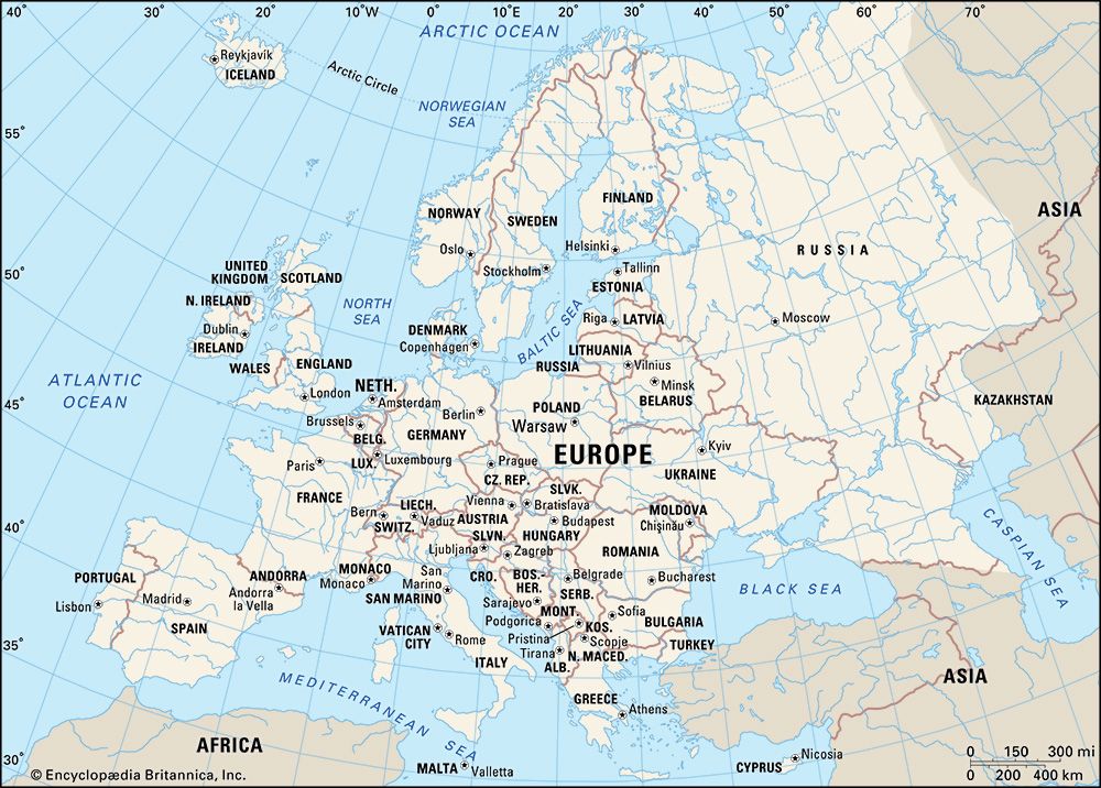
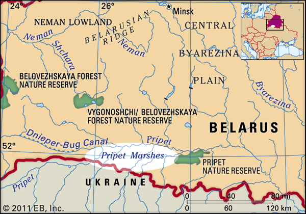
The Pripet Marshes are a vast, waterlogged region located in eastern Europe. They occupy southern Belarus and northern Ukraine.
Where are the Pripet Marshes located, and what countries do they cover?
The Pripet Marshes are a vast, waterlogged region located in eastern Europe. They occupy southern Belarus and northern Ukraine.1
Spanning approximately 104,000 square miles (270,000 square km), this area is situated within the basin of the Pripet River. The landscape is characterized by saturated sandy lowlands, dense river networks, and extensive bogs and pine forests. Due to the region’s unique geography and high water table, it remains one of the largest wetland systems on the European continent.1
How have the Pripet Marshes influenced human settlement and activities in the region?
The Pripet Marshes have profoundly shaped human activity in the region by acting as a formidable natural barrier and a challenging environment for development.
Impact on Settlement and Infrastructure
Due to the region’s waterlogged terrain and underdeveloped infrastructure, the Pripet Marshes remain the least-populated area of Belarus. Historically, the marshes served as a natural boundary between Poland and Russia, effectively isolating communities and limiting large-scale settlement.31
Military and Strategic Consequences
The marshes have historically been a significant obstacle to military operations. During the Eastern Front of World War I, the vast, saturated landscape made large-scale troop movements extremely difficult, forcing commanders to navigate around the region and influencing the overall strategy of the conflict.4
Economic Activities and Transformation
Human intervention has focused on transforming the landscape for economic use:
- Agriculture: In areas where the land has been successfully drained, the region supports the cultivation of crops such as rye, barley, wheat, flax, hemp, and potatoes.5
- Industry: The region’s extensive forests have supported a diversified lumber industry.5
- Land Reclamation: Large-scale efforts to drain the swamps began in 1872 and continued throughout the 20th century. These measures include regulating river channels, constructing reservoirs, and clearing vegetation to make the land more suitable for human use.5
How have drainage projects affected the Pripet Marshes over the years?
Drainage projects have significantly altered the landscape of the Pripet Marshes since they were first initiated in 1872 by a state-sponsored expedition led by I.I. Zhilinsky. Throughout the 20th century, extensive efforts were undertaken to transform these waterlogged lowlands into productive land.1
These reclamation measures have included:
- Water Management: The regulation of river channels and the construction of reservoirs to control drainage.1
- Landscape Modification: The clearing of undesirable vegetation and the afforestation of sandy uplands to stabilize the terrain.1
- Agricultural Development: By removing excess water, large sections of the marshes have been converted into agricultural land suitable for cultivating crops such as rye, barley, wheat, flax, hemp, and potatoes.1
While these projects have enabled human settlement and farming, they also involve complex engineering challenges, such as managing soil permeability and preventing the subsidence that can occur when organic-rich peat soils are drained and aerated. These interventions represent a long-term effort to overcome the region’s natural tendency toward bogging and saturation.61
What are the major rivers that flow through the Pripet Marshes?
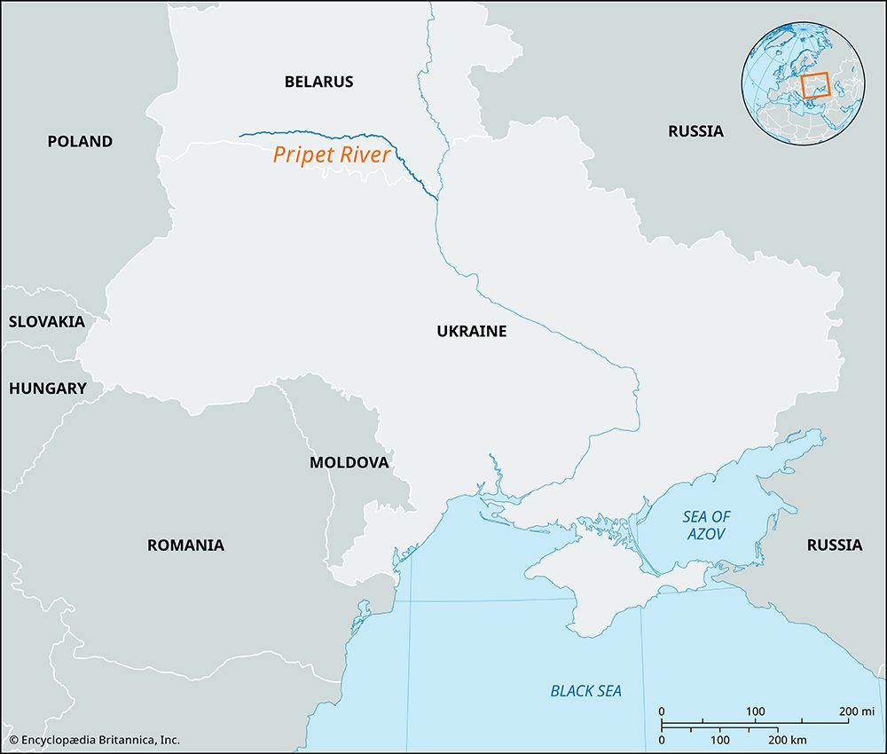
The Pripet Marshes are defined by a dense network of waterways that flow through the region’s saturated lowlands. The primary river system is the Pripet River, which serves as a major tributary of the Dnieper River.
Numerous tributaries flow into the Pripet from the surrounding highlands, contributing to the region’s extensive water coverage. Key rivers and tributaries within this network include:
- Pripet River: The central waterway of the basin, which flows eastward through the marshes before turning southeast to join the Dnieper.18
- Stokhid River1
- Styr River1
- Horyn (Goryn) River1
- Ubort River1
- Yaselda River1
- Ptich River1
Additionally, the region is connected to other major waterways through historical infrastructure, such as the Dnieper-Bug Canal, which links the Pripet basin to the Bug River and the Neman River via various canal systems.89
Sources
- Pripet Marshes — Encyclopædia Britannica
- Pripet — Merriam-Webster
- Eastern Front - Physical characteristics of the Eastern Front — Encyclopædia Britannica
- Belarus - Settlement patterns — Encyclopædia Britannica
- Marsh — Encyclopædia Britannica
- land reclamation - Reclamation of swampy lands — Encyclopædia Britannica
- Belarus - Relief — Encyclopædia Britannica
- Pripet River — Encyclopædia Britannica
- Dnieper River — Encyclopædia Britannica
Published on · 3 min read