River Derwent
There are two notable rivers named the River Derwent:
What is River Derwent?
There are two notable rivers named the River Derwent:
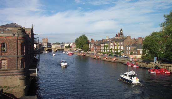
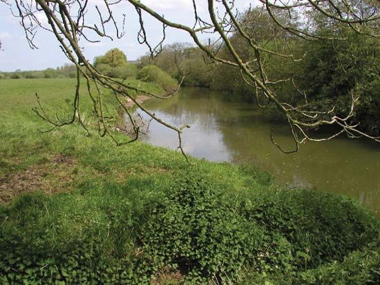
- In England: Located in North Yorkshire, this river rises on Fylingdales Moor and flows 57 miles to join the River Ouse. Its unique course, which alternates between gorges and flat vales, was shaped by ice sheet blockages during the glacial period. The name is of Celtic origin, meaning “river where oak trees grow abundantly.”1
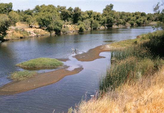
- In Australia: Located in Tasmania, this river rises in Lake St. Clair and flows 113 miles southeast into Storm Bay. Its middle course supports agriculture, including hops and fruit orchards, while its estuary serves as a deepwater port for the city of Hobart. It was named after the English river of the same name.2
How do glaciers change the path of a river?
Glaciers significantly alter the path and character of rivers through several geological processes, ranging from physical obstruction to the creation of new drainage networks.
Direct Obstruction and Diversion
Continental ice sheets and mountain glaciers can physically displace fluvial systems by blocking their established paths. When ice fronts or ice dams impound a river, the water is forced to find new outlets, often creating “glacial overflow channels” through hills or divides that were previously impassable. A notable example is the River Derwent in England, which follows a complex, winding course because its original path was blocked by an ice sheet.31
Landscape Modification
- Divide Breaching: Thick ice can flow through preglacial gaps or notches, eroding them severely. Once the ice melts, these breached divides often become the permanent drainage lines for postglacial streams.3
- Deposition: As glaciers retreat, they leave behind thick sheets of till and other glacial deposits. These materials can bury the preglacial topography, effectively “resetting” the landscape and providing new slopes upon which entirely new drainage networks form.3
- Valley Transformation: Glaciers transform V-shaped stream valleys into U-shaped valleys. Because glaciers are more viscous and have a larger cross-section than rivers, they carve straighter, smoother paths. When the ice melts, smaller tributary glaciers leave behind hanging valleys that sit high above the main valley floor, often resulting in waterfalls.4
Hydrological Impacts
During glacial periods, rivers draining meltwater often develop “braided-channel” patterns due to the massive influx of sediment and fluctuating water discharge. As conditions transition to interglacial periods, these rivers may become “underfit,” appearing too small for the large valleys they occupy. Furthermore, the sudden failure of ice dams can trigger catastrophic floods, such as jökulhlaups, which can carve entirely new, large-scale channels into the landscape.5
What is the difference between a river and an estuary?
A river is a natural, flowing watercourse that typically moves toward an ocean, sea, lake, or another river. In contrast, an estuary is a partially enclosed coastal body of water where river water meets and mixes with seawater.789
The primary differences between the two include:
- Composition: Rivers consist of fresh water flowing from inland sources. Estuaries are defined by their salinity gradients, where fresh water is measurably diluted by salt water.89
- Dynamics: While rivers are characterized by downstream flow, estuaries are influenced by the ebb and flow of tides. The term estuary is derived from Latin words meaning “the tide” and “to boil,” reflecting the turbulence created when tidal and river flows collide.89
- Classification: Rivers are often classified by their drainage patterns and landscape evolution. Estuaries are frequently classified by how they mix fresh and salt water, ranging from “salt-wedge” systems (where fresh water floats on top of salt water) to “vertically homogeneous” systems (where tidal currents cause total mixing).1011
How is hydropower generated from river water?
Hydropower is generated by converting the potential energy of falling or fast-flowing water into mechanical energy and, ultimately, into electricity.13
The process typically involves the following steps:
- Collection: Dams are used to impound rivers, creating a reservoir that stores water at a higher elevation. This elevation difference, known as the head, is critical because the potential power is directly proportional to it.13
- Conveyance: Water is directed downward through large pipes or tunnels called penstocks toward a [powerhouse].13
- Conversion: As the water exits the penstocks, its force causes turbines to rotate. Depending on the specific hydraulic conditions, these may be impulse or reaction turbines.1314
- Generation: The rotating turbines drive generators, which convert the mechanical energy into electricity. Transformers then increase the voltage for efficient long-distance transmission.13
While this process provides a renewable energy source, it is important to acknowledge that dams can significantly disrupt fish migration and submerge local ecosystems, leading to ongoing debates regarding their environmental impact.13
Sources
- River Derwent — Encyclopædia Britannica
- River Derwent — Encyclopædia Britannica
- river - Non-fluvial invasion and deposition — Encyclopædia Britannica
- glacial landform - Glacial erosion — Encyclopædia Britannica
- glacial valley — Encyclopædia Britannica
- Pleistocene Epoch - Fluvial environments — Encyclopædia Britannica
- estuary — Merriam-Webster
- river - Origin and classification — Encyclopædia Britannica
- estuary — Encyclopædia Britannica
- river — Merriam-Webster
- estuary - Vertically homogeneous estuaries — Encyclopædia Britannica
- river - Estuaries — Encyclopædia Britannica
- Did you know? — Merriam-Webster
- hydroelectric power — Encyclopædia Britannica
- turbine - Water turbines — Encyclopædia Britannica
- electric generator - Waterwheel generators — Encyclopædia Britannica
Published on · 3 min read