Sankarani River
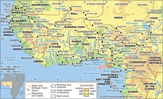
The Sankarani River is a tributary of the Niger River located in western Africa. It originates from intermittent streams in the southern reaches of the Fouta…
What is Sankarani River?
The Sankarani River is a tributary of the Niger River located in western Africa. It originates from intermittent streams in the southern reaches of the Fouta Djallon highlands in Guinea-Djallon) highlands in Guinea.1
The river flows for approximately 330 miles (530 km) in a northeasterly direction before joining the right bank of the Niger River downstream from Kolé, Mali. A significant feature of the river is the Sélingué dam, which has been a vital source of energy for Mali since it began operations in 1980.1
What is the importance of the Sélingué Dam for Mali?
The Sélingué Dam is a critical component of Mali’s energy infrastructure. Located on the Sankarani River, a tributary of the Niger River, the dam has been in operation since 1980.1
Its importance to the nation is primarily defined by its role in power generation. While much of Mali’s electricity is produced by thermal power stations located in Bamako and other urban centers, the country has been increasingly focused on expanding its use of hydroelectric power. The Sélingué Dam serves as a key facility in this effort, standing as one of the country’s most significant sources of energy.12
What are the main characteristics of the Niger River?
The Niger River is the principal river of western Africa and the third longest on the continent, stretching approximately 2,600 miles (4,200 km). Its journey begins in the Fouta Djallon highlands of Guinea, flowing north and then in a great northeasterly arc through Mali before turning southeast toward the Gulf of Guinea.34
Key characteristics include:
- Physiography: The river features diverse landscapes, including an “internal delta” of lakes and creeks in Mali, a rocky defile near Timbuktu, and a vast Niger delta in Nigeria that covers 14,000 square miles.45
- Tributaries: Its largest tributary is the Benue River, which doubles the Niger’s discharge at their confluence in Lokoja.4
- Economic Importance: The river is vital for agriculture, transportation, and power generation. It also supports significant fishing industries, though these have been impacted by environmental challenges like oil pollution in the delta.657
Where is the Fouta Djallon region located?
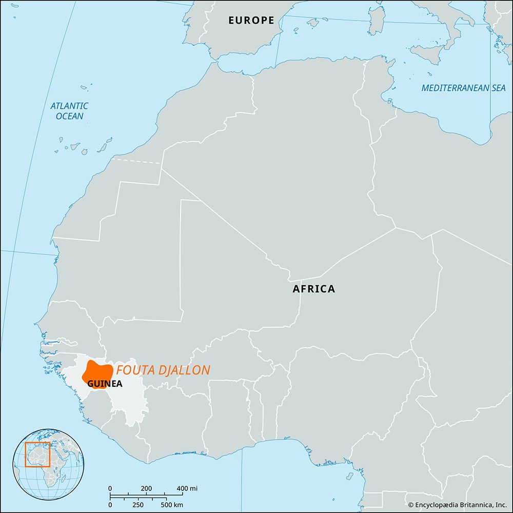
The Fouta Djallon is a mountainous region located in west-central Guinea. It consists of a series of stepped sandstone plateaus that cover approximately 30,000 square miles (77,000 square km).8
The region is geographically significant as a major watershed for western Africa, serving as the source for several major rivers, including the Gambia, Bafing, and Konkouré rivers. Its eastern slopes feed tributaries of the Niger River, and its southeastern extension connects to the Guinea Highlands, where the Niger itself originates.8
Sources
- Sankarani River — Encyclopædia Britannica
- Mali - Resources and power — Encyclopædia Britannica
- Niger River — Encyclopædia Britannica
- Niger River - Physiography — Encyclopædia Britannica
- Nigeria: Top Questions — Encyclopædia Britannica
- Niger River - People and economy — Encyclopædia Britannica
- Nigeria - Drainage — Encyclopædia Britannica
- Fouta Djallon — Encyclopædia Britannica
- Western Africa — Encyclopædia Britannica
- Fouta — Encyclopædia Britannica
Published on · 2 min read