River Wharfe
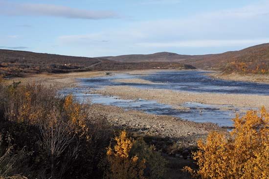
The River Wharfe is a 60-mile (97 km) river located in the historic county of Yorkshire, England. It originates in the Pennines within North Yorkshire and…
What is River Wharfe?
The River Wharfe is a 60-mile (97 km) river located in the historic county of Yorkshire, England. It originates in the Pennines within North Yorkshire and flows southeast, serving as a boundary between North Yorkshire and West Yorkshire before joining the River Ouse as a major tributary.1
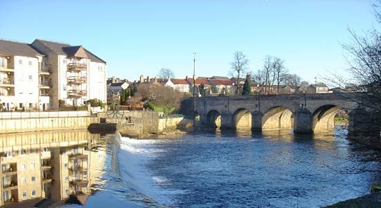
The river’s upper course flows through a steep, troughlike valley known as Wharfedale. This scenic valley is characterized by its agricultural land, particularly dairy farming, and includes parts of the Yorkshire Dales National Park. Notable locations along the river include the village of Grassington, the historic Bolton Priory, and the towns of Ilkley, Burley, and Otley.12
What are the Pennines and why are they important?
The Pennines are a major upland mass often described as the “backbone” or “spine” of northern England. Extending from Northumberland south into Derbyshire, they are not a single mountain range but a series of hills broken by valleys known as dales.3
The Pennines are important for several reasons:
- Watershed: They act as a primary north-south watershed, determining the course of all major rivers in northern England.3
- Water Supply: Reservoirs located in the Millstone Grit areas are vital for supplying water to the manufacturing regions of West Yorkshire and Lancashire.3
- Geology and Scenery: Their unique limestone and gritstone structure has created remarkable landscapes, including deep caverns, chasms, and scenic dales that support significant tourism.3
- Economy and History: The region supports sheep farming and quarrying. It also holds historical significance, featuring prehistoric sites like Arbor Low and the Roman-era Hadrian’s Wall.3
What is the Yorkshire Dales National Park?
The Yorkshire Dales National Park is a protected area in northern England known for its distinctive limestone landscape and deep, scenic valleys, or “dales,” that cut through the central Pennines.
Key features of the park include:
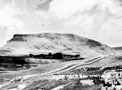
- Geography: The park encompasses bleak limestone uplands and high, gritstone-capped summits such as Ingleborough, Pen-y-Ghent, and Whernside, which exceed 2,000 feet (610 metres) in elevation.35
- Landscape: It is characterized by its rural beauty, featuring attractive stone-built villages, dramatic gorges, and waterfalls, such as those found in Wensleydale and Wharfedale.526
- Economy: The region is predominantly rural, with an economy historically and currently rooted in sheep grazing and dairy farming. Tourism is also a vital component of the local economy, supported by the park’s designation and its scenic appeal.356
- Heritage: The area contains significant historical sites, including remnants of ancient settlements and medieval structures like Bolton Priory and Bolton Castle.526
How do rivers like the Wharfe shape the landscape?
Rivers like the River Wharfe are primary agents in molding the Earth’s surface, acting as more than just conduits for water and sediment. They shape the landscape through a continuous process of erosion and deposition.1
In their upper reaches, such as the Pennines, rivers often expend their energy in vertical entrenchment, carving out narrow, deep, and steep-sided valleys known as dales. Over time, as rivers smooth their longitudinal profiles and approach their base level, they shift their energy toward lateral erosion, which progressively broadens the valley floor.89
The specific morphology of these valleys is influenced by the underlying geology and rock structures. For instance, the limestone and gritstone of the Pennines have allowed water action to create not only surface valleys like Wharfedale but also remarkable underground features, including caverns and chasms. Ultimately, the size and shape of a valley are typically a direct reflection of the river’s size and its historical developmental processes.892
Sources
- River Wharfe — Encyclopædia Britannica
- Wharfedale — Encyclopædia Britannica
- Pennines — Encyclopædia Britannica
- Peak District — Encyclopædia Britannica
- Craven — Encyclopædia Britannica
- Yorkshire — Encyclopædia Britannica
- Wensleydale — Encyclopædia Britannica
- river - Rivers as agents of landscape evolution — Encyclopædia Britannica
- river - Valleys and canyons — Encyclopædia Britannica
- river - Valley evolution — Encyclopædia Britannica
- River Aire — Encyclopædia Britannica
Published on · 3 min read