Rupat Island
Rupat Island is a circular, low-lying, and swampy island located in the Strait of Malacca within the Riau province of Indonesia. Situated just off the…
What is Rupat Island?
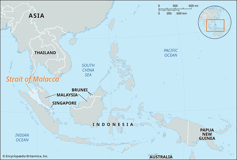
Rupat Island is a circular, low-lying, and swampy island located in the Strait of Malacca within the Riau province of Indonesia. Situated just off the eastern coast of Sumatra, the island spans approximately 30 miles (48 km) in diameter and is separated from Malaysia by a narrow 3-mile-wide channel.1
The island experiences a hot, humid climate with heavy rainfall throughout most of the year. Due to unmanageable seasonal flooding that renders cultivation nearly impossible, the interior remains largely unexplored and sparsely populated. Human habitation is primarily restricted to the dry coastal regions, with Batupanjang on the southwestern coast serving as the island’s only major settlement.1
What is the significance of the Strait of Malacca?
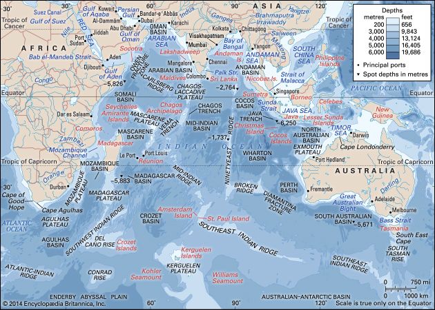
The Strait of Malacca is one of the world’s most vital maritime corridors, serving as the primary shipping link between the Indian Ocean and the Pacific Ocean via the South China Sea2.2
Economic Significance
As the shortest sea route between India and China, the strait is a critical global “choke point,” accounting for approximately 30 percent of all international maritime trade. It facilitates the movement of essential goods, including massive volumes of petroleum transported from the Middle East to major economies in East Asia, such as Japan.32
Historical and Cultural Impact
Historically, the strait has been a nexus for cultural and religious exchange. It played a pivotal role in the spread of Islam throughout Southeast Asia, as the region’s great trading ports—most notably Malacca—served as hubs for merchants from the Middle East, India, and China. Over centuries, the strait was controlled by various powers, including the Arabs, Portuguese, Dutch, and British, and it remains central to the identity and development of the surrounding “Malay world”.43
How does the geography of Sumatra influence nearby islands?
The geography of Sumatra significantly influences nearby islands and the surrounding region through its physical structure, drainage patterns, and geological history.
Sedimentation and Land Formation
Sumatra’s rivers play a critical role in shaping the coastal environments of adjacent islands. Large volumes of material are carried down from the Sumatran highlands by rivers, leading to significant silt accretion along the coast. These sediments contribute to the formation of sand ridges and islets in the Strait of Malacca, which can hinder maritime passage at the strait’s southern entrance.5
Coastal and Swampy Terrain
The eastern half of Sumatra is characterized by broad, low-lying alluvial lowlands and extensive swampy forests. This geography extends to nearby islands such as Rupat and Bengkalis, which are also largely covered by similar swampy terrain. These environments are often subject to seasonal flooding, which limits human habitation and agricultural development on both the Sumatran coast and these adjacent islands.627
Geological and Environmental Context
Sumatra sits on the Sunda Shelf, a shallow continental extension of Asia. The islands in this region, including those near Sumatra, share a common geological origin, having been connected by land bridges during the Pleistocene Epoch. This connectivity facilitated the migration of plants and animals between the Asian continent and the archipelago. Additionally, Sumatra’s proximity to deep-sea trenches and its active volcanic mountain systems influence the seismic and environmental risks for the entire region, as evidenced by the impact of the 2004 Indian Ocean tsunami on both the Sumatran coast and its adjacent islands.87
What are the challenges of living in swampy coastal regions?
Living in swampy coastal regions presents significant challenges due to the unique hydrological and geological conditions of these environments. The primary difficulties include:
- Water Management and Flooding: These regions are often near sea level, making them highly susceptible to coastal flooding, storm surges, and erosion. Because the land is often waterlogged, drainage is a critical and difficult factor; systems must frequently rely on complex infrastructure like dikes or “empoldering” to hold back both the sea and river floods.1213
- Infrastructure and Development: The low-relief, sediment-heavy terrain makes land unstable for construction and transportation. Maintaining water-control outlets is often hindered by heavy sediment discharge, which can clog drainage gates and impede the effectiveness of flood-control systems.1413
- Agricultural Limitations: While some coastal areas are fertile, the constant threat of inundation requires crops that can tolerate occasional drowning. Furthermore, the lack of oxygen in waterlogged soils limits the types of vegetation that can thrive, often restricting agricultural options to specific, adapted crops like rice.131516
- Environmental Risks: Residents in these areas face increased vulnerability to rising sea levels, which threaten to displace populations and disrupt local economies.12
Sources
- Rupat Island — Encyclopædia Britannica
- Strait of Malacca — Encyclopædia Britannica
- Malaysia - The advent of Islam — Encyclopædia Britannica
- List of Important Straits — Encyclopædia Britannica
- Sumatra — Encyclopædia Britannica
- Riau — Encyclopædia Britannica
- Indonesia - Islands of the Sunda Shelf — Encyclopædia Britannica
- Indonesia - Relief — Encyclopædia Britannica
- Indonesia - Climate — Encyclopædia Britannica
- Sunda Islands — Encyclopædia Britannica
- Indonesia - Drainage — Encyclopædia Britannica
- Papua New Guinea - Drainage and soils — Encyclopædia Britannica
- Swamp — Encyclopædia Britannica
- sea level rise: Top Questions — Encyclopædia Britannica
- Wetland - Climate — Encyclopædia Britannica
- Agricultural technology - Water management — Encyclopædia Britannica
Published on · 3 min read