Samara River
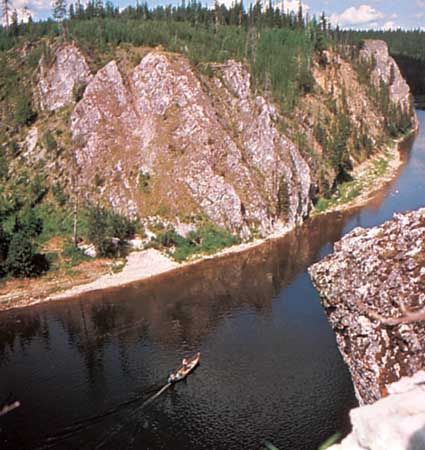
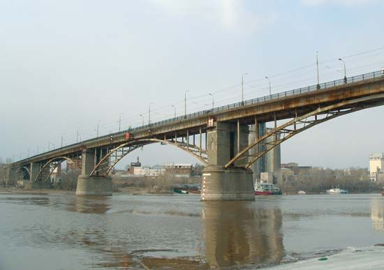
The Samara River is a river located in the Orenburg and Samara oblasti (provinces) of western Russia. It serves as a left-bank tributary of the Volga River.
What is Samara River?
The Samara River is a river located in the Orenburg and Samara oblasti (provinces) of western Russia. It serves as a left-bank tributary of the Volga River.1
Rising in the southern Ural Mountains northwest of Pavlovka, the river flows for 369 miles (594 km) in a generally west-northwest direction. It eventually joins the Volga at the city of Samara, which was founded at this confluence in 1586 to protect the Volga trade route. The Samara River features a drainage basin covering approximately 18,000 square miles (46,500 square km).12
What is the significance of the Volga River in Russia?
The Volga River is the longest river in Europe and serves as the historic cradle of the Russian state. Its immense economic, cultural, and historic importance makes it one of the world’s great rivers, with its basin covering about two-fifths of European Russia and supporting nearly half of the country’s population.3
Economic Significance
The Volga is a vital artery for the Russian economy:
- Navigation: Navigable for approximately 2,000 miles, the river and its tributaries carry nearly half of all inland freight and passengers in the region. It is integrated into a vast network of waterways, including the Volga–Don Ship Canal, the Moscow Canal, and connections to the Baltic and White seas.4
- Agriculture: The Volga economic region is a major center for large-scale agricultural production, particularly for grain.5
- Industry: The river supports significant transport of raw materials, including petroleum, coal, fertilizers, and machinery, through major ports such as Nizhny Novgorod, Kazan, and Volgograd.4
While the river’s development has been essential to national growth, it has faced ecological challenges, including habitat alteration and pollution, which have impacted native fish populations like the sturgeon.6
How do the Ural Mountains influence the rivers in this region?
The Ural Mountains act as a critical geographic and hydrological divide, significantly influencing the drainage patterns and water characteristics of the surrounding regions.
Drainage and Watersheds
The mountains serve as a primary watershed, directing water toward the Arctic Ocean or the Caspian Sea.
- Western Slope: Rivers such as the Pechora River flow toward the Barents Sea, while the Kama River—a major tributary of the Volga River—collects water from the western slopes to feed the Caspian basin.10
- Eastern Slope: Most rivers, including the Tobol, belong to the Ob River system, which empties into the Kara Sea.10
Topography and Climate Influence
The character of these rivers is shaped by the mountains’ topography and climate:
- Flow Patterns: Rivers often begin in wide, longitudinal troughs before cutting through ridges in narrow valleys to reach the plains.10
- Water Volume: Western slope rivers generally carry more water than those on the east. The eastern slope of the Southern Urals experiences the slowest flow rates due to low precipitation and intense evaporation.10
- Precipitation: The mountains themselves influence local moisture, with higher elevations receiving over 28 inches (711 mm) of annual precipitation, significantly more than the surrounding plains.7
What are the major industries found in the city of Samara?
Samara is one of Russia’s largest industrial centers, with its growth significantly bolstered by the development of the Volga-Urals oil field and its role as a strategic hub during World War II.
The city’s major industries include:
- Oil and Petrochemicals: These are primary sectors, with extensive refining operations concentrated in the area, particularly in the satellite town of Novokuybyshevsk.213
- Engineering: Samara hosts large factories that produce a diverse array of goods, including petroleum equipment, machinery, ball bearings, cables, and precision machine tools.2
- Manufacturing: The city supports a wide range of building-materials and consumer-goods industries.2
- Energy: Much of the region’s industrial power is supplied by a major hydroelectric plant located at Zhigulyovsk2.13
Additionally, the broader Samara region is known for its agricultural output and, notably, the large automobile production facilities located in nearby Tolyattigrad.13
Sources
- Samara River — Encyclopædia Britannica
- Samara — Encyclopædia Britannica
- Volga River — Encyclopædia Britannica
- Volga River - Navigation — Encyclopædia Britannica
- Russia - Agriculture — Encyclopædia Britannica
- Volga River - Physical features — Encyclopædia Britannica
- Volga River - Physiography — Encyclopædia Britannica
- Volga River - Environmental changes — Encyclopædia Britannica
- Volga River - Hydrology — Encyclopædia Britannica
- Ural Mountains - Drainage — Encyclopædia Britannica
- Russia - Climate of Russia — Encyclopædia Britannica
- Russia - Precipitation — Encyclopædia Britannica
- Samara — Encyclopædia Britannica
Published on · 3 min read