Scotia Sea
The Scotia Sea serves as a vital transition zone within the Antarctic ecosystem, defined largely by the Antarctic Convergence. This boundary separates the…
How does the Scotia Sea contribute to the Antarctic ecosystem?
The Scotia Sea serves as a vital transition zone within the Antarctic ecosystem, defined largely by the Antarctic Convergence. This boundary separates the sub-Antarctic climatic zone to the north from the colder Antarctic zone to the south, significantly influencing the region’s biodiversity.1
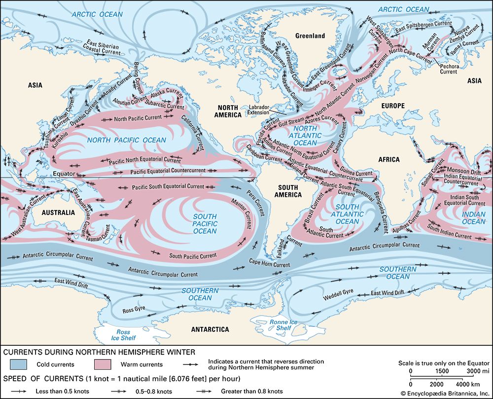
The sea acts as a conduit for the Antarctic Circumpolar Current, which funnels water in a clockwise race around the continent. This movement supports a diverse range of marine life, including nearly 100 species of fish, as well as various whales and seals. The seafloor, particularly in the East Scotia Basin and West Scotia Basin, is characterized by deposits of diatom and foraminifera skeletons, reflecting the high biological productivity of these waters.123
While the region supports rich bird populations—such as penguins, petrels, and terns—it faces ecological challenges, including the historical impact of human predation on marine mammals and the threat posed by introduced species to island nesting grounds.1
How does the Antarctic Circumpolar Current influence the Scotia Sea?
The Antarctic Circumpolar Current (ACC) is a fundamental driver of the Scotia Sea environment, acting as a powerful, west-to-east flow that shapes the region’s physical and biological character.12
Key influences include:
- Water Transport and Funneling: As the ACC makes its clockwise race around the Antarctic continent, it is funneled through the Drake Passage and the Scotia Sea. This massive movement of water pours through the passes of the Scotia Ridge, effectively linking the major oceans and diminishing differences between them.14
- Topographic Interaction: The current reaches the seafloor and is guided by the complex, irregular bottom topography of the Scotia Sea, including the West Scotia Basin and East Scotia Basin. As it flows, the current generates large meanders and eddies that facilitate the poleward transfer of heat.24
- Ecological Isolation: By establishing a deep-ocean circumpolar belt, the ACC isolates Antarctica from the warmer surface waters of the subtropics, maintaining the cold conditions necessary for the unique Antarctic ecosystem.5
What is the geological history of the Scotia Sea and how was it formed?
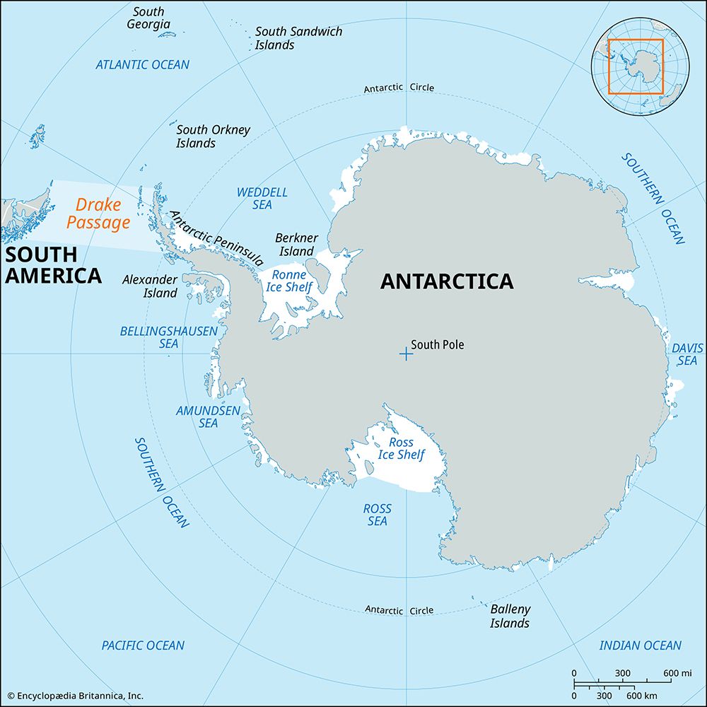
The Scotia Sea is situated within a complex, tectonically active marine basin. Its geological structure is defined by the Scotia Ridge, a 2,700-mile-long, west-opening submarine loop that connects the southern tip of South America (Tierra del Fuego) to the northern part of the Antarctic Peninsula.2
Geologically, the Scotia Ridge is characterized by an active volcanic arc-trench system at its eastern end. This formation is often compared to the Northern Antilles volcanic chain in the Caribbean, leading early geologists to refer to the region as the “Southern Antilles.” The sea itself is divided into two primary basins—the West Scotia Basin and the East Scotia Basin—separated by a slight submerged rise that links the island of South Georgia to the South Orkney Islands.21
The basin floors contain deposits of silt, likely glacial rock flour, alongside oozes composed of the skeletons of diatoms and foraminifera, which reflect the region’s high biological productivity.1
Where is the Scotia Sea located and what are its geographical boundaries?
The Scotia Sea is a marine region located in the South Atlantic Ocean, covering an area of approximately 350,000 square miles (900,000 square km).1
Its geographical boundaries are defined by the following features:
- North, East, and South: The sea is enclosed by the Scotia Ridge, a 2,700-mile-long, west-opening submarine loop that connects Tierra del Fuego in South America to the northern part of the Antarctic Peninsula.12
- West: The western limit is formed by a discontinuous, northwest-trending rise that separates the basin from the Drake Passage.1
The region is further characterized by the Scotia Arc, an island arc system that includes the South Georgia, South Sandwich, and South Orkney islands, which follow the curve of the ridge. Internally, the sea is divided into the West Scotia Basin and the East Scotia Basin by a slight submerged rise connecting South Georgia to the South Orkney Islands.219
Sources
- Scotia Sea — Encyclopædia Britannica
- West Scotia Basin — Encyclopædia Britannica
- East Scotia Basin — Encyclopædia Britannica
- ocean current - Thermohaline circulation — Encyclopædia Britannica
- ocean current - The Antarctic Circumpolar Current — Encyclopædia Britannica
- Antarctic Peninsula — Merriam-Webster
- Scotia Sea — Merriam-Webster
- Antarctica - Structural framework — Encyclopædia Britannica
- Scotia Arc — Encyclopædia Britannica
Published on · 3 min read