Slieve Donard
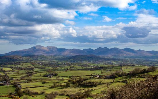
Slieve Donard is the highest peak in the Mourne Mountains, located in Northern Ireland. Rising to an elevation of 2,796 feet (852 metres), it is situated…
What is Slieve Donard?
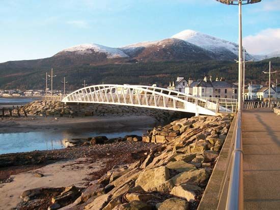
Slieve Donard is the highest peak in the Mourne Mountains, located in Northern Ireland. Rising to an elevation of 2,796 feet (852 metres), it is situated near the coast at the northeastern end of the range.1
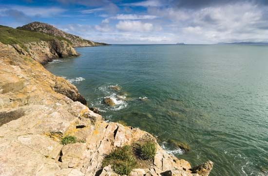
The mountain is named after St. Domhangort (Donard), who reportedly erected an oratory on the summit during the 5th century; remains of this structure can still be found there today. The surrounding landscape is characterized by intensive glacial and periglacial activity, which has resulted in bare crags and significant rock debris on the lower slopes. As part of the broader Mourne range, the peak is composed of granite and rises quite abruptly from the nearby Irish Sea.12
What are the Mourne Mountains known for?
The Mourne Mountains are a compact range of granite peaks in southeastern Northern Ireland known for several distinct features:
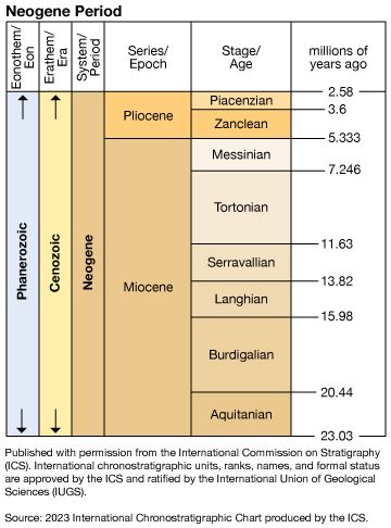
- Geological Composition: The range is defined by five overlapping granite intrusions that rose during the Neogene Period, creating a series of dramatic peaks that rise abruptly from the Irish Sea.2
- High Peaks: The mountains contain numerous summits exceeding 2,000 feet, including the highest point in Northern Ireland, Slieve Donard, which reaches 2,796 feet (852 metres).21
- Water Supply: The hills serve as vital reservoirs, providing water to cities and towns including Belfast, Portadown, and Banbridge.2
- Historical and Economic Significance: Historically, the region was known for exporting dressed granite. Today, the surrounding coastal towns like Newcastle, Kilkeel, and Rostrevor function as fishing and vacation centers. The area also features historical sites such as the ruined castles at Greencastle and Dundrum.2
Who was Saint Domhangort?
Saint Domhangort, also known as Donard, was a 5th-century figure associated with the Mourne Mountains in Northern Ireland. He is historically recognized for erecting an oratory on the summit of the mountain that now bears his name, Slieve Donard. Remains of this ancient structure can still be found on the peak today.1
How do glaciers shape mountain landscapes?
Glaciers are powerful agents of landscape transformation, reshaping mountain environments through the processes of erosion and deposition. By acting as massive, viscous “sandpaper,” glaciers drastically alter the topography of the regions they occupy.45
Erosional Landforms
Glaciers reshape the landscape by removing loose debris and eroding bedrock, creating several iconic features:
- U-Shaped Valleys: Glaciers inherit V-shaped stream valleys and transform them into U-shaped valleys by widening and deepening the floor and steepening the sidewalls to provide the least frictional resistance to ice flow.46
- Cirques and Tarns: At the head of a glacial valley, glaciers carve out cirques—amphitheatre-shaped basins with steep headwalls. When a glacier retreats, these basins often contain small lakes known as tarns.67
- Arêtes and Horns: As neighboring cirques expand, they narrow the ridges between them into jagged, knife-edge arêtes. When three or more cirques erode a mountain radially, they leave behind a sharp, pyramid-shaped peak known as a horn, such as the Matterhorn.6
- Hanging Valleys: Because smaller tributary glaciers erode their beds less rapidly than the main glacier, their valleys are left “hanging” high above the main valley floor, often resulting in waterfalls.4
Depositional Processes
As glaciers move, they transport rock debris, which is eventually deposited as till or reworked by meltwater into outwash. These deposits, along with the erosional features mentioned above, define the rugged, scenic character of many of the world’s high mountain ranges.89
Sources
- Slieve Donard — Encyclopædia Britannica
- Mourne Mountains — Encyclopædia Britannica
- Mourne Mountains — Merriam-Webster
- glacial valley — Encyclopædia Britannica
- glacial landform - Cirques , tarns, U-shaped valleys, arêtes, and horns — Encyclopædia Britannica
- glacial landform - Erosional landforms of valley glaciers — Encyclopædia Britannica
- cirque — Encyclopædia Britannica
- glacial landform - Small-scale features of glacial erosion — Encyclopædia Britannica
- glacial landform - Glacial erosion — Encyclopædia Britannica
- glacial landform - Meltwater deposits — Encyclopædia Britannica
- glacier - Classification of mountain glaciers — Encyclopædia Britannica
- glacier - Surface features — Encyclopædia Britannica
- glacial landform - Glacial deposition — Encyclopædia Britannica
Published on · 3 min read