Glacial Landform
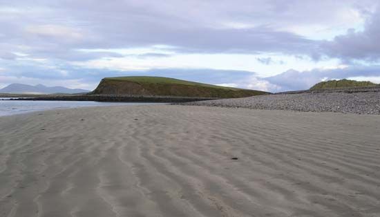
A drumlin is an elongated, oval-shaped hill formed by the streamlined movement of glacial ice over till or rock debris. These landforms typically feature a…
How do drumlins form and what can they tell us about glacial processes?
A drumlin is an elongated, oval-shaped hill formed by the streamlined movement of glacial ice over till or rock debris1. These landforms typically feature a steep, high “stoss” side facing the direction of the advancing ice and a smooth, tapered “lee” side.12
Regarding their formation, drumlins are believed to develop subglacially near the margins of an ice sheet, often appearing in large clusters known as drumlin fields. While the exact mechanisms are still studied, their presence provides significant insight into glacial processes:2
- Direction of Flow: Because their long axes align parallel to the path of ice movement, they serve as indicators of the regional direction of glacial flow.12
- Sediment Dynamics: The internal “fabric” of a drumlin—where rock and sand grains are oriented parallel to the ice flow—reveals how glaciers actively shape and redistribute debris.2
- Landscape Evolution: Drumlins often form down-ice from large lake basins, demonstrating how ice sheets modify topography during an advance.2
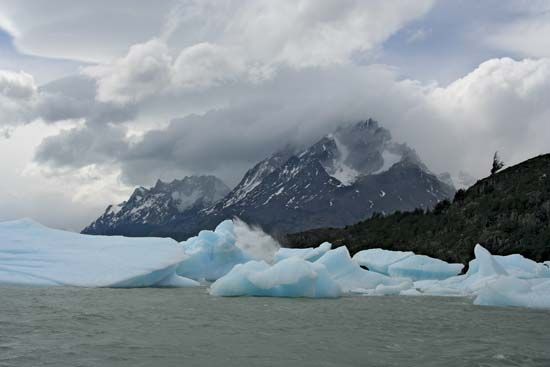
How do glaciers shape the landscape as they move?
Glaciers act as powerful agents of landscape transformation through two primary mechanisms: erosion and deposition.3
Glacial Erosion
Glaciers reshape the land by wearing down bedrock through two main processes:
- Abrasion: Acting like a massive sheet of sandpaper, glaciers use embedded rock debris to grind, scratch, and polish the underlying surface. This process creates various streamlined landforms and leaves behind “tool-marks” ranging from microscopic scratches to deep gouges.43
- Plucking (Quarrying): Glaciers remove large blocks of rock from their beds. This occurs when ice flows around obstacles, creating stress gradients that fracture the rock, or when meltwater refreezes in cracks, forcing the rock apart.43
These erosional forces drastically alter topography. For example, glaciers transform V-shaped river valleys into characteristic U-shaped valleys with steep, vertical sidewalls. They also carve out cirques (amphitheatre-shaped hollows), sharpen mountain ridges into arêtes, and create pointed horns.5
Glacial Deposition
As glaciers move, they transport debris and eventually deposit it as the ice melts.
- Till: Material deposited directly by ice, often forming moraines—chaotic ridges of debris—or drumlins, which are streamlined mounds that indicate the direction of ice flow.678
- Meltwater Deposits: Streams flowing from glaciers create glaciofluvial deposits like eskers (winding gravel ridges) and kames (mounds of sand and gravel). When ice blocks melt within these deposits, they leave behind steep-sided depressions known as kettles, which often become lakes.2
What are the main types of glacial landforms and how are they formed?
Glacial landforms are categorized into two primary types based on whether they are created by the erosive power of moving ice or the deposition of glacial debris.
Erosional Landforms
Glaciers reshape the landscape by grinding down bedrock through abrasion and plucking.
- Cirques: Amphitheatre-shaped hollows carved into mountainsides, often containing a lake known as a tarn.2
- U-shaped Valleys: Glaciers widen and deepen existing V-shaped river valleys into broad, parabolic profiles with steep sidewalls.2
- Arêtes and Horns: Sharp, knife-edge ridges (arêtes) form between parallel valleys, while radial erosion by multiple cirques creates pointed peaks called horns.2
Depositional Landforms
These form as glaciers melt and release their load of till or sediment-laden meltwater.
- Moraines: Ridges of till deposited at the glacier’s margins. These include terminal moraines (marking the furthest advance) and recessional moraines (formed during standstills).410
- Drumlins: Streamlined, oval-shaped hills of till that align with the direction of ice flow.45
- Glaciofluvial Deposits: Meltwater streams create features like eskers (winding gravel ridges), kames (isolated mounds), and kettles (depressions left by melting ice blocks).57
Can you explain the formation of U-shaped valleys and cirques?
Cirques and U-shaped valleys are iconic landforms created by the erosive power of glaciers. Their formation is driven by the glacier’s ability to act as a powerful abrasive system, using embedded rock debris to grind away the landscape.3
Cirques
A cirque is an amphitheatre-shaped hollow found at the head of a glacial valley. Its formation involves:114
- Frost Shattering: The process often begins at the bergschrund—a deep crevasse separating moving ice from the headwall. Diurnal temperature changes cause frost shattering and ice wedging, which break off rock and create steep, vertical cliffs.114
- Scouring: Debris falling into the crevasse is incorporated into the glacier. As the ice moves, this rock acts as an abrasive tool, scouring the floor of the hollow into a deep basin.114
- Tarns: If the glacier retreats, these basins often fill with water to form small lakes known as tarns.4
U-Shaped Valleys
Glaciers transform narrow, V-shaped stream valleys into broad U-shaped valleys through a process of widening and deepening:12
- Uniform Erosion: Unlike rivers, which erode a narrow line, glaciers occupy a large portion of the valley’s cross-section. They remove loose debris and preferentially erode the bedrock along the base and lower sidewalls.412
- Frictional Efficiency: The U-shape provides the least frictional resistance to the moving ice, allowing the glacier to straighten and smooth the valley as it flows.12
- Hanging Valleys: Because larger glaciers erode more deeply than smaller tributaries, the tributary valleys are often left high above the main valley floor, resulting in hanging valleys that may feature waterfalls.12
Sources
- drumlin — Encyclopædia Britannica
- glacial landform - Depositional landforms of continental glaciers — Encyclopædia Britannica
- glacial landform - Glacial erosion — Encyclopædia Britannica
- glacial landform - Cirques , tarns, U-shaped valleys, arêtes, and horns — Encyclopædia Britannica
- glacial landform - Moraines — Encyclopædia Britannica
- erosion — Encyclopædia Britannica
- glacial landform - Glaciofluvial deposits — Encyclopædia Britannica
- glacial landform - Meltwater deposits — Encyclopædia Britannica
- glacial landform - Glacial deposition — Encyclopædia Britannica
- Quaternary - Landforms — Encyclopædia Britannica
- cirque — Encyclopædia Britannica
- glacial valley — Encyclopædia Britannica
- U-valley — Merriam-Webster
- arête — Encyclopædia Britannica
Published on · 4 min read