Tha River
The Tha River is a waterway located in northwestern Laos and serves as one of the 12 principal tributaries of the Mekong River. Rising on the Chinese…
What is Tha River?
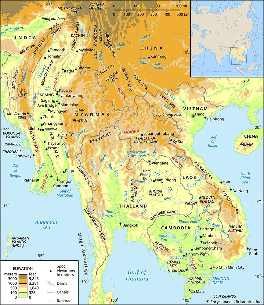
The Tha River is a waterway located in northwestern Laos and serves as one of the 12 principal tributaries of the Mekong River. Rising on the Chinese frontier, it flows southwestward through deep, narrow valleys for approximately 134 miles (215 km) before joining the Mekong southeast of Ban Houayxay.1
While the river is navigable only by small craft, it remains the primary stream of extreme northwestern Laos. The area surrounding the river is notable for its deposits of copper, alluvial gold, sapphire, and zircon. It is important to note that the Tha River is distinct from the major river systems of neighboring Thailand, such as the Chao Phraya.12
What is the significance of the Mekong River in Southeast Asia?
The Mekong River is of vital significance to Southeast Asia, serving as the longest river in the region and a critical artery for economic, agricultural, and social development across its lower basin, which includes Laos, Thailand, Cambodia, and Vietnam.3
Agricultural and Economic Importance
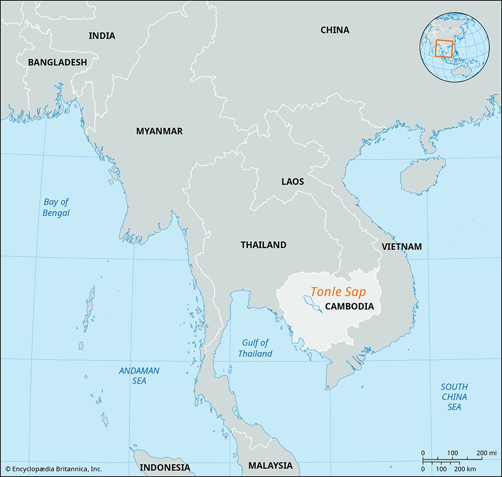
The river is essential for agricultural production, particularly for rice cultivation. Because the region experiences a long dry season, the Mekong’s waters are crucial for irrigation. Water management projects, coordinated by the Mekong Committee, have enabled farmers to move beyond single-crop cycles, allowing for second or third crops and reducing losses from seasonal flooding. Additionally, the river supports hydroelectric power generation and provides highly productive fishing grounds, most notably at the Tonle Sap.456
Navigation and Regional Connectivity
While navigation is limited in some areas by falls and rapids, such as the Khone Falls, the river remains a key transport route. It connects major urban centers, including the capitals Vientiane and Phnom Penh, and features an elaborate canal system in its delta that facilitates trade and movement.73
How do rivers contribute to the formation of alluvial gold and gemstone deposits?
Rivers play a fundamental role in the formation of alluvial placers, which are natural concentrations of heavy, durable minerals like gold, platinum, and various gemstones. This process is driven by the interaction between gravity and flowing water.9
The Concentration Process
When heavy minerals are released from their original rock matrix through weathering, they are washed downslope into streams. Because these minerals possess high specific gravity and are chemically resistant, they remain intact while the lighter matrix materials are winnowed away by the current.9
The Role of Flow Velocity
The concentration of these deposits depends heavily on the river’s flow rate. The ability of a stream to transport solid material is proportional to the square of its velocity. As a result:9
- High Velocity: The river carries both light and heavy particles.
- Decreased Velocity: When the flow rate slows—such as where a river enters a lake or overflows its banks—the river loses its capacity to carry heavy particles. Consequently, heavy minerals are deposited much more quickly than lighter ones, leading to their accumulation in stream gravels.910
What are the main geographical features of Laos?
Laos is characterized by a diverse and rugged landscape, dominated primarily by mountainous terrain and river systems.
Mountains and Plateaus
The country is largely covered by forest-clad mountains that often impede travel. The principal range is the Annamese Cordillera, which runs along a northwest-southeast axis and contains the nation’s highest peak, Mount Bia, rising to 9,245 feet (2,818 metres). Other notable features include:1617
- Xiangkhoang Plateau: Located in north-central Laos, this area features the Plain of Jars, known for its prehistoric stone jars and rolling grasslands.16
- Bolovens Plateau: Situated in the south at an elevation of about 3,600 feet (1,100 metres), this region is characterized by fertile soil and open woodland.16
- Karst Landscapes: The central provinces of Bolikhamxay and Khammouan contain distinctive limestone pinnacles and extensive cavern systems.16
Drainage and Lowlands
The general slope of the land in Laos descends from east to west. Most major rivers, including the Ou and Ngum rivers, are tributaries of the Mekong River, which forms much of the country’s western border. The only extensive lowlands in the country are found along the eastern bank of the Mekong, where most urban settlements are located.18167
Sources
- Tha River — Encyclopædia Britannica
- Thailand - Drainage of Thailand — Encyclopædia Britannica
- Mekong River — Encyclopædia Britannica
- Mekong River - Irrigation and flood control — Encyclopædia Britannica
- Mekong River - Navigation — Encyclopædia Britannica
- Mekong River - Climate and hydrology — Encyclopædia Britannica
- Mekong River - Physiography — Encyclopædia Britannica
- Mekong River - Study and exploration — Encyclopædia Britannica
- mineral deposit - Alluvial placers — Encyclopædia Britannica
- placer deposit — Encyclopædia Britannica
- river - Floodplain deposits, origins, and features — Encyclopædia Britannica
- mineral deposit - Formation of mineral deposits — Encyclopædia Britannica
- alluvium — Encyclopædia Britannica
- sedimentation — Encyclopædia Britannica
- alluvial deposit — Encyclopædia Britannica
- Laos - Relief — Encyclopædia Britannica
- Laos - Climate — Encyclopædia Britannica
- Laos - Drainage — Encyclopædia Britannica
- Laos - Settlement patterns — Encyclopædia Britannica
- Mount Bia — Encyclopædia Britannica
Published on · 3 min read