Turfan Depression
The Turfan Depression served as a vital geographical anchor for the ancient Silk Road. Its higher northern region provided long-established natural corridors…
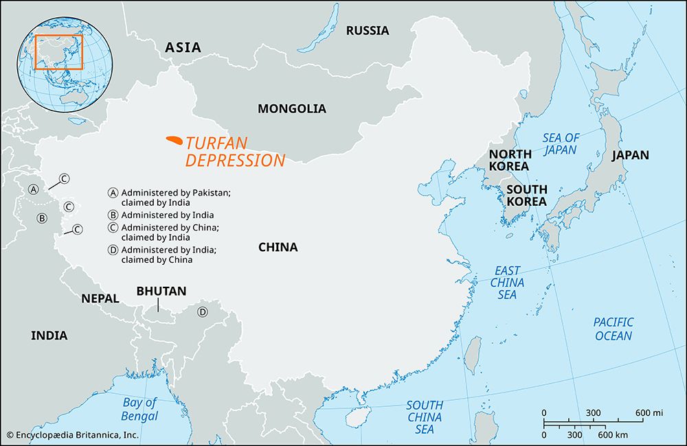
How does the Turfan Depression relate to the ancient Silk Road trade routes?
The Turfan Depression served as a vital geographical anchor for the ancient Silk Road. Its higher northern region provided long-established natural corridors that connected travelers to the Hexi (Gansu) Corridor in the southeast.1
The city of Turfan, located on the northern edge of the basin, functioned as a critical trade hub and a fertile oasis for merchants traversing the main northern branch of the Silk Road between Hami and Kashgar. This location allowed the region to act as a bridge between nomadic northern cultures and the settled oasis societies of Xinjiang.2
Throughout history, the area’s commercial importance fluctuated with the rise and fall of various dynasties, notably experiencing significant prosperity during the period of Mongol rule when Central Asian land routes flourished. Today, the region remains a site of historical significance, featuring ancient ruins like Jiaohe that reflect its past as a crossroads of civilization.2
What are the unique climatic conditions found in the Turfan Depression?
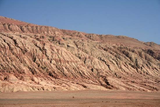
The Turfan Depression is characterized by extreme climatic conditions, defined primarily by its status as a deep, arid fault trough that descends to 508 feet (155 meters) below sea level. The region experiences significant temperature volatility, with average monthly temperatures ranging from 14 °F (−10 °C) in January to 90 °F (32 °C) in July. These averages are often surpassed by enormous daily fluctuations, and the area has recorded some of the highest temperatures in China, reaching up to 118 °F (48 °C).1
Precipitation in the basin is exceptionally sparse, totaling only 0.6 to 1.2 inches (16 to 30 mm) per year. These harsh conditions, compounded by frequent windblown sands, present persistent challenges for the local inhabitants. Despite this arid climate, the region supports intensive agriculture through sophisticated irrigation, utilizing surface water in the north and a traditional Persian technique of tunnels to tap groundwater in the south. This allows for the cultivation of various crops, including grapes, melons, and cotton.1
How has the Turfan Depression influenced local agriculture and water management?
The Turfan Depression has profoundly shaped local agriculture through its unique geography and climate, necessitating highly specialized water management systems to sustain life in an arid environment. Despite receiving only 0.6 to 1.2 inches of annual precipitation, the basin is intensively farmed, supporting a variety of crops including grapes, Hami melons, watermelons, wheat, and cotton.1
Water management is divided by the region’s topography:
- Northern Section: Agriculture relies primarily on the use of surface water, which is more readily available at the foot of the Bogda Mountains.1
- Southern Section: Inhabitants utilize a traditional Persian technique involving a network of tunnels designed to tap and transport groundwater from higher elevations to the arid basin floor.1
These irrigation strategies have allowed the region to function as a fertile oasis for centuries, supporting both local populations and the historical demands of the Silk Road.12
What historical and archaeological significance does the Turfan Depression hold?
The Turfan Depression holds immense historical and archaeological significance, primarily due to its strategic location as a vital hub on the northern branch of the Silk Road. For centuries, this fertile oasis served as a crucial gateway connecting the East and West, facilitating the exchange of goods, religions, and cultural ideas between China and civilizations as far as the Mediterranean.24
Archaeologically, the region is home to significant sites that reflect its complex past as a borderland between nomadic and settled peoples:
- Jiaohe: A major archaeological site representing one of the cities of the ancient Gaochang kingdom, offering insight into the region’s political and social history.2
- Bezeklik Thousand Buddha Caves: These caves serve as a testament to the historical influence of Buddhism and other traditions that flourished along the trade routes.24
Throughout history, the area transitioned through various powers, including the Han dynasty, the state of Gaochang, the Tang dynasty, and the Mongols, each leaving distinct cultural imprints. Today, the national government has designated the area a historical and cultural city to preserve its rich heritage.2
Sources
- Turfan Depression — Encyclopædia Britannica
- Turfan — Encyclopædia Britannica
- Tarim Basin — Encyclopædia Britannica
- history of Central Asia: Top Questions — Encyclopædia Britannica
Published on · 3 min read