Tarim Basin
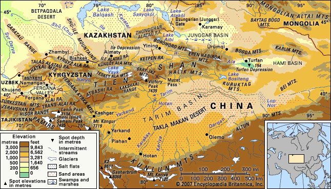
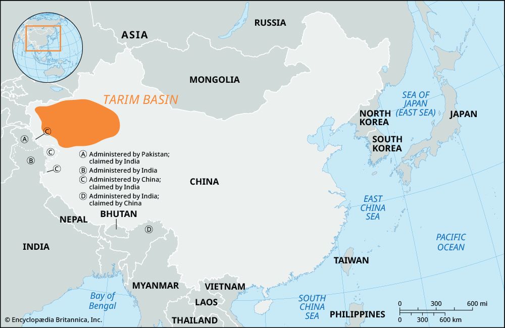
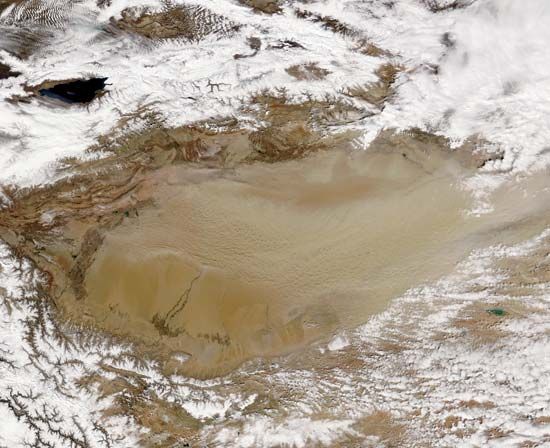
The Tarim Basin is characterized by an extremely arid climate, as surrounding mountain ranges block moist sea air, resulting in annual rainfall of less than…
How has the climate of the Tarim Basin influenced human settlement and agriculture in the region?
The Tarim Basin is characterized by an extremely arid climate, as surrounding mountain ranges block moist sea air, resulting in annual rainfall of less than 4 inches (100 mm) in most areas. This harsh environment has fundamentally dictated human settlement and agricultural patterns, which are largely concentrated near water sources.12
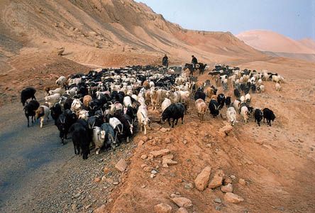
Historically, human activity has relied on oasis agriculture in scattered Uygur settlements. Because the region is the driest in Eurasia, agriculture is dependent on the Tarim River and its tributaries, which are fed by snowmelt from the Tien Shan and Kunlun Mountains.21
In the mid-20th century, the Chinese government promoted large-scale irrigation projects to support agricultural expansion, including the cultivation of cotton, rice, grains, and fruits. However, these water management efforts—such as dams and reservoirs—have also led to significant environmental changes, including the drying of the river’s lower course and the desiccation of Lop Nur.2
What unique plant and animal species can be found in the Tarim Basin?
The extreme aridity of the Tarim Basin limits plant and animal life primarily to river valleys, deltas, and the desert’s periphery where groundwater is accessible.23
Flora
Vegetation is sparse, with the most diverse plant life found along the Tarim River and its tributaries. Key species include:
- Trees and Shrubs: Diversiform-leaved poplar (including the Turanga variety), tamarisk, oleaster, and nitre bushes.23
- Ground Cover: Dense growths of Indian hemp, Ural licorice, sea buckthorn, reeds, camel thorn, saltworts, and wormwood.23
Fauna
Animal life is similarly concentrated in areas with water and vegetation. Notable species include:
- Mammals: Herds of gazelles, wild boars, wolves, foxes, and the rare Siberian deer. Small mammals such as rabbits, gerbils, jerboas, mice, bats, and the long-eared hedgehog are also present. The wild camel is a rare inhabitant of the eastern desert.3
- Birds: The region serves as a stopover for migratory birds, with the Tarim jay and small, tufted larks being common.23
How has the Tarim Basin’s population changed over the centuries, and what ethnic groups inhabit the region today?
The population of the Tarim Basin has undergone significant shifts over the centuries, transitioning from a region defined by indigenous oasis-dwelling agriculturalists and pastoralists to one experiencing substantial demographic changes following the consolidation of Chinese control in 1949.4
Historical and Demographic Shifts
For centuries, the region’s population was primarily composed of indigenous groups, such as the Uyghurs, who practiced oasis agriculture along the foothills of the surrounding mountains. In 1953, approximately three-fourths of the total population of Xinjiang resided south of the mountains in the Tarim Basin.45
Since the mid-20th century, the region has seen a major influx of Han Chinese migrants, driven by government policies aimed at integrating the regional economy. While this migration was initially directed toward the resource-rich Junggar Basin, the Han population has become increasingly ubiquitous across urban settlements in the region.465
Ethnic Composition Today
The Tarim Basin and the broader Xinjiang region are home to more than 40 ethnic groups. The primary groups include:5
- Uyghurs: The largest indigenous group, traditionally centered in oasis settlements.54
- Han Chinese: A large and growing segment of the population, particularly in urban centers.54
- Other Groups: The region also hosts Hui (Chinese Muslims), Mongolians, Kazakhs, Uzbeks, Tajiks, Tatars, Manchu, and others.5
While the government maintains a policy of allowing ethnic groups to preserve their cultural identities, the region has experienced ethnic tensions, particularly between the Uyghur and Han populations.4
How does the Tarim Basin contribute to China’s economy, particularly in terms of natural resources?
The Tarim Basin is a vital contributor to China’s economy, primarily serving as a significant source of energy and agricultural products.
Energy Resources
The basin is of national significance for its petroleum and natural gas reserves. Since the late 1980s, the exploitation of these hydrocarbons has expanded substantially, with major fields developed throughout the region. To support national demand, China constructed west-east pipelines to transport natural gas from the basin to industrial centers on the east coast. Additionally, the region contains high-quality light oil, further bolstering its role in China’s energy sector.21
Agriculture and Industry
Beyond energy, the basin supports irrigation-based agriculture, which produces high-quality cotton and cotton cloth for export, alongside grains, silk, wool, and various fruits like watermelons and grapes. Industrial activity is concentrated in urban centers such as Korla and Zepu, where petrochemical plants and facilities for processing agricultural and animal products—including textile mills—have been established to leverage local raw materials.82
Sources
- Tarim Basin — Encyclopædia Britannica
- Tarim River — Encyclopædia Britannica
- Takla Makan Desert - Plant and animal life — Encyclopædia Britannica
- Tien Shan - People — Encyclopædia Britannica
- Xinjiang - Population composition — Encyclopædia Britannica
- Xinjiang — Encyclopædia Britannica
- Xinjiang - Settlement patterns — Encyclopædia Britannica
- Xinjiang - Resources and manufacturing — Encyclopædia Britannica
- China - Minerals of China — Encyclopædia Britannica
- China - Resources and power — Encyclopædia Britannica
- Tien Shan - Resource development — Encyclopædia Britannica
Published on · 4 min read