Wadden Sea
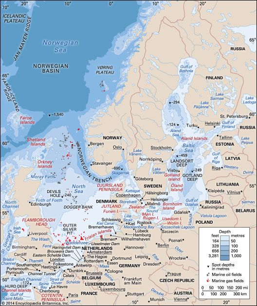
The Wadden Sea is a shallow, saltwater tidal delta located between the West Frisian Islands and the northern mainland of the Netherlands. It extends from…
What is the Wadden Sea and where is it located?
The Wadden Sea is a shallow, saltwater tidal delta located between the West Frisian Islands and the northern mainland of the Netherlands. It extends from Noord-Holland to the northeast, where the islands curve toward the coast.1
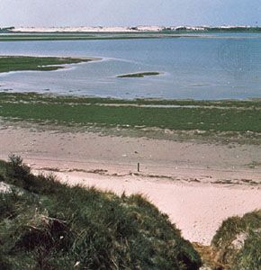
Physically, the area consists of sand flats that are largely uncovered at low tide, intersected by deep channels that connect to the North Sea. The term “wadden” (or Watten in German) refers to the narrow belt of shallow waters and tidal mud flats that separate the Frisian Islands from the mainland.12
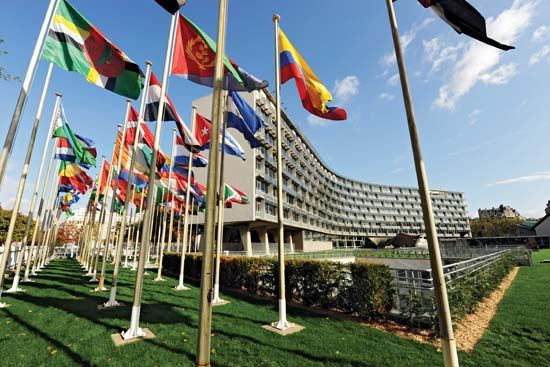
In 2009, UNESCO designated the broader Wadden Sea tidal flat region—which encompasses the Wadden Sea area as well as two national parks in Germany—as a World Heritage site. The region serves as an important refuge for waterfowl and supports local fishing activities.1
How was the Wadden Sea formed, and what are its unique geological features?
The Wadden Sea is a dynamic, shallow saltwater tidal delta that formed through complex interactions between rising sea levels, glacial activity, and human engineering. Its geological history is deeply tied to the evolution of the North Sea basin, which was significantly reshaped during the Pleistocene Epoch as ice sheets advanced and retreated, depositing layers of clay and sediment.1435
Geological Formation and Features
The region’s unique landscape is defined by several key features:
- Tidal Flats and Channels: The area is characterized by extensive sand flats that are largely exposed at low tide, intersected by deep channels that connect to the North Sea. These tidal flats are shaped by electrochemical interactions where fine particles, or muds, are deposited by incoming tides and become resistant to erosion during the ebb.16
- Sediment Dynamics: There is a distinct size gradient in the sediment, moving from nearshore muds to coarser lag sands toward the sea. This process is influenced by the flocculation of riverborne clay minerals in saline waters.6
- Barrier Systems: The Wadden Sea is protected by the West Frisian Islands, which act as a barrier system. These islands, formed primarily by waves and longshore currents, separate the shallow lagoons from the open marine environment.17
- Human Influence: The modern geography was significantly altered by the construction of the Afsluitdijk in the early 20th century, which separated the former Zuiderzee into the open Wadden Sea and the freshwater IJsselmeer.14
How does the Wadden Sea contribute to the Netherlands’ economy and culture?
The Wadden Sea plays a significant role in the economy and culture of the Netherlands, primarily through its natural resources and its status as a protected environmental landmark.
Economic Contributions
- Fishing: The Wadden Sea supports local fishing industries, which have historically been a vital part of the regional economy.1
- Infrastructure and Engineering: The region is central to the history of Dutch water management. The construction of the Afsluitdijk in the early 20th century transformed the area, separating the open Wadden Sea from the freshwater IJsselmeer. This massive engineering project allowed for the creation of fertile polders, which expanded the nation’s land area and provided new space for agriculture and development.86
- Ports: The area hosts important maritime hubs, such as the ports of Den Helder and Harlingen, which facilitate regional commerce.1
Cultural Significance
- Conservation and Heritage: In 2009, UNESCO designated the Wadden Sea as a World Heritage site, recognizing its importance as a refuge for waterfowl and its unique tidal ecosystem.1
- Historical Resilience: The region is deeply tied to the cultural identity of the Frisians, a seafaring people who have inhabited these low-lying areas since approximately 400 CE. Their historical efforts to build terpen—mounds for protection against rising tides—represent some of the most significant early engineering works in human history.8
What recreational activities are popular in the Wadden Sea area?
The Wadden Sea area offers a variety of recreational activities centered on its unique tidal landscape and status as a protected World Heritage site. While the region is primarily recognized as a vital refuge for waterfowl, visitors often engage in the following:
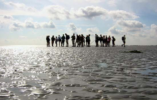
- Mudflat Hiking: Known locally as wadlopen, this activity involves walking across the extensive sand flats that are exposed during low tide. It is a popular way to experience the unique geology of the tidal delta firsthand.
- Birdwatching: Due to its designation as a critical habitat, the area is a premier destination for observing diverse species of migratory birds that rely on the Wadden Sea for food and shelter.
- Maritime Exploration: The deep channels and proximity to the West Frisian Islands make the region ideal for sailing and boating. Travelers often use ports like Harlingen as starting points to explore the islands and the surrounding North Sea waters.
Sources
- Wadden Sea — Encyclopædia Britannica
- Frisian Islands — Encyclopædia Britannica
- North Sea - Physiography — Encyclopædia Britannica
- North Sea - Geology — Encyclopædia Britannica
- sedimentary rock - Origin of shales — Encyclopædia Britannica
- Zuiderzee — Encyclopædia Britannica
- coastal landforms - Barrier island/estuarine systems — Encyclopædia Britannica
- East Friesland — Encyclopædia Britannica
- Netherlands - Drainage and dikes — Encyclopædia Britannica
- IJsselmeer — Encyclopædia Britannica
Published on · 4 min read