Zuiderzee
Many former Zuiderzee ports in the Netherlands have undergone significant economic and structural transformations following the construction of the…
What are some of the towns and cities that were once Zuiderzee ports, and how have they adapted?
Many former Zuiderzee ports in the Netherlands have undergone significant economic and structural transformations following the construction of the Afsluitdijk in 1932, which converted the saltwater inlet into the freshwater IJsselmeer.
- Enkhuizen: Once a major hub for herring fishing, the town shifted its focus after the sea was sealed off. Today, it maintains a connection to its maritime heritage through eel fishing and distribution, while diversifying its economy into manufacturing (electrical goods, chemicals, and foodstuffs) and agriculture.1
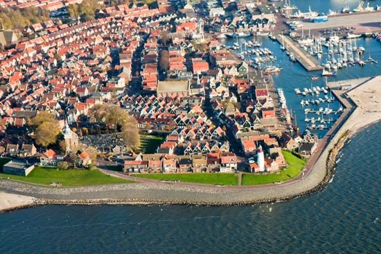
- Volendam and Marken: Both locations experienced a decline in their traditional fishing industries. They have successfully adapted by leveraging their historical character to become prominent tourist destinations. Visitors are drawn to their traditional architecture, such as dwellings on piles, and the preservation of regional cultural customs.23
- New Developments: Beyond the adaptation of historic ports, the Zuiderzee project facilitated the creation of entirely new land and cities. Lelystad, for example, was developed on reclaimed polder land to serve residential, industrial, and recreational needs.4
How has the closure of the Zuiderzee affected the environment and local communities?
The closure of the Zuiderzee via the Afsluitdijk in 1932 fundamentally transformed both the regional environment and the livelihoods of local communities.
Environmental Impact
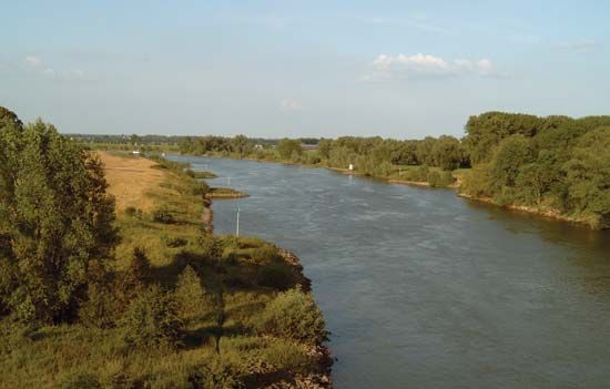
The most significant change was the transition of the Zuiderzee from a saltwater inlet of the North Sea into the freshwater IJsselmeer. This was achieved by sealing the area off from tidal flows and allowing the inflow of the IJssel River to flush out the salt. This conversion provided a vital source of fresh water for surrounding provinces, helping to mitigate summer droughts and improve brackish marshlands. Additionally, the project enabled the reclamation of 626 square miles of fertile polder land, which was converted into agricultural territory.16
Impact on Communities
For local communities, the closure necessitated a complete economic shift. The traditional saltwater fishing industry—which targeted herring, anchovies, and flounder—was effectively ended. In its place, a freshwater fishery emerged, focused primarily on eels that enter the lake through locks. Many former port towns were forced to diversify their economies, moving toward agriculture, manufacturing, or tourism to survive the loss of their maritime trade.16
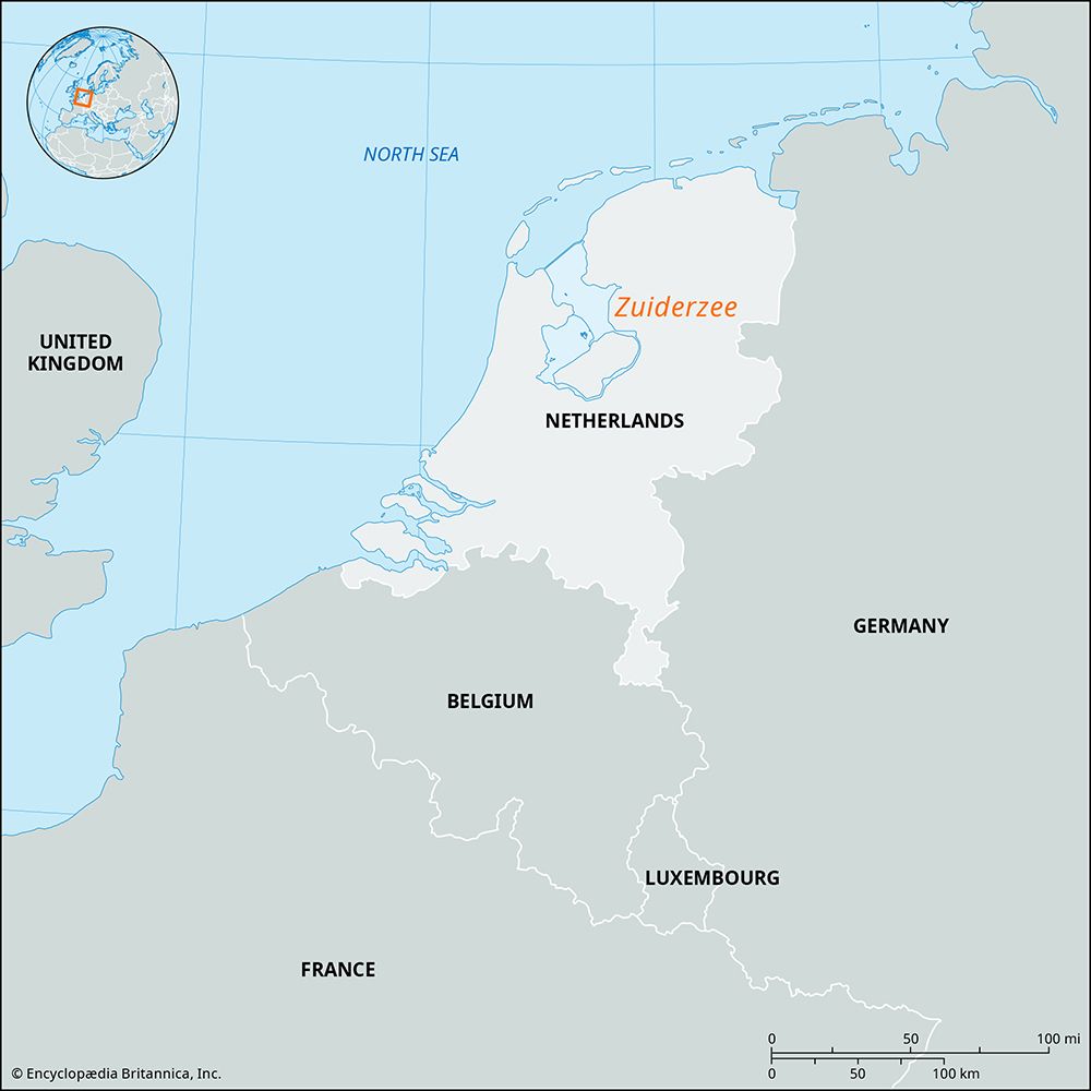
What was the Zuiderzee and where was it located in the Netherlands?
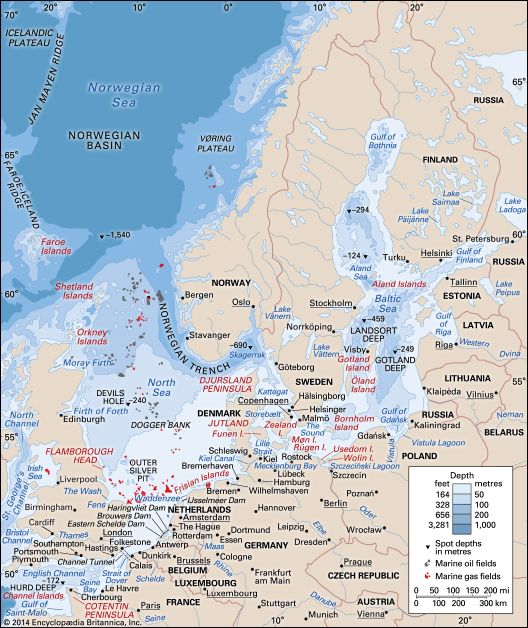
The Zuiderzee was a former inlet of the North Sea located in the northern part of the Netherlands. From the 13th to the 20th century, it occupied approximately 2,000 square miles (5,000 square km) and was separated from the North Sea by an arc of sandflats known as the West Frisian Islands.19
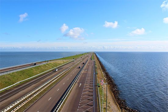
The area originated from a collection of lowland lakes that expanded due to rising sea levels and major flooding events in the 13th century, which created the Zuiderzee proper. In 1932, the construction of the 19-mile-long Afsluitdijk dam fundamentally altered the region by separating the inlet into two distinct bodies of water: the Waddenzee, which remains open to the North Sea, and the IJsselmeer, a freshwater lake. This project also enabled the reclamation of significant polder land, transforming much of the former sea into agricultural territory.19
How did the Zuiderzee form, and what was its historical significance?
The Zuiderzee was a former inlet of the North Sea that played a central role in the history and geography of the Netherlands.
Formation
Originally, the region consisted of a mixture of lowland and freshwater lakes, including the Roman-era Flevo Lacus, which drained into the Rhine River. During a period of rising sea levels between 250 and 600 CE, these lakes expanded. The Zuiderzee proper was formed in the 13th century, particularly following catastrophic storm surges in 1219 and 1282 that collapsed coastal land barriers and submerged vast areas of the interior.18
Historical Significance
The Zuiderzee was historically significant for several reasons:
- Economic Development: The creation of the inlet provided direct sea access for inland settlements, most notably allowing Amsterdam to develop into a major port city.8
- Engineering and Reclamation: For centuries, residents battled the sea by building dikes and terpen (mounds). This struggle led to the development of polder technology, eventually culminating in the Zuiderzee project.
- Transformation: The 1932 completion of the Afsluitdijk dam permanently altered the landscape, turning the saltwater inlet into the freshwater IJsselmeer and enabling the reclamation of over 600 square miles of land.15
Sources
- Zuiderzee — Encyclopædia Britannica
- Enkhuizen — Encyclopædia Britannica
- Marken — Encyclopædia Britannica
- Volendam — Encyclopædia Britannica
- Netherlands - Drainage and dikes — Encyclopædia Britannica
- IJsselmeer — Encyclopædia Britannica
- North Sea - Reclamation and flood-control projects — Encyclopædia Britannica
- Zuiderzee floods — Encyclopædia Britannica
- Zuider Zee — Merriam-Webster
- history of the Low Countries - Growth of Flanders — Encyclopædia Britannica
Published on · 3 min read