Wind River
The Wind River is a river located in west-central Wyoming, U.S. It originates from several branches at the northern edge of the Wind River Range within the…
What is Wind River?
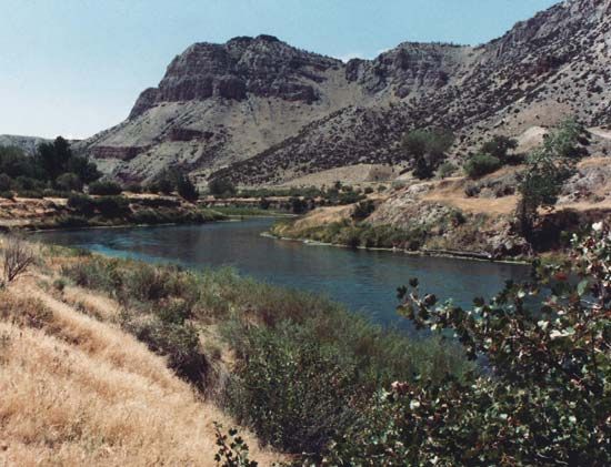
The Wind River is a river located in west-central Wyoming, U.S. It originates from several branches at the northern edge of the Wind River Range within the Shoshone National Forest.1
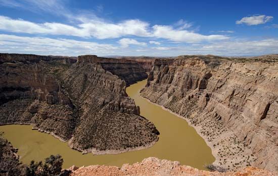
The river flows southeast for approximately 110 miles, passing through the Wind River Indian Reservation—home to the Shoshone and Arapaho peoples—before reaching Rivertonrapaho) peoples—before reaching Riverton. After joining the Popo Agie River, the stream continues through the Boysen Reservoir and the Wind River Canyon toward Thermopolis, eventually forming the Bighorn River. The river derives its name from the strong, prevailing northwesterly winds that characterize the valley between the Shoshone and Wind River mountain ranges.1
What is the significance of the Continental Divide?
The Continental Divide is a significant geographical feature, defined as a continuous ridge of mountain summits that serves as the primary watershed for a continent. In North America, it acts as the boundary that separates the continent’s drainage systems: water on one side flows eastward toward the Hudson Bay or the Mississippi and Rio Grande rivers, while water on the other side flows westward into the Pacific Ocean.3
This divide primarily follows the crest of the Rocky Mountains, stretching from British Columbia through the western United States—including Montana, Wyoming, Colorado, and New Mexico—and continuing southward into Mexico and Central America. Occasionally referred to as the Great Divide, it represents the line of highest points of land that dictates the direction of water flow across the continent.34
Who are the Shoshone and Arapaho people?
The Shoshone and Arapaho are distinct North American Indigenous peoples who share a historical connection to the Wind River region of Wyoming.561
The Shoshone
The Shoshone people historically occupied a vast territory spanning from southeastern California across the Great Basin into Idaho and Wyoming. They were organized into four primary groups:6
- Western Shoshone: Traditionally nomadic, they subsisted on wild plants, small mammals, and fish.6
- Northern and Wind River Shoshone: These groups acquired horses by the late 17th century, becoming skilled buffalo hunters and warriors who adopted many Plains Indian cultural traits.6
- Comanche: A branch that split from the Wind River Shoshone and migrated south into Texas.6
The Arapaho
The Arapaho are an Algonquian-speaking people who originally lived in the Eastern Woodlands before migrating westward to the Great Plains. As they moved, they transitioned from an agricultural lifestyle to become nomadic equestrians who relied heavily on buffalo hunting. They were traditionally a highly religious people, known for their veneration of a sacred flat pipe and their participation in the Sun Dance.5
Shared History and Reservation
Historically, the Arapaho and Shoshone were often at war with one another. However, following the 19th-century conflicts and the establishment of reservation systems, the Northern Arapaho were assigned to the Wind River Indian Reservation in Wyoming alongside the Shoshone. Today, both groups maintain a presence in this region.512
What was the historical importance of the Oregon Trail?
The Oregon Trail was a vital 2,000-mile route that served as a primary artery for 19th-century westward expansion in the United States. Stretching from Independence, Missouri, to Oregon City, Oregon, the trail facilitated the migration of an estimated 300,000 to 500,000 people between the mid-1840s and late 1860s.78
Its historical importance is defined by several key factors:
- National Expansion: The trail was central to the concept of Manifest Destiny, the belief that American expansion across the continent was preordained. It provided a path for farmers seeking fertile land in the Willamette Valley, prospectors chasing gold, and those fleeing economic hardship or the American Civil War.8
- Unification and Settlement: By opening the American West to large-scale migration, the pioneers who traversed the trail played a crucial role in molding and unifying the country.8
- Geopolitical Impact: Early missionary efforts, such as those by Marcus Whitman, and the subsequent “great migration” of 1843 helped solidify American claims to the Oregon country, eventually leading to the establishment of the Oregon Territory in 1848.9
Sources
- Wind River — Encyclopædia Britannica
- Wind River Range — Encyclopædia Britannica
- Continental Divide — Encyclopædia Britannica
- Continental Divide — Merriam-Webster
- Arapaho — Encyclopædia Britannica
- Shoshone — Encyclopædia Britannica
- How long was the Oregon Trail? — Encyclopædia Britannica
- Oregon Trail - Hazards of the journey — Encyclopædia Britannica
- Oregon Trail - The journey — Encyclopædia Britannica
- Oregon Trail - Missionaries, Mormons, and others — Encyclopædia Britannica
Published on · 3 min read