Rocky Mountains
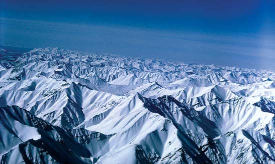
The Rocky Mountains serve as the cordilleran backbone of the great upland system dominating western North America. This vast mountain system stretches…
What is the geographical extent of the Rocky Mountains in North America?
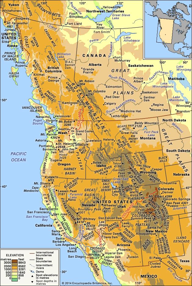
The Rocky Mountains serve as the cordilleran backbone of the great upland system dominating western North America. This vast mountain system stretches approximately 3,000 miles (4,800 km) from northern Alberta and British Columbia in Canada southward to New Mexico in the United States southward to New Mexico in the United States.1
The system varies significantly in width, reaching 300 miles or more in certain areas. Its geographical limits are often considered arbitrary, particularly in the northwest, where some definitions include mountain systems such as the Brooks Range in Alaska. The Rockies are bounded by the Great Plains to the east, while their western borders are defined by the Interior Plateau, the Coast Mountains, the Columbia Plateau, and the Basin and Range Province.1
How were the Rocky Mountains formed, and what geological processes shaped them?
The formation of the Rocky Mountains was a complex, multi-stage process primarily driven by the Laramide orogeny, a series of mountain-building events occurring from the Late Cretaceous to the Paleogene period (roughly 70 to 40 million years ago).32
Tectonic Processes
The Rockies were shaped by significant crustal deformation:
- Compression and Thrusting: In the Canadian and Northern Rockies, the process involved the eastward thrusting of thick Paleozoic limestone sheets over Mesozoic rocks. This occurred as the North American basement was underthrust westward beneath the continental margin.24
- Block Faulting: In the United States, the Laramide orogeny caused the uplift of large blocks of Precambrian crystalline rock, forming the cores of ranges like the Wind River Range and the Front Range.45
- Volcanism: Magmatic activity accompanied these tectonic shifts, resulting in volcanic deposits in regions such as the San Juan Mountains.25
Sculpting the Landscape
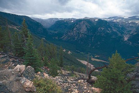
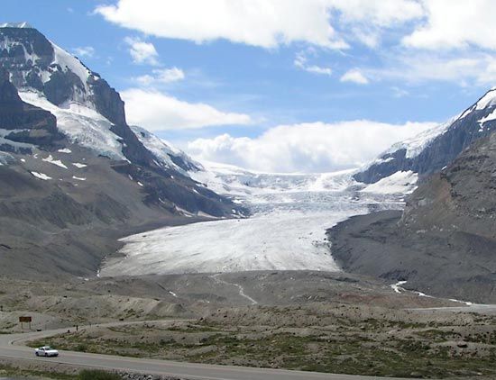
Following their initial uplift, the mountains were extensively modified by erosion and glaciation. Glacial activity during the Quaternary period carved deep alpine valleys and sharpened peaks, while river systems—superimposed during the last 10 million years—cut deep, transverse canyons through the rising ranges.26
What are some popular recreational activities in the Rocky Mountains?
The Rocky Mountains offer a vast array of recreational opportunities, largely centered within the region’s numerous national parks, national forests, and wilderness areas.7
Summer Activities
During the warmer months, the rugged terrain and scenic landscapes attract many visitors for:
- Hiking and Backpacking: With hundreds of miles of trails, such as those in Rocky Mountain National Park, hiking is a primary way to explore the backcountry.89
- Climbing: The region is a haven for rock climbers, ranging from casual enthusiasts to those attempting to scale challenging peaks like Longs Peak.9
- Fishing: The area is renowned for its high-quality trout fisheries.7
- Other Pursuits: Visitors also enjoy horseback riding, camping, and scenic driving along high-altitude routes like Trail Ridge Road.89
Winter Activities
As snow blankets the mountains, the region transforms into a hub for winter sports:
- Skiing: Both downhill and cross-country skiing are popular recreational staples.87
- Snowshoeing and Snowmobiling: Many high mountain roads and trails that are inaccessible to automobiles during the winter are utilized by snowshoeing and snowmobile enthusiasts.87
How do the Rocky Mountains affect water resources and river systems in North America?
The Rocky Mountains serve as a critical hydrological engine for North America, primarily by acting as the Continental Divide. This ridge of summits separates the continent’s drainage, directing water eastward toward the Mississippi and Rio Grande rivers or westward into the Pacific Ocean.1112
Water Supply and Management
The Rockies are a region of water surplus where precipitation exceeds evaporation and runoff, making them a vital source of water for the surrounding arid and semiarid lands. Fed by perpetual snowpacks and ice, major rivers such as the Colorado, Columbia, Fraser, and Yukon originate in these mountains. These systems are essential for:1312
- Human Consumption and Industry: Water is diverted through complex networks of reservoirs, tunnels, and pipelines to support large urban centers, such as the scheme diverting water from the Front Range to Denver.13
- Agriculture and Power: The mountains provide water for irrigation and the generation of hydroelectric power.13
Environmental Impact
While the Rockies are a source of life, human activities have altered these systems. Mining has introduced harmful metals into groundwater and streams, while logging and reservoir operations have caused erosion, siltation, and the disruption of natural flow patterns and fisheries.14
Sources
- Rocky Mountains — Encyclopædia Britannica
- Rocky Mountains - Physiography — Encyclopædia Britannica
- Laramide orogeny — Encyclopædia Britannica
- mountain - The North American Cordillera — Encyclopædia Britannica
- Quaternary - Landforms — Encyclopædia Britannica
- Western Cordillera — Encyclopædia Britannica
- Rocky Mountain National Park — Encyclopædia Britannica
- 7 Wonders of America — Encyclopædia Britannica
- Exploring 7 of Earth’s Great Mountain Ranges - Rocky Mountains — Encyclopædia Britannica
- Rocky Mountains - National parks , forests, and recreational areas — Encyclopædia Britannica
- Continental Divide — Encyclopædia Britannica
- North America - Drainage — Encyclopædia Britannica
- Rocky Mountains - Water resources — Encyclopædia Britannica
- Rocky Mountains - Environmental concerns — Encyclopædia Britannica
- Rocky Mountains - Climate — Encyclopædia Britannica
- Colorado River — Encyclopædia Britannica
Published on · 4 min read