Wular Lake
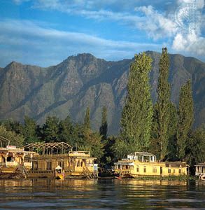
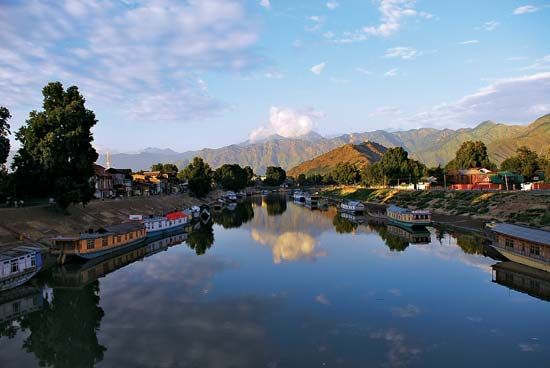
Wular Lake is the largest natural freshwater lake in India, located in the northern part of the Jammu and Kashmir union territory. Unlike many Himalayan…
What is Wular Lake?
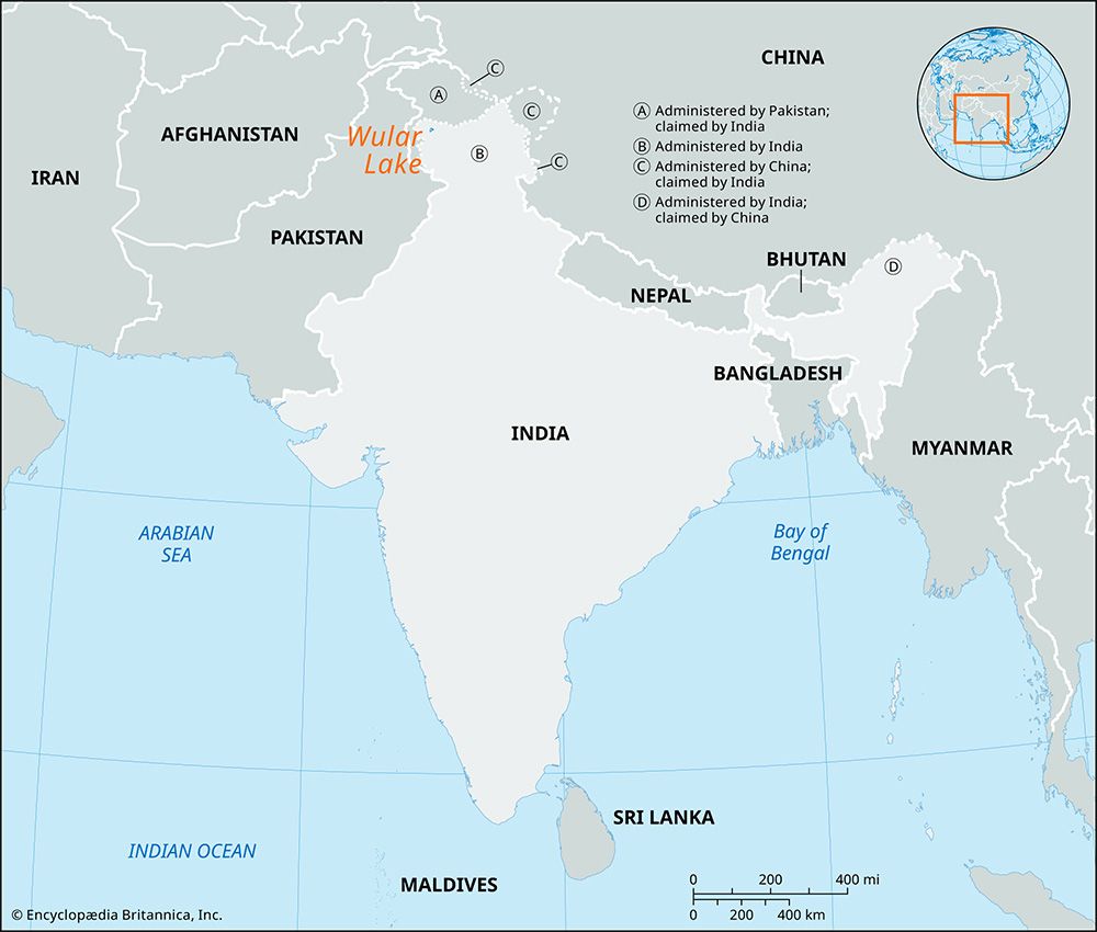
Wular Lake is the largest natural freshwater lake in India, located in the northern part of the Jammu and Kashmir union territory. Unlike many Himalayan lakes formed by glacial activity, Wular Lake was created by a tectonic depression.12
Situated at the north end of the Vale of Kashmir, approximately 20 miles (32 km) north-northwest of Srinagar, the lake measures about 10 miles (16 km) long and 6 miles (10 km) wide. Its surface area is dynamic, fluctuating between 12 and 100 square miles (30 to 260 square km) depending on the season.1
The lake plays a vital role in regional hydrology by controlling the flow of the Jhelum River, which passes through it. The town of Sopur is located on its southwestern shore, and an island in the northeast features ruins dating back to the 15th century.13
What is a tectonic depression?
A tectonic depression is a topographic low—such as a valley, basin, or trough—formed by the movement of the Earth’s crust through tectonic processes. These features are primarily created by the uplift or subsidence of crustal blocks, layers, or slices of the planet’s surface.45
There are two main ways these depressions develop:
- Crustal Extension: When the Earth’s brittle crust is pulled apart, it fractures. As large crustal blocks diverge, a smaller block may slide down into the resulting gap, creating a graben (a German term for “ditch” or “trough”) or a rift valley.45
- Crustal Compression: Horizontal forces can cause the crust to shorten and thicken. This can result in “ramp valleys,” where the margins of a valley are pushed over its floor, or “foreland basins,” which form through the gentle downward bending or flexing of the entire lithosphere.4
Additionally, tectonic depressions can result from the cooling and thermal contraction of the Earth’s outer layers or from subsidence triggered by earthquake activity.65
How do seasonal changes affect the size of Wular Lake?
The size of Wular Lake is highly dynamic, with its surface area fluctuating significantly between 12 and 100 square miles (30 to 260 square km) depending on the season.1
This variation is primarily driven by the hydrology of the Jhelum River, which traverses the lake and is its primary water source. The river’s discharge levels are heavily influenced by two main factors:12
- Spring Snowmelt: The melting of snow from the Himalaya and Karakoram ranges significantly increases water volume during the spring.2
- Southwest Monsoon: Heavy rainfall brought by the monsoon from June to September further swells the river, leading to higher water levels in the lake.2
Conversely, because little rain falls during the winter, the river level—and consequently the lake’s surface area—is substantially lower during those months.2
What are some other major freshwater lakes in India?
India has relatively few natural lakes, and many of its largest water bodies are actually artificial reservoirs created by damming rivers for water storage and distribution.39
While Wular Lake stands out as the largest natural freshwater lake in the country, other significant water bodies in India include:
- Reservoirs: These artificial lakes serve as critical infrastructure and biodiversity hubs. Notable examples include the Hirakud Reservoir in Odisha, Gobind Sagar in Himachal Pradesh, Nagarjuna Sagar in Telangana, and Periyar Lake in Kerala.9
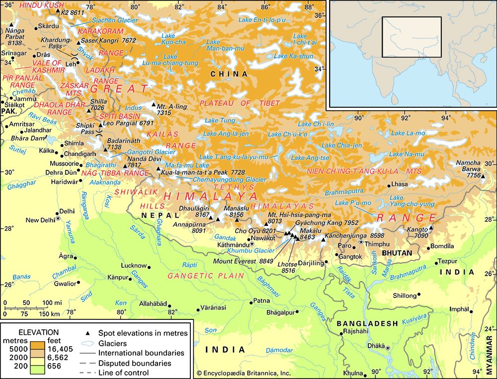
- Himalayan Lakes: Many natural lakes in the Himalayan region were formed by glacial activity, where glaciers either excavated basins or dammed areas with rock and earth debris.3
It is important to note that while India contains these freshwater bodies, much of the country’s inland drainage is ephemeral, particularly in the arid regions of Rajasthan, where salt lakes like Sambhar Salt Lake are prominent Lake](https://www.britannica.com/place/Sambhar-Salt-Lake) are prominent.3
Sources
- Wular Lake — Encyclopædia Britannica
- Jhelum River — Encyclopædia Britannica
- India - Lakes and inland drainage — Encyclopædia Britannica
- tectonic basins and rift valleys — Encyclopædia Britannica
- lake - Basins formed by tectonism , volcanism, and landslides — Encyclopædia Britannica
- tectonic landform — Encyclopædia Britannica
- glacial landform - Glaciolacustrine deposits — Encyclopædia Britannica
- Quaternary - Lakes — Encyclopædia Britannica
- Environment and sustainable development in India: Top Questions — Encyclopædia Britannica
- water infrastructure in India - Reservoirs — Encyclopædia Britannica
Published on · 3 min read