Abyssal Hill
Abyssal hills, seamounts, and underwater volcanoes are distinct features of the ocean floor, primarily differentiated by their size, formation, and…
How do abyssal hills differ from seamounts and underwater volcanoes?
Abyssal hills, seamounts, and underwater volcanoes are distinct features of the ocean floor, primarily differentiated by their size, formation, and topography.
Abyssal Hills
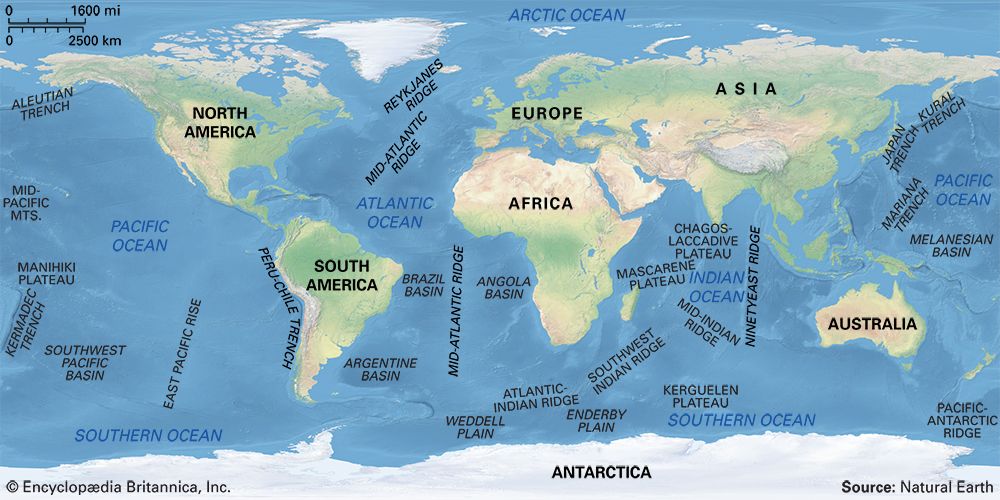
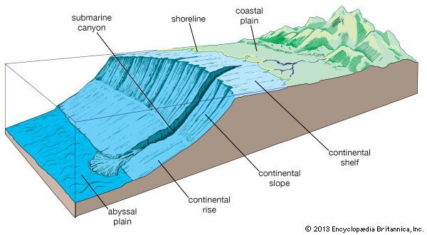
Abyssal hills are small, topographically well-defined features that typically rise from several meters to several hundred meters above the seafloor. They are characterized by their relatively low elevation—less than 1 kilometer—and are often found in vast provinces covering large portions of the ocean floor. These hills are constructed through a combination of volcanism and block faulting at spreading centres, resulting in an elongated shape that trends parallel to oceanic ridges.123
Seamounts and Underwater Volcanoes
In contrast, seamounts are large submarine volcanic mountains that rise at least 1,000 meters above the surrounding deep-sea floor. While abyssal hills are often the result of tectonic faulting, seamounts are primarily volcanic in origin.43
- Structure: Seamounts are often elliptical or elongate and may occur in linear clusters. Smaller submarine volcanoes are referred to as sea knolls, while flat-topped seamounts are known as guyots.45
- Activity: Many active submarine volcanoes are essentially seamounts. Unlike the widespread, sediment-covered abyssal hills, seamounts represent significant, isolated volcanic peaks that stand out prominently from the abyssal plains.514
What is the average size and height of abyssal hills?
Abyssal hills are small, topographically distinct features found on the ocean floor. Their dimensions are characterized as follows:
- Height: These hills typically rise from several meters to several hundred meters above the surrounding seafloor. Generally, they are defined as having a height of less than 1 kilometer (or less than 3,300 feet).237
- Diameter: Typical abyssal hills have diameters ranging from several meters to several hundred meters.2
These features are constructed through a combination of volcanism and block faulting at spreading centres. While they are often covered by marine sediment, they are believed to underlie most of the ocean floor, forming extensive provinces that cover a significant portion of the Pacific and Atlantic basins.23
What role do abyssal hills play in ocean circulation and mixing?
The provided search results do not contain information regarding the specific role that abyssal hills play in ocean circulation and mixing. While the documents detail the geological formation of abyssal hills and the mechanisms of thermohaline circulation, they do not establish a functional link between the two.
How do scientists study and map abyssal hills given their deep-sea location?
Because the deep seafloor is opaque to light, scientists rely on sophisticated acoustic and satellite technologies to study and map abyssal hills.
Acoustic Mapping
- Sonar Systems: Sonar is the primary tool for seafloor mapping. Modern multibeam echo sounders, such as Seabeam, measure the time it takes for an acoustic pulse to travel to the seafloor and back, allowing for precise depth calculations.1213
- Detailed Imaging: For high-resolution mapping, researchers use near-bottom systems like the “Deep Tow,” which operates 10 to 100 meters above the seafloor to capture fine-scale features. Additionally, scanning sonars like GLORIA can map large swaths of the ocean floor rapidly.1213
- Subbottom Profiling: Lower-frequency acoustic pulses are used to penetrate the seafloor, revealing the thickness of marine sediment and the underlying geological structure.1213
Satellite and Geophysical Methods
- Satellite Altimetry: Satellites like Seasat use radar altimeters to measure the shape of the ocean surface. Because massive seafloor features exert gravitational attraction, they cause the sea surface to bulge or downwarp, allowing scientists to create comprehensive gravity maps of uncharted topography.1213
Direct Sampling
Sources
- seamount — Merriam-Webster
- abyssal hill — Encyclopædia Britannica
- abyssal hill — Merriam-Webster
- seamount — Encyclopædia Britannica
- volcano - Submarine volcanoes — Encyclopædia Britannica
- ocean basin - General features — Encyclopædia Britannica
- Indian Ocean - Ocean basins — Encyclopædia Britannica
- abyssal plain — Encyclopædia Britannica
- seafloor spreading — Encyclopædia Britannica
- ocean current - Pressure gradients — Encyclopædia Britannica
- ocean current - Thermohaline circulation — Encyclopædia Britannica
- ocean basin - Exploration of the ocean basins — Encyclopædia Britannica
- ROV — Merriam-Webster
- undersea exploration - Exploration of the seafloor and the Earth’s crust — Encyclopædia Britannica
- surveying - Height determination — Encyclopædia Britannica
Published on · 3 min read